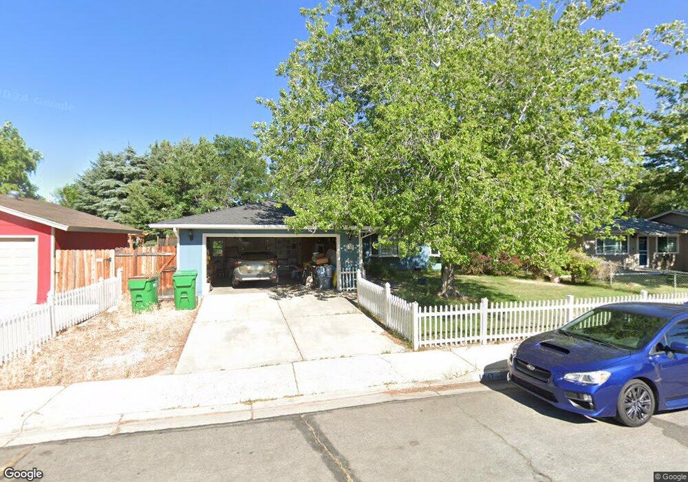
1947 Carriage Crest Dr Carson City, NV 89706
Northridge NeighborhoodEstimated Value: $419,000 - $460,000
3
Beds
2
Baths
1,790
Sq Ft
$249/Sq Ft
Est. Value
About This Home
This home is located at 1947 Carriage Crest Dr, Carson City, NV 89706 and is currently estimated at $444,859, approximately $248 per square foot. 1947 Carriage Crest Dr is a home located in Carson City with nearby schools including Mark Twain Elementary School, Carson Middle School, and Carson High School.
Ownership History
Date
Name
Owned For
Owner Type
Purchase Details
Closed on
Jul 22, 2006
Sold by
Damon Charles F and Adams Robert W
Bought by
Woods Dale L and Woods Vickie
Current Estimated Value
Home Financials for this Owner
Home Financials are based on the most recent Mortgage that was taken out on this home.
Original Mortgage
$236,000
Outstanding Balance
$140,957
Interest Rate
6.76%
Mortgage Type
Purchase Money Mortgage
Estimated Equity
$303,902
Create a Home Valuation Report for This Property
The Home Valuation Report is an in-depth analysis detailing your home's value as well as a comparison with similar homes in the area
Home Values in the Area
Average Home Value in this Area
Purchase History
| Date | Buyer | Sale Price | Title Company |
|---|---|---|---|
| Woods Dale L | $295,000 | First Amer Title Co Of Nv |
Source: Public Records
Mortgage History
| Date | Status | Borrower | Loan Amount |
|---|---|---|---|
| Open | Woods Dale L | $236,000 |
Source: Public Records
Tax History Compared to Growth
Tax History
| Year | Tax Paid | Tax Assessment Tax Assessment Total Assessment is a certain percentage of the fair market value that is determined by local assessors to be the total taxable value of land and additions on the property. | Land | Improvement |
|---|---|---|---|---|
| 2025 | $1,606 | $60,534 | $34,300 | $26,234 |
| 2024 | $1,506 | $60,157 | $34,300 | $25,857 |
| 2023 | $1,463 | $54,672 | $29,750 | $24,922 |
| 2022 | $1,355 | $46,828 | $23,800 | $23,028 |
| 2021 | $1,315 | $43,840 | $20,650 | $23,190 |
| 2020 | $1,315 | $40,207 | $16,800 | $23,407 |
| 2019 | $1,238 | $40,475 | $16,800 | $23,675 |
| 2018 | $1,202 | $37,326 | $14,000 | $23,326 |
| 2017 | $1,167 | $36,255 | $12,600 | $23,655 |
| 2016 | $1,138 | $35,104 | $10,500 | $24,604 |
| 2015 | $1,135 | $34,597 | $9,625 | $24,972 |
| 2014 | $1,102 | $31,413 | $7,700 | $23,713 |
Source: Public Records
Map
Nearby Homes
- 1970 Hamilton Ave
- 1381 Spooner Dr
- 1654 Spooner Dr
- 2542 Ravenshorn Dr
- 2616 Carriage Crest Dr
- 2613 Pinion Pine Dr
- 2048 Poole Way
- 2756 Table Rock Dr
- 1902 Peters St
- 1955 F St
- 1772 Hogan Peak St
- 493 Hot Springs Rd Unit 1
- 493 Hot Springs Rd Unit 24
- Cross Creek, Plan 6 at Cross Creek
- Cross Creek, Plan 3 at Cross Creek
- Cross Creek, Plan 1 at Cross Creek
- Cross Creek, Plan 4X at Cross Creek
- Cross Creek, Plan 2 at Cross Creek
- Cross Creek, Plan 4 at Cross Creek
- Cross Creek, Plan 5 at Cross Creek
- 1953 Carriage Crest Dr
- 1941 Carriage Crest Dr
- 1942 Sunland Dr
- 1948 Sunland Dr
- 1959 Carriage Crest Dr
- 1936 Sunland Dr
- 1935 Carriage Crest Dr
- 1948 Carriage Crest Dr
- 1942 Carriage Crest Dr
- 1954 Carriage Crest Dr
- 1936 Carriage Crest Dr
- 1619 Karin Dr
- 1954 Sunland Dr
- 1960 Carriage Crest Dr
- 1924 Sunland Dr
- 1930 Carriage Crest Dr
- 1 Sunland Cir
- 1925 Carriage Crest Dr
- 1625 Karin Dr
- 2 Sunland Cir