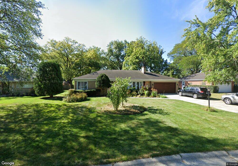
1947 Fenton Ln Park Ridge, IL 60068
Estimated Value: $630,000 - $779,000
4
Beds
2
Baths
2,306
Sq Ft
$304/Sq Ft
Est. Value
About This Home
This home is located at 1947 Fenton Ln, Park Ridge, IL 60068 and is currently estimated at $700,101, approximately $303 per square foot. 1947 Fenton Ln is a home located in Cook County with nearby schools including Franklin Elementary School, Emerson Middle School, and Maine East High School.
Ownership History
Date
Name
Owned For
Owner Type
Purchase Details
Closed on
Feb 10, 2005
Sold by
Henshell Morton J and Henshell Flossie J
Bought by
Soto David and Soto Adriana
Current Estimated Value
Home Financials for this Owner
Home Financials are based on the most recent Mortgage that was taken out on this home.
Original Mortgage
$472,000
Outstanding Balance
$257,798
Interest Rate
6.9%
Mortgage Type
Unknown
Estimated Equity
$442,303
Create a Home Valuation Report for This Property
The Home Valuation Report is an in-depth analysis detailing your home's value as well as a comparison with similar homes in the area
Home Values in the Area
Average Home Value in this Area
Purchase History
| Date | Buyer | Sale Price | Title Company |
|---|---|---|---|
| Soto David | $590,000 | Pntn |
Source: Public Records
Mortgage History
| Date | Status | Borrower | Loan Amount |
|---|---|---|---|
| Open | Soto David | $472,000 | |
| Closed | Soto David | $118,000 |
Source: Public Records
Tax History Compared to Growth
Tax History
| Year | Tax Paid | Tax Assessment Tax Assessment Total Assessment is a certain percentage of the fair market value that is determined by local assessors to be the total taxable value of land and additions on the property. | Land | Improvement |
|---|---|---|---|---|
| 2024 | $11,023 | $43,931 | $13,031 | $30,900 |
| 2023 | $10,535 | $43,931 | $13,031 | $30,900 |
| 2022 | $10,535 | $43,931 | $13,031 | $30,900 |
| 2021 | $11,325 | $40,566 | $10,424 | $30,142 |
| 2020 | $10,942 | $40,566 | $10,424 | $30,142 |
| 2019 | $11,818 | $48,772 | $10,424 | $38,348 |
| 2018 | $10,641 | $40,621 | $9,121 | $31,500 |
| 2017 | $11,243 | $42,832 | $9,121 | $33,711 |
| 2016 | $11,067 | $42,832 | $9,121 | $33,711 |
| 2015 | $10,278 | $35,948 | $7,492 | $28,456 |
| 2014 | $10,911 | $38,657 | $7,492 | $31,165 |
| 2013 | $10,318 | $38,657 | $7,492 | $31,165 |
Source: Public Records
Map
Nearby Homes
- 1580 Habberton Ave
- 1710 Dempster St Unit A
- 8253 N Western Ave
- 1819 Glenview Ave
- 8619 W Park Ln
- 1712 Woodland Ave
- 8810 Briar Ct Unit 1B
- 8846 Dee Rd Unit E
- 1720 Greendale Ave
- 8554 W Bruce Dr
- 1039 N Northwest Hwy Unit A5
- 1316 N Northwest Hwy
- 8999 Kennedy Dr Unit 102B
- 1044 N Knight Ave
- 1144 N Greenwood Ave
- 1035 N Dee Rd
- 8974 N Western Ave Unit D409
- 9332 Landings Ln Unit 504
- 1025 N Knight Ave
- 9356 Landings Ln Unit 505
- 1957 Fenton Ln
- 1937 Fenton Ln
- 1980 Burton Ln
- 1503 Vernon Ave
- 1927 Fenton Ln
- 1990 Burton Ln
- 1960 Burton Ln
- 1493 Vernon Ave
- 1954 Fenton Ln
- 1940 Burton Ln
- 1917 Fenton Ln
- 1964 Fenton Ln
- 1934 Fenton Ln
- 1533 Vernon Ave
- 1924 Fenton Ln
- 1920 Burton Ln
- 1907 Fenton Ln
- 1508 Vernon Ave
- 1498 Vernon Ave
- 1914 Fenton Ln