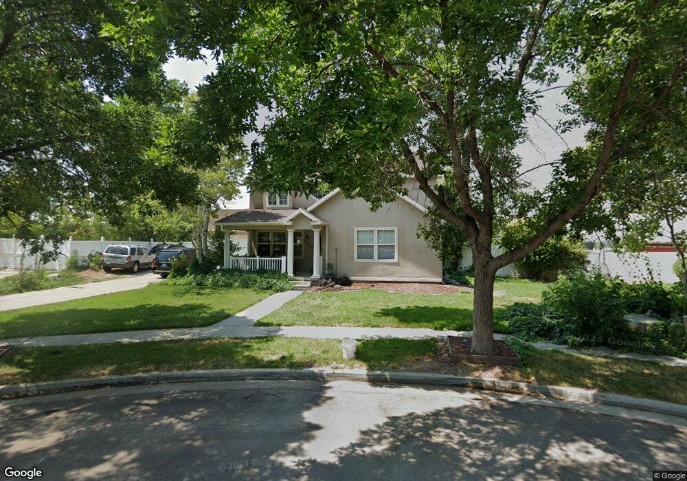
1947 N 370 W Tooele, UT 84074
Estimated Value: $457,000 - $499,000
4
Beds
4
Baths
3,040
Sq Ft
$160/Sq Ft
Est. Value
About This Home
This home is located at 1947 N 370 W, Tooele, UT 84074 and is currently estimated at $485,867, approximately $159 per square foot. 1947 N 370 W is a home located in Tooele County with nearby schools including Overlake Elementary School, Clarke N. Johnsen Junior High School, and Stansbury High School.
Ownership History
Date
Name
Owned For
Owner Type
Purchase Details
Closed on
Oct 18, 2010
Sold by
Beneficial Financial 1 Inc
Bought by
Brimhall Jacob K
Current Estimated Value
Home Financials for this Owner
Home Financials are based on the most recent Mortgage that was taken out on this home.
Original Mortgage
$163,530
Outstanding Balance
$107,472
Interest Rate
4.27%
Mortgage Type
New Conventional
Estimated Equity
$378,395
Purchase Details
Closed on
Jul 6, 2010
Sold by
Outzen Michael B and Outzen Doreen
Bought by
Beneficial Financial 1 Inc
Purchase Details
Closed on
Jun 17, 2009
Sold by
Outzen Michael O and Outzen Doreen
Bought by
Outzen Michael O and Outzen Doreen
Create a Home Valuation Report for This Property
The Home Valuation Report is an in-depth analysis detailing your home's value as well as a comparison with similar homes in the area
Home Values in the Area
Average Home Value in this Area
Purchase History
| Date | Buyer | Sale Price | Title Company |
|---|---|---|---|
| Brimhall Jacob K | -- | None Available | |
| Beneficial Financial 1 Inc | -- | Inwest Title Services Salt | |
| Outzen Michael O | -- | None Available |
Source: Public Records
Mortgage History
| Date | Status | Borrower | Loan Amount |
|---|---|---|---|
| Open | Brimhall Jacob K | $163,530 |
Source: Public Records
Tax History Compared to Growth
Tax History
| Year | Tax Paid | Tax Assessment Tax Assessment Total Assessment is a certain percentage of the fair market value that is determined by local assessors to be the total taxable value of land and additions on the property. | Land | Improvement |
|---|---|---|---|---|
| 2025 | $3,382 | $272,567 | $62,563 | $210,004 |
| 2024 | $3,293 | $243,481 | $62,563 | $180,918 |
| 2023 | $3,293 | $269,318 | $59,568 | $209,750 |
| 2022 | $3,454 | $285,371 | $71,858 | $213,513 |
| 2021 | $2,991 | $205,469 | $24,166 | $181,303 |
| 2020 | $2,796 | $338,260 | $43,938 | $294,322 |
| 2019 | $2,601 | $311,503 | $43,938 | $267,565 |
| 2018 | $2,253 | $256,750 | $30,000 | $226,750 |
| 2017 | $1,752 | $236,136 | $30,000 | $206,136 |
| 2016 | $1,605 | $119,866 | $11,000 | $108,866 |
| 2015 | $1,605 | $113,835 | $0 | $0 |
| 2014 | -- | $113,835 | $0 | $0 |
Source: Public Records
Map
Nearby Homes
- 1913 N 370 W
- 437 W 1910 N Unit 317
- 452 W 1910 N Unit 314
- 463 W 1910 N Unit 320
- 1969 N 270 W
- Franklin Plan at Compass Point
- Ash Plan at Compass Point
- Chapman Plan at Compass Point
- Kennedy Plan at Compass Point
- McKinley Plan at Compass Point
- Hickory Plan at Compass Point
- Spruce Pantry Plan at Compass Point
- Holly Plan at Compass Point
- Basswood Plan at Compass Point
- Merriwood Plan at Compass Point
- Hancock Plan at Compass Point
- Harrison Plan at Compass Point
- Cedar Plan at Compass Point
- Monroe Plan at Compass Point
- Mesquite Plan at Compass Point