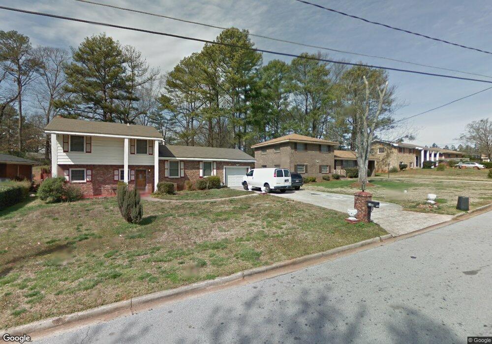
1947 Preston Place Decatur, GA 30032
Parker NeighborhoodEstimated Value: $552,000 - $666,000
4
Beds
4
Baths
2,800
Sq Ft
$218/Sq Ft
Est. Value
About This Home
This home is located at 1947 Preston Place, Decatur, GA 30032 and is currently estimated at $609,774, approximately $217 per square foot. 1947 Preston Place is a home located in DeKalb County with nearby schools including McNair Middle School, McNair High School, and Charles Drew Charter School.
Ownership History
Date
Name
Owned For
Owner Type
Purchase Details
Closed on
Sep 11, 2019
Sold by
Lewis Lakyishia N
Bought by
Gresham Terrance Gideon and Gresham Deindre Renee
Current Estimated Value
Purchase Details
Closed on
Feb 5, 2018
Sold by
Itl Llc
Bought by
Lewis Lakyishia N
Home Financials for this Owner
Home Financials are based on the most recent Mortgage that was taken out on this home.
Original Mortgage
$366,249
Interest Rate
3.62%
Mortgage Type
FHA
Purchase Details
Closed on
Jan 29, 2009
Sold by
Security Bk Of Gwinnett Cnty
Bought by
Itl Llc
Create a Home Valuation Report for This Property
The Home Valuation Report is an in-depth analysis detailing your home's value as well as a comparison with similar homes in the area
Home Values in the Area
Average Home Value in this Area
Purchase History
| Date | Buyer | Sale Price | Title Company |
|---|---|---|---|
| Gresham Terrance Gideon | $400,000 | -- | |
| Lewis Lakyishia N | $389,900 | -- | |
| Itl Llc | $40,000 | -- |
Source: Public Records
Mortgage History
| Date | Status | Borrower | Loan Amount |
|---|---|---|---|
| Previous Owner | Lewis Lakyishia N | $366,249 |
Source: Public Records
Tax History Compared to Growth
Tax History
| Year | Tax Paid | Tax Assessment Tax Assessment Total Assessment is a certain percentage of the fair market value that is determined by local assessors to be the total taxable value of land and additions on the property. | Land | Improvement |
|---|---|---|---|---|
| 2024 | $7,395 | $250,840 | $56,520 | $194,320 |
| 2023 | $7,395 | $205,760 | $52,400 | $153,360 |
| 2022 | $6,556 | $211,160 | $50,000 | $161,160 |
| 2021 | $5,741 | $175,840 | $50,000 | $125,840 |
| 2020 | $5,313 | $157,000 | $50,000 | $107,000 |
| 2019 | $5,674 | $169,480 | $50,000 | $119,480 |
| 2018 | $3,300 | $128,800 | $50,000 | $78,800 |
| 2017 | $630 | $13,520 | $13,520 | $0 |
| 2016 | $629 | $13,480 | $13,480 | $0 |
| 2014 | $644 | $13,480 | $13,480 | $0 |
Source: Public Records
Map
Nearby Homes
- 1856 Timberwood Trace
- 2025 Shawn Wayne Cir SE
- 2263 Leicester Way SE
- 2334 Second Ave Unit LAND
- 1937 Joseph Ct
- 2424 Flat Shoals Rd
- 1956 Joseph Ct
- 2025 East Dr
- 1949 Capri Dr
- 2213 Leicester Way SE
- 1794 N Umberland Way SE
- 1944 Capri Dr
- 1902 Joseph Ct
- 2168 Somerset Place SE
- 2417 Castle Keep Way SE
- 1903 Valencia Rd Unit 1
- 2252 Brannen Rd SE
- 2236 Brannen Rd SE
- 2203 Second Ave
- 1947 Preston Park Place
- 1904 Shawn Wayne Ct SE
- 1951 Preston Park Place
- 1906 Shawn Wayne Ct SE
- 1902 Shawn Wayne Ct SE
- 1908 Shawn Wayne Ct SE
- 1908 Shawn Wayne Ct SE
- 1957 Preston Park Place
- 1907 Shawn Wayne Ct SE
- 1907 Shawn Wayne Ct SE Unit 1907
- 1900 Shawn Wayne Ct SE Unit 1900
- 1900 Shawn Wayne Ct SE
- 2325 Preston Park Ct
- 1898 Shawn Wayne Ct SE
- 1944 Preston Park Place
- 2331 Preston Park Ct SE
- 1896 Shawn Wayne Ct SE
- 1905 Shawn Wayne Ct SE
- 2331 Preston Park Ct
- 0 Shawn Wayne Ct SE Unit 7033861