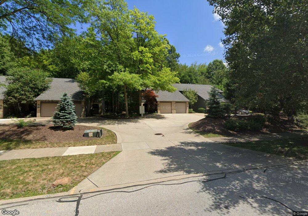
1947 Savannah Pkwy Unit 1947 Westlake, OH 44145
Estimated Value: $247,000 - $279,000
2
Beds
2
Baths
1,442
Sq Ft
$180/Sq Ft
Est. Value
About This Home
This home is located at 1947 Savannah Pkwy Unit 1947, Westlake, OH 44145 and is currently estimated at $259,851, approximately $180 per square foot. 1947 Savannah Pkwy Unit 1947 is a home located in Cuyahoga County with nearby schools including Dover Intermediate School, Lee Burneson Middle School, and Westlake High School.
Ownership History
Date
Name
Owned For
Owner Type
Purchase Details
Closed on
Jan 13, 1998
Sold by
Jazwa Cindy M
Bought by
Jazwa Jeffrey
Current Estimated Value
Home Financials for this Owner
Home Financials are based on the most recent Mortgage that was taken out on this home.
Original Mortgage
$90,000
Interest Rate
7.24%
Purchase Details
Closed on
May 20, 1992
Sold by
Ransbury David H
Bought by
Jazwa Cindy M
Purchase Details
Closed on
Mar 24, 1987
Sold by
Meagher Gayle M
Bought by
Ransbury David H
Purchase Details
Closed on
Jan 1, 1984
Bought by
Meagher Gayle M
Create a Home Valuation Report for This Property
The Home Valuation Report is an in-depth analysis detailing your home's value as well as a comparison with similar homes in the area
Home Values in the Area
Average Home Value in this Area
Purchase History
| Date | Buyer | Sale Price | Title Company |
|---|---|---|---|
| Jazwa Jeffrey | $113,000 | -- | |
| Jazwa Cindy M | $111,000 | -- | |
| Ransbury David H | $89,500 | -- | |
| Meagher Gayle M | -- | -- |
Source: Public Records
Mortgage History
| Date | Status | Borrower | Loan Amount |
|---|---|---|---|
| Closed | Jazwa Jeffrey | $90,000 |
Source: Public Records
Tax History Compared to Growth
Tax History
| Year | Tax Paid | Tax Assessment Tax Assessment Total Assessment is a certain percentage of the fair market value that is determined by local assessors to be the total taxable value of land and additions on the property. | Land | Improvement |
|---|---|---|---|---|
| 2024 | $4,190 | $88,445 | $8,295 | $80,150 |
| 2023 | $3,373 | $60,870 | $5,500 | $55,370 |
| 2022 | $3,319 | $60,870 | $5,500 | $55,370 |
| 2021 | $3,323 | $60,870 | $5,500 | $55,370 |
| 2020 | $2,788 | $46,830 | $4,240 | $42,600 |
| 2019 | $2,703 | $133,800 | $12,100 | $121,700 |
| 2018 | $2,715 | $46,830 | $4,240 | $42,600 |
| 2017 | $2,474 | $40,150 | $4,240 | $35,910 |
| 2016 | $2,461 | $40,150 | $4,240 | $35,910 |
| 2015 | $2,584 | $40,150 | $4,240 | $35,910 |
| 2014 | $2,584 | $41,380 | $4,380 | $37,000 |
Source: Public Records
Map
Nearby Homes
- 1670 Cedarwood Dr Unit 148
- 1625 Cedarwood Dr Unit 218
- 1510 Alder Ln Unit 7C
- 1480 Cedarwood Dr Unit 21F
- 1316 Cedarwood Dr Unit D3
- 1476 Bobby Ln Unit 7
- 31000 Logan Ct
- 29379 Detroit Rd
- 29363 Detroit Rd Unit 5
- 31035 Wilderness Trail
- 2075 Bassett Rd
- 31072 Riviera Ln
- 2647 Piedmont Ct Unit 56
- 0 Avon Rd Unit 4372752
- 0 Avon Rd Unit 4372753
- 31587 Turtle Cr
- 2847 Rocky Ridge Dr
- 2705 Rocky Ridge Dr
- 2891 Rocky Ridge Dr Unit V/L 173
- V/L Rocky Ridge Dr
- 1951 Savannah Pkwy Unit 1951
- 1957 Savannah Pkwy Unit 1957
- 1959 Savannah Pkwy
- 1939 Savannah Pkwy
- 1935 Savannah Pkwy
- 1931 Savannah Pkwy Unit 1931
- 1967 Savannah Pkwy
- 1923 Savannah Pkwy
- 1919 Savannah Pkwy Unit 1919
- 1915 Savannah Pkwy
- 1985 Savannah Pkwy
- 1944 Savannah Pkwy
- 1940 Savannah Pkwy
- 1948 Savannah Pkwy Unit 1948
- 1952 Savannah Pkwy
- 1911 Savannah Pkwy
- 1911 Savannah Pkwy Unit 1911
- 1956 Savannah Pkwy Unit 1956
- 1932 Savannah Pkwy
- 1960 Savannah Pkwy Unit 1960