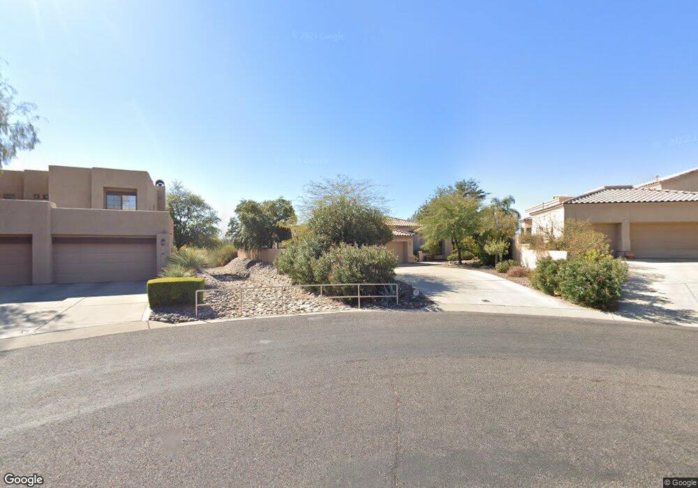
1947 W Muirhead Loop Tucson, AZ 85737
Estimated Value: $581,000 - $761,000
Studio
3
Baths
2,630
Sq Ft
$246/Sq Ft
Est. Value
About This Home
This home is located at 1947 W Muirhead Loop, Tucson, AZ 85737 and is currently estimated at $646,614, approximately $245 per square foot. 1947 W Muirhead Loop is a home located in Pima County with nearby schools including Richard B. Wilson Jr. School, Ironwood Ridge High School, and Leman Academy Of Excellence-Oro Valley Arizona.
Ownership History
Date
Name
Owned For
Owner Type
Purchase Details
Closed on
Aug 8, 1996
Sold by
Bock Erich V and Bock Raymond F
Bought by
Bock Erich and Bock Raymond F
Current Estimated Value
Purchase Details
Closed on
Nov 2, 1995
Sold by
First Interstate Bank Of Arizona Na and Bock Raymond F
Bought by
Bock Raymond F and Bock Erich
Purchase Details
Closed on
Nov 5, 1993
Sold by
First American Title Ins Co Tr 4507
Bought by
First American Title Insurance Company T
Home Financials for this Owner
Home Financials are based on the most recent Mortgage that was taken out on this home.
Original Mortgage
$4,800,000
Interest Rate
6.97%
Create a Home Valuation Report for This Property
The Home Valuation Report is an in-depth analysis detailing your home's value as well as a comparison with similar homes in the area
Home Values in the Area
Average Home Value in this Area
Purchase History
| Date | Buyer | Sale Price | Title Company |
|---|---|---|---|
| Bock Erich | -- | -- | |
| Bock Erich | -- | -- | |
| Bock Erich | -- | -- | |
| Bock Erich | -- | -- | |
| Bock Raymond F | -- | -- | |
| First American Title Insurance Company T | $52,850 | First American Title | |
| Canada Hills Development Limited Partner | -- | -- |
Source: Public Records
Mortgage History
| Date | Status | Borrower | Loan Amount |
|---|---|---|---|
| Previous Owner | Canada Hills Development Limited Partner | $214,000 | |
| Previous Owner | Canada Hills Development Limited Partner | $4,800,000 |
Source: Public Records
Tax History
| Year | Tax Paid | Tax Assessment Tax Assessment Total Assessment is a certain percentage of the fair market value that is determined by local assessors to be the total taxable value of land and additions on the property. | Land | Improvement |
|---|---|---|---|---|
| 2026 | $5,117 | $42,967 | -- | -- |
| 2025 | $5,117 | $40,921 | -- | -- |
| 2024 | $4,884 | $38,972 | -- | -- |
| 2023 | $4,693 | $37,116 | $0 | $0 |
| 2022 | $4,460 | $35,349 | $0 | $0 |
| 2021 | $4,399 | $32,063 | $0 | $0 |
| 2020 | $4,328 | $32,063 | $0 | $0 |
| 2019 | $4,191 | $31,591 | $0 | $0 |
| 2018 | $4,011 | $28,016 | $0 | $0 |
| 2017 | $3,980 | $28,016 | $0 | $0 |
| 2016 | $4,076 | $29,701 | $0 | $0 |
| 2015 | $3,980 | $28,401 | $0 | $0 |
Source: Public Records
Map
Nearby Homes
- 1968 W Muirhead Loop
- 10706 N Sand Canyon Place
- 1975 W Muirhead Loop
- 2051 W Hidden Pointe Ct
- 1851 W Desert Forest Ct
- 10895 N Canada Hills Ct
- 10991 N Double Eagle Ct
- 10355 N La Cholla Blvd
- 11018 N Mountain Breeze Dr
- 11137 N Par Dr
- 11143 N Divot Dr
- 1870 W Hawkridge St
- 11153 N Par Dr
- 10959 N Tatum Dr
- 1538 W Carmel Pointe Dr
- 10374 N Wild Creek Dr
- 11281 N Chynna Rose Place
- 2200 W Owl Head Place
- 1489 W Bridalveil Place
- 10312 N Wild Creek Dr
- 1951 W Muirhead Loop
- 1943 W Muirhead Loop
- 1955 W Muirhead Loop
- 1939 W Muirhead Loop
- 1956 W Muirhead Loop
- 1959 W Muirhead Loop
- 1935 W Muirhead Loop
- 1960 W Muirhead Loop
- 1963 W Muirhead Loop
- 1931 W Muirhead Loop
- 1964 W Muirhead Loop
- 1928 W Muirhead Loop
- 1967 W Muirhead Loop
- 1911 W Carnoustie Place
- 1927 W Muirhead Loop
- 10685 N La Quinta Dr
- 10714 N Sand Canyon Place
- 1924 W Muirhead Loop
- 1910 W Carnoustie Place
- 10698 N Sand Canyon Place