Estimated Value: $313,391 - $510,000
Studio
--
Bath
--
Sq Ft
3,311
Sq Ft Lot
About This Home
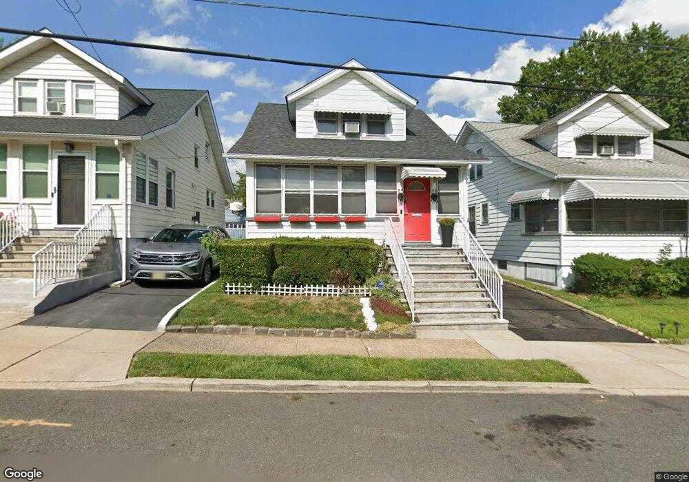
This home is located at 1947 William St, Union, NJ 07083 and is currently estimated at $415,098. 1947 William St is a home located in Union County with nearby schools including Franklin Elementary School, Burnet Middle School, and Union High School.
Ownership History
Date
Name
Owned For
Owner Type
Purchase Details
Closed on
Oct 9, 2001
Sold by
Household Financial Services
Bought by
Hall Diane C
Current Estimated Value
Home Financials for this Owner
Home Financials are based on the most recent Mortgage that was taken out on this home.
Original Mortgage
$140,097
Interest Rate
6.84%
Mortgage Type
FHA
Purchase Details
Closed on
Jul 11, 2001
Sold by
Matthews Kenya and Mathews Kenya
Bought by
Household Financial Services
Purchase Details
Closed on
Oct 31, 1997
Sold by
Zaleski Stanley and Zaleski Stella Frances
Bought by
Mathews Kenya S
Home Financials for this Owner
Home Financials are based on the most recent Mortgage that was taken out on this home.
Original Mortgage
$107,844
Interest Rate
7.15%
Create a Home Valuation Report for This Property
The Home Valuation Report is an in-depth analysis detailing your home's value as well as a comparison with similar homes in the area
Home Values in the Area
Average Home Value in this Area
Purchase History
| Date | Buyer | Sale Price | Title Company |
|---|---|---|---|
| Hall Diane C | $141,000 | -- | |
| Household Financial Services | $3,861 | -- | |
| Mathews Kenya S | $115,000 | -- |
Source: Public Records
Mortgage History
| Date | Status | Borrower | Loan Amount |
|---|---|---|---|
| Previous Owner | Hall Diane C | $140,097 | |
| Previous Owner | Mathews Kenya S | $107,844 |
Source: Public Records
Tax History
| Year | Tax Paid | Tax Assessment Tax Assessment Total Assessment is a certain percentage of the fair market value that is determined by local assessors to be the total taxable value of land and additions on the property. | Land | Improvement |
|---|---|---|---|---|
| 2025 | $7,286 | $32,600 | $13,200 | $19,400 |
| 2024 | $7,064 | $32,600 | $13,200 | $19,400 |
| 2023 | $7,064 | $32,600 | $13,200 | $19,400 |
| 2022 | $6,819 | $32,600 | $13,200 | $19,400 |
| 2021 | $6,653 | $32,600 | $13,200 | $19,400 |
| 2020 | $6,521 | $32,600 | $13,200 | $19,400 |
| 2019 | $6,433 | $32,600 | $13,200 | $19,400 |
| 2018 | $6,323 | $32,600 | $13,200 | $19,400 |
| 2017 | $6,230 | $32,600 | $13,200 | $19,400 |
| 2016 | $6,078 | $32,600 | $13,200 | $19,400 |
| 2015 | $5,977 | $32,600 | $13,200 | $19,400 |
| 2014 | $5,843 | $32,600 | $13,200 | $19,400 |
Source: Public Records
Map
Nearby Homes
- 1968 William St
- 179 Hollywood Ave
- 25
- 71 Coolidge St
- 31 Orchard Place
- 1584 Walker Ave
- 1535 Gregory Ave
- 181 Jacoby St
- 47 Lindsley Ave
- 18 Gifford Ct
- 122 Harper Ave
- 539 Union Ave Unit 4
- 20 Toronto Ct
- 319 Park Place
- 1395 Isabella Ave
- 916 Stuyvesant Ave Unit 2
- 924 Stuyvesant Ave Unit E1
- 120 Parkside Dr
- 1779 Oak Hill Dr
- 192 Burnett Ave Unit 1
- 1949 William St
- 1943 William St
- 1951 William St
- 1955 William St
- 1956 Ostwood Terrace
- 1939 William St
- 1958 Ostwood Terrace
- 1950 Ostwood Terrace
- 1957 William St
- 1960 Ostwood Terrace
- 1944 Ostwood Terrace
- 1937 William St
- 1962 Ostwood Terrace
- 1940 Ostwood Terrace
- 1961 William St
- 1933 William St
- 1944 William St
- 1948 William St
- 1966 Ostwood Terrace
- 1950 William St
Your Personal Tour Guide
Ask me questions while you tour the home.