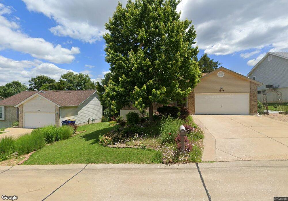
1948 Anchorage Dr Festus, MO 63028
Festus/Crystal City NeighborhoodEstimated Value: $250,666 - $307,000
Studio
--
Bath
1,246
Sq Ft
$227/Sq Ft
Est. Value
About This Home
This home is located at 1948 Anchorage Dr, Festus, MO 63028 and is currently estimated at $283,417, approximately $227 per square foot. 1948 Anchorage Dr is a home located in Jefferson County with nearby schools including Festus Elementary School, Festus Intermediate School, and Festus Middle School.
Ownership History
Date
Name
Owned For
Owner Type
Purchase Details
Closed on
Oct 22, 2013
Sold by
Gronborg Gary E and Gronborg Bernadette
Bought by
Gronborg Gary E and Gronborg Bernadett
Current Estimated Value
Purchase Details
Closed on
Jan 2, 2004
Sold by
K A B Construction Co Llc
Bought by
Gronborg Gary E and Gronborg Bernadette
Home Financials for this Owner
Home Financials are based on the most recent Mortgage that was taken out on this home.
Original Mortgage
$126,700
Outstanding Balance
$59,088
Interest Rate
5.86%
Mortgage Type
Purchase Money Mortgage
Estimated Equity
$224,329
Create a Home Valuation Report for This Property
The Home Valuation Report is an in-depth analysis detailing your home's value as well as a comparison with similar homes in the area
Home Values in the Area
Average Home Value in this Area
Purchase History
| Date | Buyer | Sale Price | Title Company |
|---|---|---|---|
| Gronborg Gary E | -- | None Available | |
| Gronborg Gary E | -- | -- |
Source: Public Records
Mortgage History
| Date | Status | Borrower | Loan Amount |
|---|---|---|---|
| Open | Gronborg Gary E | $126,700 |
Source: Public Records
Tax History
| Year | Tax Paid | Tax Assessment Tax Assessment Total Assessment is a certain percentage of the fair market value that is determined by local assessors to be the total taxable value of land and additions on the property. | Land | Improvement |
|---|---|---|---|---|
| 2025 | $1,891 | $35,600 | $8,800 | $26,800 |
| 2024 | $1,891 | $33,400 | $8,800 | $24,600 |
| 2023 | $1,891 | $33,400 | $8,800 | $24,600 |
| 2022 | $1,881 | $33,400 | $8,800 | $24,600 |
| 2021 | $1,883 | $33,400 | $8,800 | $24,600 |
| 2020 | $1,809 | $30,100 | $8,000 | $22,100 |
| 2019 | $1,809 | $30,100 | $8,000 | $22,100 |
| 2018 | $1,631 | $30,100 | $8,000 | $22,100 |
| 2016 | $1,449 | $26,600 | $6,400 | $20,200 |
Source: Public Records
Map
Nearby Homes
- 1434 Moose Pass
- 17 Parkville Ln
- 1604 Sugar Creek Dr
- 1603 Sugar Creek Dr
- 1605 Sugar Creek Dr
- 715 Tanglewood Acres
- 1607 Sugar Creek Dr
- 1614 Sugar Creek Dr
- 120 Greenbrier Blvd
- 45 Ashford Place
- 61 Ashford Place
- 621 Westwood Dr S Unit A
- 11787 Gamel Cemetery Rd
- 2214 Buck Creek Rd
- 518 Westwood Place
- 0 Tbb Birchwood Overlook-Hickory
- 813 American Legion Dr
- 0 Tbb Birchwood Overlook -Pin Oa Unit MAR24022705
- 17 Ash Ct
- 955 S 3rd St
- 1944 Anchorage Dr
- 1952 Anchorage Dr
- 1947 McKinley Range
- 1951 McKinley Range
- 1940 Anchorage Dr
- 1947 Anchorage Dr
- 1943 McKinley Range
- 1956 Anchorage Dr
- 1433 Moose Pass
- 1955 Anchorage Dr
- 1939 McKinley Range
- 1936 Anchorage Dr
- 1951 Anchorage Dr
- 1959 Anchorage Dr
- 1931 Anchorage Dr
- 1935 McKinley Range
- 1943 Anchorage Dr
- 1958 McKinley Range
- 1954 McKinley Range
- 1932 Anchorage Dr
Your Personal Tour Guide
Ask me questions while you tour the home.