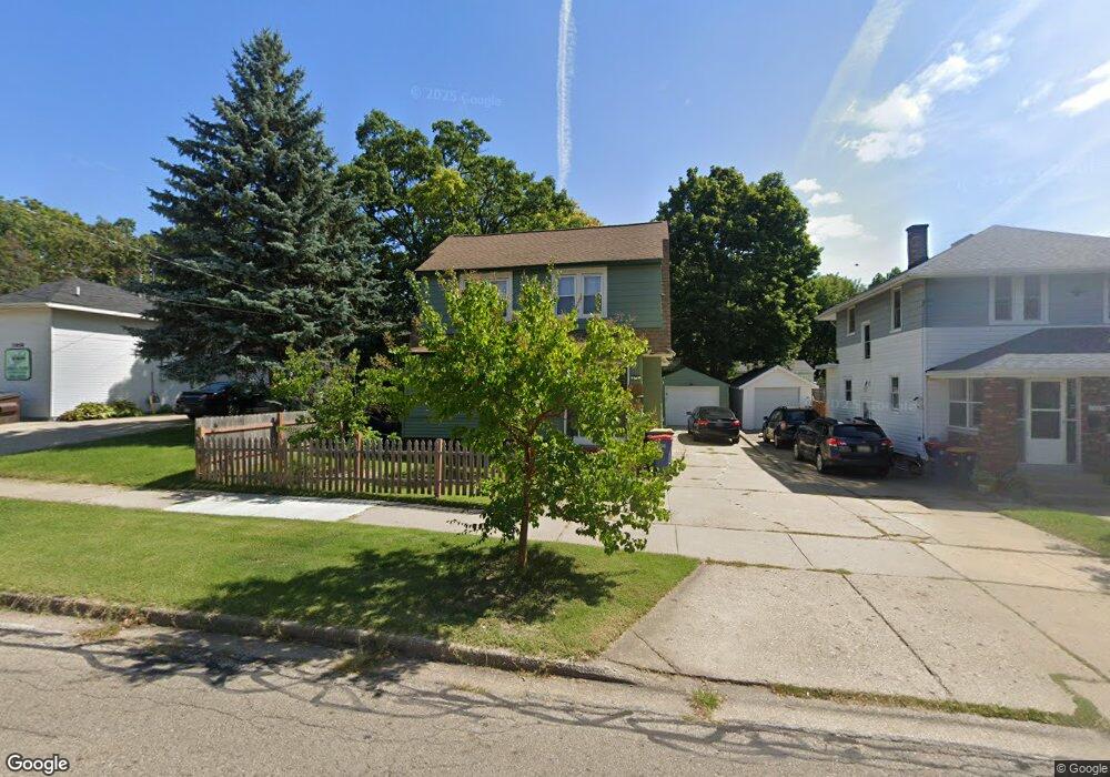
1948 Coit Ave NE Unit Bldg-Unit Grand Rapids, MI 49505
Creston NeighborhoodEstimated Value: $278,000 - $312,233
3
Beds
2
Baths
1,339
Sq Ft
$220/Sq Ft
Est. Value
About This Home
This home is located at 1948 Coit Ave NE Unit Bldg-Unit, Grand Rapids, MI 49505 and is currently estimated at $294,308, approximately $219 per square foot. 1948 Coit Ave NE Unit Bldg-Unit is a home located in Kent County with nearby schools including Palmer School, Riverside Middle School, and Union High School.
Ownership History
Date
Name
Owned For
Owner Type
Purchase Details
Closed on
Mar 30, 2016
Sold by
Borkowski Michael
Bought by
Arizola Melissa Y and Arizola Jimmy L
Current Estimated Value
Home Financials for this Owner
Home Financials are based on the most recent Mortgage that was taken out on this home.
Original Mortgage
$97,171
Outstanding Balance
$77,373
Interest Rate
3.75%
Mortgage Type
FHA
Estimated Equity
$216,935
Purchase Details
Closed on
Feb 24, 2012
Sold by
Federal National Mortgage Association
Bought by
Borkowski Michael
Home Financials for this Owner
Home Financials are based on the most recent Mortgage that was taken out on this home.
Original Mortgage
$38,885
Interest Rate
3.75%
Mortgage Type
FHA
Purchase Details
Closed on
Oct 12, 2011
Sold by
Ketchapaw John H and Ketchapaw Linda
Bought by
Federal National Mortgage Association
Create a Home Valuation Report for This Property
The Home Valuation Report is an in-depth analysis detailing your home's value as well as a comparison with similar homes in the area
Home Values in the Area
Average Home Value in this Area
Purchase History
| Date | Buyer | Sale Price | Title Company |
|---|---|---|---|
| Arizola Melissa Y | $99,000 | None Available | |
| Borkowski Michael | $39,900 | None Available | |
| Federal National Mortgage Association | $79,997 | None Available |
Source: Public Records
Mortgage History
| Date | Status | Borrower | Loan Amount |
|---|---|---|---|
| Open | Arizola Melissa Y | $97,171 | |
| Previous Owner | Borkowski Michael | $38,885 |
Source: Public Records
Tax History Compared to Growth
Tax History
| Year | Tax Paid | Tax Assessment Tax Assessment Total Assessment is a certain percentage of the fair market value that is determined by local assessors to be the total taxable value of land and additions on the property. | Land | Improvement |
|---|---|---|---|---|
| 2025 | $3,929 | $138,100 | $0 | $0 |
| 2024 | $3,929 | $123,900 | $0 | $0 |
| 2023 | $2,177 | $111,600 | $0 | $0 |
| 2022 | $2,190 | $99,900 | $0 | $0 |
| 2021 | $2,141 | $88,300 | $0 | $0 |
| 2020 | $2,047 | $76,800 | $0 | $0 |
| 2019 | $2,144 | $69,900 | $0 | $0 |
| 2018 | $2,070 | $59,500 | $0 | $0 |
| 2017 | $3,129 | $51,800 | $0 | $0 |
| 2016 | $1,484 | $47,100 | $0 | $0 |
| 2015 | $1,381 | $47,100 | $0 | $0 |
| 2013 | -- | $40,600 | $0 | $0 |
Source: Public Records
Map
Nearby Homes
- 1922 Coit Ave NE
- 225 Burr Oak St NE
- 2060 Swensberg Ave NE
- 142 Burr Oak St NE
- 143 Dean St NE
- 2107 Prospect Ave NE
- 22 Elmwood St NE
- 240 Eleanor St NE
- 155 Palmer St NE
- 122 Bowne St NE
- 16 Graceland St NE
- 68 Bowne St NE
- 465 Kenwood St NE
- 483 Kenwood St NE
- 30 Palmer St NW
- 310 Sweet St NE
- 212 Saunders Ct NE
- 2033 Melita Ave NE
- 741 Knapp St NE
- 1530 Queen Ave NE
- 1948 Coit Ave NE
- 1940 Coit Ave NE
- 210 Knapp St NE
- 1936 Coit Ave NE
- 211 Elmwood St NE
- 214 Knapp St NE
- 1932 Coit Ave NE
- 215 Elmwood St NE
- 1949 Coit Ave NE
- 1945 Coit Ave NE
- 1953 Coit Ave NE
- 218 Knapp St NE
- 165 Elmwood St NE
- 1957 Coit Ave NE
- 219 Elmwood St NE
- 2000 Coit Ave NE
- 222 Knapp St NE
- 159 Elmwood St NE
- 223 Elmwood St NE
- 154 Knapp St NE