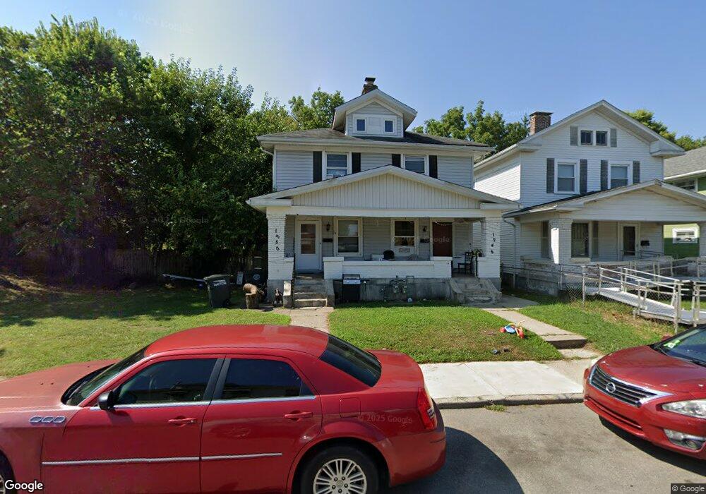
1948 Deanwood Ave Dayton, OH 45410
Linden Heights NeighborhoodEstimated Value: $135,000 - $214,836
3
Beds
3
Baths
2,244
Sq Ft
$76/Sq Ft
Est. Value
About This Home
This home is located at 1948 Deanwood Ave, Dayton, OH 45410 and is currently estimated at $169,959, approximately $75 per square foot. 1948 Deanwood Ave is a home located in Montgomery County with nearby schools including Cleveland Elementary School, Horace Mann Elementary School, and Eastmont Elementary.
Ownership History
Date
Name
Owned For
Owner Type
Purchase Details
Closed on
Mar 23, 2005
Sold by
Street Rino
Bought by
Street Dalaney J
Current Estimated Value
Home Financials for this Owner
Home Financials are based on the most recent Mortgage that was taken out on this home.
Original Mortgage
$85,350
Outstanding Balance
$43,270
Interest Rate
5.61%
Mortgage Type
New Conventional
Estimated Equity
$126,689
Purchase Details
Closed on
Oct 28, 2000
Sold by
Keyer Michael A
Bought by
Street Dalaney J and Street Rino
Home Financials for this Owner
Home Financials are based on the most recent Mortgage that was taken out on this home.
Original Mortgage
$84,956
Interest Rate
7.96%
Mortgage Type
FHA
Purchase Details
Closed on
Apr 11, 1994
Sold by
Keyer Kristin A
Bought by
Keyer Michael A
Create a Home Valuation Report for This Property
The Home Valuation Report is an in-depth analysis detailing your home's value as well as a comparison with similar homes in the area
Home Values in the Area
Average Home Value in this Area
Purchase History
| Date | Buyer | Sale Price | Title Company |
|---|---|---|---|
| Street Dalaney J | -- | None Available | |
| Street Dalaney J | $95,000 | -- | |
| Keyer Michael A | -- | -- |
Source: Public Records
Mortgage History
| Date | Status | Borrower | Loan Amount |
|---|---|---|---|
| Open | Street Dalaney J | $85,350 | |
| Closed | Street Dalaney J | $84,956 |
Source: Public Records
Tax History Compared to Growth
Tax History
| Year | Tax Paid | Tax Assessment Tax Assessment Total Assessment is a certain percentage of the fair market value that is determined by local assessors to be the total taxable value of land and additions on the property. | Land | Improvement |
|---|---|---|---|---|
| 2024 | $3,147 | $54,420 | $11,500 | $42,920 |
| 2023 | $3,147 | $54,420 | $11,500 | $42,920 |
| 2022 | $2,685 | $35,820 | $7,570 | $28,250 |
| 2021 | $2,670 | $35,820 | $7,570 | $28,250 |
| 2020 | $2,665 | $35,820 | $7,570 | $28,250 |
| 2019 | $1,625 | $19,420 | $5,400 | $14,020 |
| 2018 | $1,627 | $19,420 | $5,400 | $14,020 |
| 2017 | $1,616 | $19,420 | $5,400 | $14,020 |
| 2016 | $1,627 | $18,600 | $5,400 | $13,200 |
| 2015 | $1,541 | $18,600 | $5,400 | $13,200 |
| 2014 | $1,541 | $18,600 | $5,400 | $13,200 |
| 2012 | -- | $22,130 | $8,750 | $13,380 |
Source: Public Records
Map
Nearby Homes
- 853 Carlisle Ave
- 2316 Wyoming St
- 827 Carlisle Ave Unit 825
- 1114 Arbor Ave
- 1105 Pursell Ave
- 2010 Argyle Ave
- 2312 Saint Charles Ave
- 1205 Pursell Ave
- 722 Saint Nicholas Ave
- 1230 Pursell Ave
- 630 Carlisle Ave
- 1235 Holly Ave
- 1254 Creighton Ave
- 626 Creighton Ave
- 621 Creighton Ave
- 1300 Carlisle Ave
- 607 Carlisle Ave
- 1254 Phillips Ave
- 1311 Pursell Ave
- 1255 Phillips Ave
- 1944 Deanwood Ave
- 1940 Deanwood Ave
- 1936 Deanwood Ave
- 851 Hodapp Ave
- 1934 Deanwood Ave
- 2209 Wyoming St
- 858 Carlisle Ave
- 2215 Wyoming St
- 2205 Wyoming St
- 2201 Wyoming St
- 847 Hodapp Ave
- 1928 Deanwood Ave
- 854 Carlisle Ave
- 2139 Wyoming St
- 2006 Deanwood Ave
- 852 Hodapp Ave
- 2135 Wyoming St
- 843 Hodapp Ave
- 850 Carlisle Ave
- 2303 Wyoming St Unit E