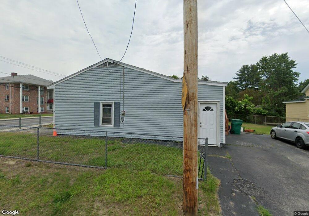
1948 Middlesex St Lowell, MA 01851
Highlands NeighborhoodEstimated Value: $481,361 - $528,000
5
Beds
2
Baths
1,447
Sq Ft
$353/Sq Ft
Est. Value
About This Home
This home is located at 1948 Middlesex St, Lowell, MA 01851 and is currently estimated at $510,340, approximately $352 per square foot. 1948 Middlesex St is a home located in Middlesex County with nearby schools including Charles W. Morey Elementary School, Dr. Gertrude Bailey Elementary School, and Joseph McAvinnue Elementary School.
Ownership History
Date
Name
Owned For
Owner Type
Purchase Details
Closed on
Jan 19, 2007
Sold by
Raschak Done and Raschak Manichanh
Bought by
Raschak Mainchanh and Raschak Manichanh
Current Estimated Value
Purchase Details
Closed on
Jun 25, 1993
Sold by
Delllano Carlos and Del Llano Sonia
Bought by
Raschak Done and Raschak Manichanh
Create a Home Valuation Report for This Property
The Home Valuation Report is an in-depth analysis detailing your home's value as well as a comparison with similar homes in the area
Home Values in the Area
Average Home Value in this Area
Purchase History
| Date | Buyer | Sale Price | Title Company |
|---|---|---|---|
| Raschak Mainchanh | $40,000 | -- | |
| Raschak Mainchanh | $40,000 | -- | |
| Raschak Done | $91,500 | -- | |
| Raschak Done | $91,500 | -- |
Source: Public Records
Mortgage History
| Date | Status | Borrower | Loan Amount |
|---|---|---|---|
| Previous Owner | Raschak Done | $50,000 | |
| Previous Owner | Raschak Done | $130,000 | |
| Previous Owner | Raschak Done | $80,000 |
Source: Public Records
Tax History
| Year | Tax Paid | Tax Assessment Tax Assessment Total Assessment is a certain percentage of the fair market value that is determined by local assessors to be the total taxable value of land and additions on the property. | Land | Improvement |
|---|---|---|---|---|
| 2025 | $4,952 | $431,400 | $177,100 | $254,300 |
| 2024 | $4,809 | $403,800 | $165,500 | $238,300 |
| 2023 | $4,579 | $368,700 | $143,900 | $224,800 |
| 2022 | $4,131 | $325,500 | $130,900 | $194,600 |
| 2021 | $4,004 | $297,500 | $113,800 | $183,700 |
| 2020 | $3,606 | $269,900 | $107,000 | $162,900 |
| 2019 | $3,468 | $247,000 | $91,000 | $156,000 |
| 2018 | $3,308 | $229,900 | $86,700 | $143,200 |
| 2017 | $3,208 | $215,000 | $78,800 | $136,200 |
| 2016 | $3,096 | $204,200 | $78,800 | $125,400 |
| 2015 | $3,111 | $201,000 | $78,800 | $122,200 |
| 2013 | $3,026 | $201,600 | $82,600 | $119,000 |
Source: Public Records
Map
Nearby Homes
- 1975 Middlesex St Unit 51
- 1975 Middlesex St Unit 10
- 24 Brouilette St Unit A
- 5 Augusta Way
- 4 Tamarack St
- 527 Pawtucket Blvd Unit 207
- 3 Louis Farm Rd Unit 3
- 591 Varnum Ave
- 15 Robin Ln
- 20 Sandy Ln
- 339 Pawtucket Blvd Unit 19
- 351 Pawtucket Blvd Unit 3
- 351 Pawtucket Blvd Unit 29
- 63 Prescott Dr Unit 63
- 311 Pawtucket Blvd Unit 3
- 1215 Pawtucket Blvd Unit 19
- 295 Pawtucket Blvd Unit 7
- 307 Pawtucket Blvd Unit 24
- 694 Westford St
- 29 Middlesex St Unit 1
- 1940 Middlesex St
- 10 Thorncliff Ave
- 1958 Middlesex St
- 9 Nelson St
- 9 Thorncliff Ave
- 20 Thorncliff Ave
- 1928 Middlesex St
- 16 Nelson St
- 1982 Middlesex St Unit 5
- 1982 Middlesex St Unit vary
- 1982 Middlesex St
- 1982 Middlesex St Unit 6
- 1959 Middlesex St Unit D
- 1959 Middlesex St Unit C
- 1959 Middlesex St Unit A
- 1959 Middlesex St Unit E
- 1959 Middlesex St Unit F
- 1959 Middlesex St Unit G
- 1959 Middlesex St Unit H
- 1959 Middlesex St Unit B
Your Personal Tour Guide
Ask me questions while you tour the home.