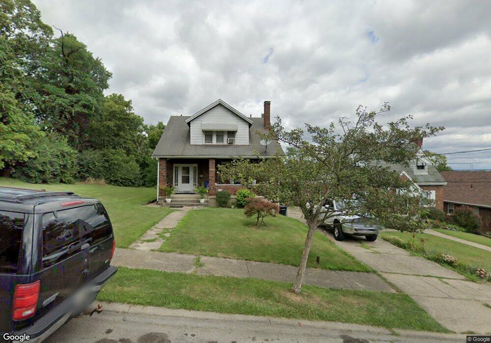
1948 Neyer Ave Cincinnati, OH 45225
Millvale NeighborhoodEstimated Value: $71,000 - $130,332
3
Beds
3
Baths
2,197
Sq Ft
$45/Sq Ft
Est. Value
About This Home
This home is located at 1948 Neyer Ave, Cincinnati, OH 45225 and is currently estimated at $98,083, approximately $44 per square foot. 1948 Neyer Ave is a home located in Hamilton County with nearby schools including Ethel M. Taylor Academy, Robert A. Taft Information Technology High School, and Western Hills High School.
Ownership History
Date
Name
Owned For
Owner Type
Purchase Details
Closed on
Aug 26, 2002
Sold by
Stephens Bernice Ivery
Bought by
Ivery Isaac and Ivery Sandra
Current Estimated Value
Purchase Details
Closed on
Jul 9, 2002
Sold by
Estate Of Eugene Ivery
Bought by
Stephens Bernice Ivery
Purchase Details
Closed on
Aug 17, 2001
Sold by
Estate Of Eugene Ivery Jr
Bought by
Ivery Eugene
Create a Home Valuation Report for This Property
The Home Valuation Report is an in-depth analysis detailing your home's value as well as a comparison with similar homes in the area
Home Values in the Area
Average Home Value in this Area
Purchase History
| Date | Buyer | Sale Price | Title Company |
|---|---|---|---|
| Ivery Isaac | $44,000 | -- | |
| Stephens Bernice Ivery | -- | -- | |
| Ivery Eugene | -- | -- |
Source: Public Records
Tax History
| Year | Tax Paid | Tax Assessment Tax Assessment Total Assessment is a certain percentage of the fair market value that is determined by local assessors to be the total taxable value of land and additions on the property. | Land | Improvement |
|---|---|---|---|---|
| 2025 | $1,487 | $22,992 | $1,796 | $21,196 |
| 2024 | $1,485 | $22,992 | $1,796 | $21,196 |
| 2023 | $1,488 | $22,992 | $1,796 | $21,196 |
| 2022 | $1,368 | $18,992 | $2,587 | $16,405 |
| 2021 | $1,336 | $18,992 | $2,587 | $16,405 |
| 2020 | $1,339 | $18,992 | $2,587 | $16,405 |
| 2019 | $1,530 | $19,782 | $2,695 | $17,087 |
| 2018 | $1,531 | $19,782 | $2,695 | $17,087 |
| 2017 | $1,474 | $19,782 | $2,695 | $17,087 |
| 2016 | $1,775 | $23,296 | $3,171 | $20,125 |
| 2015 | $1,588 | $23,296 | $3,171 | $20,125 |
| 2014 | $1,597 | $23,296 | $3,171 | $20,125 |
| 2013 | $1,708 | $24,525 | $3,339 | $21,186 |
Source: Public Records
Map
Nearby Homes
- 1970 Westwood Northern Blvd
- 2163 Baltimore Ave
- 2352 Iroll Ave
- 2183 Westwood Northern Blvd
- 1817 Elmore St
- 1642 Sutter Ave
- 2911 Moosewood Ct
- 3384 Ninann Ct
- 1965 Baltimore Ave
- 3813 Borden St
- 1646 Pulte St
- 1785 Townsend St
- 3521 Mchenry Ave
- 1771 Townsend St
- 3519 Mchenry Ave
- 1932 Powers St
- 1797 Denham St
- 1930 Powers St
- 3836 Llewellyn Ave
- 1808 Carll St
- 1940 Neyer Ave
- 1936 Neyer Ave
- 1949 Neyer Ave
- 1947 Neyer Ave
- 1943 Neyer Ave
- 1934 Neyer Ave
- 1939 Neyer Ave
- 1930 Neyer Ave
- 1935 Neyer Ave
- 1931 Neyer Ave
- 1927 Neyer Ave
- 1920 Neyer Ave
- 1921 Neyer Ave
- 1918 Neyer Ave
- 1917 Neyer Ave
- 1916 Neyer Ave
- 1915 Neyer Ave
- 2317 Weron Ln
- 1912 Neyer Ave
- 1959 Millcreek Rd
Your Personal Tour Guide
Ask me questions while you tour the home.