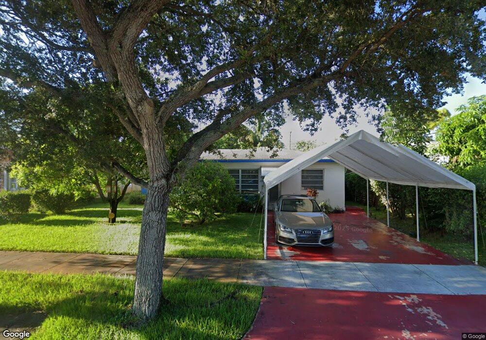
1948 Roosevelt St Unit 1 Hollywood, FL 33020
Royal Poinciana NeighborhoodEstimated Value: $421,000 - $712,000
2
Beds
1
Bath
650
Sq Ft
$785/Sq Ft
Est. Value
About This Home
This home is located at 1948 Roosevelt St Unit 1, Hollywood, FL 33020 and is currently estimated at $510,482, approximately $785 per square foot. 1948 Roosevelt St Unit 1 is a home located in Broward County with nearby schools including Dania Elementary School, Olsen Middle School, and South Broward High School.
Ownership History
Date
Name
Owned For
Owner Type
Purchase Details
Closed on
Jul 19, 2012
Sold by
Beaudoin Jacqueline
Bought by
Demar Wayne Patrick
Current Estimated Value
Home Financials for this Owner
Home Financials are based on the most recent Mortgage that was taken out on this home.
Original Mortgage
$130,134
Outstanding Balance
$89,872
Interest Rate
3.68%
Mortgage Type
VA
Estimated Equity
$420,610
Purchase Details
Closed on
Aug 1, 1991
Sold by
Available Not
Bought by
Available Not
Create a Home Valuation Report for This Property
The Home Valuation Report is an in-depth analysis detailing your home's value as well as a comparison with similar homes in the area
Home Values in the Area
Average Home Value in this Area
Purchase History
| Date | Buyer | Sale Price | Title Company |
|---|---|---|---|
| Demar Wayne Patrick | $130,200 | Attorney | |
| Available Not | $64,286 | -- |
Source: Public Records
Mortgage History
| Date | Status | Borrower | Loan Amount |
|---|---|---|---|
| Open | Demar Wayne Patrick | $130,134 |
Source: Public Records
Tax History Compared to Growth
Tax History
| Year | Tax Paid | Tax Assessment Tax Assessment Total Assessment is a certain percentage of the fair market value that is determined by local assessors to be the total taxable value of land and additions on the property. | Land | Improvement |
|---|---|---|---|---|
| 2025 | $3,821 | $217,360 | -- | -- |
| 2024 | $3,471 | $214,220 | -- | -- |
| 2023 | $3,471 | $192,680 | $0 | $0 |
| 2022 | $2,129 | $135,440 | $0 | $0 |
| 2021 | $2,060 | $131,500 | $0 | $0 |
| 2020 | $2,015 | $129,690 | $0 | $0 |
| 2019 | $1,979 | $126,780 | $0 | $0 |
| 2018 | $1,884 | $124,420 | $0 | $0 |
| 2017 | $1,782 | $121,870 | $0 | $0 |
| 2016 | $1,767 | $119,370 | $0 | $0 |
| 2015 | $1,777 | $118,550 | $0 | $0 |
| 2014 | $1,776 | $117,610 | $0 | $0 |
| 2013 | -- | $115,880 | $16,060 | $99,820 |
Source: Public Records
Map
Nearby Homes
- 1923 Roosevelt St
- 1918 Taft St
- 1853 Taft St
- 1939 Arthur St
- 1830 Cleveland St Unit 3
- 1830 Cleveland St Unit 2
- 1812 Roosevelt St
- 1219 N 20th Ave
- 1850 Arthur St Unit 2
- 1708 N Dixie Hwy
- 1917 Harding St
- 1922 Garfield St
- 1611 N 22nd Ave
- 2132 Mckinley St
- 2128 Cleveland St
- 1820 Coolidge St
- 2210 Roosevelt St
- 1812 Coolidge St
- 1830 Dixieanna St Unit 503
- 1830 Dixieanna St Unit 606
- 1942 Roosevelt St
- 1954 Roosevelt St
- 1936 Roosevelt St
- 1939 Mckinley St
- 1937 Mckinley St Unit 3
- 1937 Mckinley St Unit 4 EAST
- 1937 Mckinley St Unit 2
- 1937 Mckinley St
- 1955 Roosevelt St
- 1943 Roosevelt St
- 1947 Roosevelt St
- 1503 N 20th Ave Unit C
- 1503 N 20th Ave
- 1935 Mckinley St Unit 5
- 1935 Mckinley St Unit 4 EAST
- 1935 Mckinley St Unit 1 EAST
- 1935 Mckinley St Unit 2 EAST
- 1935 Mckinley St Unit 1
- 1935 Mckinley St