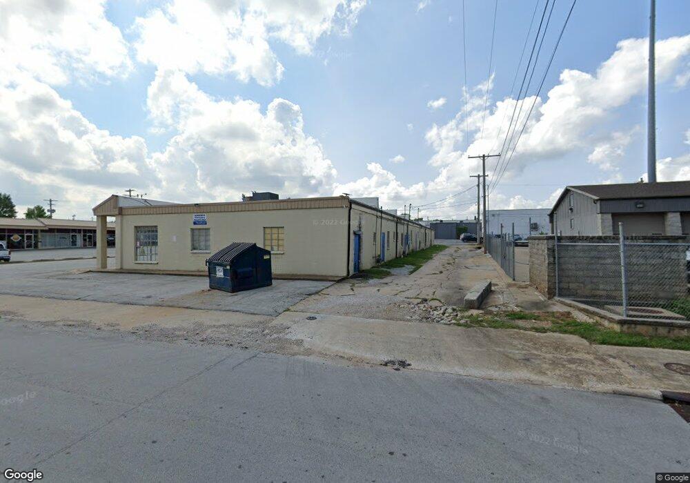
1948 S Glenstone Ave Unit A Springfield, MO 65804
Brentwood Neighborhood
--
Bed
--
Bath
2,224
Sq Ft
1.06
Acres
About This Home
This home is located at 1948 S Glenstone Ave Unit A, Springfield, MO 65804. 1948 S Glenstone Ave Unit A is a home located in Greene County with nearby schools including Glendale High School and Discovery Garden Montessori School.
Ownership History
Date
Name
Owned For
Owner Type
Purchase Details
Closed on
Feb 7, 2024
Sold by
Nubridge Commercial Lndg Llc
Bought by
Nubridge Commercial Lending Reo Spv Ii Llc
Purchase Details
Closed on
Dec 13, 2023
Sold by
Lowther Craig
Bought by
Nubridge Commercial Lndg Llc
Purchase Details
Closed on
Feb 5, 2021
Sold by
Weathers Richard E and Weathers Kay V
Bought by
Pqckt Llc
Home Financials for this Owner
Home Financials are based on the most recent Mortgage that was taken out on this home.
Original Mortgage
$3,720,000
Interest Rate
2.65%
Mortgage Type
New Conventional
Purchase Details
Closed on
Jul 31, 2006
Sold by
Plaza South Inc
Bought by
Weathers Richard E and Weathers V
Home Financials for this Owner
Home Financials are based on the most recent Mortgage that was taken out on this home.
Original Mortgage
$565,000
Interest Rate
6.66%
Mortgage Type
FHA
Create a Home Valuation Report for This Property
The Home Valuation Report is an in-depth analysis detailing your home's value as well as a comparison with similar homes in the area
Home Values in the Area
Average Home Value in this Area
Purchase History
| Date | Buyer | Sale Price | Title Company |
|---|---|---|---|
| Nubridge Commercial Lending Reo Spv Ii Llc | -- | None Listed On Document | |
| Nubridge Commercial Lending Reo Spv Ii Llc | -- | None Listed On Document | |
| Nubridge Commercial Lndg Llc | -- | None Listed On Document | |
| Nubridge Commercial Lndg Llc | -- | None Listed On Document | |
| Pqckt Llc | -- | None Available | |
| Pqckt Llc | -- | None Listed On Document | |
| Weathers Richard E | -- | None Available |
Source: Public Records
Mortgage History
| Date | Status | Borrower | Loan Amount |
|---|---|---|---|
| Previous Owner | Pqckt Llc | $3,720,000 | |
| Previous Owner | Weathers Richard E | $565,000 |
Source: Public Records
Tax History Compared to Growth
Tax History
| Year | Tax Paid | Tax Assessment Tax Assessment Total Assessment is a certain percentage of the fair market value that is determined by local assessors to be the total taxable value of land and additions on the property. | Land | Improvement |
|---|---|---|---|---|
| 2025 | $17,287 | $322,910 | $83,390 | $239,520 |
| 2024 | $17,287 | $269,890 | $91,490 | $178,400 |
| 2023 | $17,204 | $269,890 | $91,490 | $178,400 |
| 2022 | $15,072 | $231,840 | $73,180 | $158,660 |
| 2021 | $15,071 | $231,840 | $73,180 | $158,660 |
| 2020 | $15,679 | $232,250 | $73,180 | $159,070 |
| 2019 | $15,305 | $232,250 | $73,180 | $159,070 |
| 2018 | $15,527 | $235,710 | $73,180 | $162,530 |
| 2017 | $15,394 | $234,170 | $73,180 | $160,990 |
| 2016 | $15,269 | $234,170 | $73,180 | $160,990 |
| 2015 | $15,152 | $234,170 | $73,180 | $160,990 |
| 2014 | $15,176 | $233,120 | $73,180 | $159,940 |
Source: Public Records
Map
Nearby Homes
- 2147 S Prairie Ln
- 2140 S Link Ave
- 1623 S Link Ave
- 2036 E Seminole St
- 1534 S Kentwood Ave
- 1500 E Lindberg St
- 2112 E Cinderella St
- 2125 E Wayland St
- 1856 S Pickwick Ave
- 1615 S Delaware Ave
- 2128 S Glendale Ave
- 1520 E Seminole St
- 1927 S Pickwick Ave
- 1503 S Fairway Ave
- 2347 E Kirkwood St
- 1462 E Wayland St
- 1435 S Fairway Ave
- 2407 E Bancroft St
- 2344 E Manchester St
- 1541 E Crestview St
- 1948 S Glenstone Ave
- 2003 S Stewart Ave Unit 100
- 1930 S Glenstone Ave
- 1936 S Glenstone Ave Unit B
- 1936 S Glenstone Ave
- 1936 S Glenstone Ave
- 1930 S Stewart Ave
- 1928 S Glenstone Ave
- 1948 S Stewart Ave Unit 1
- 1908 S Stewart Ave
- 1926 S Glenstone Ave
- 1916 S Glenstone Ave
- 1907 S Stewart Ave Unit E
- 1907 S Stewart Ave Unit K & L
- 1907 S Stewart Ave Unit H & E
- 1907 S Stewart Ave Unit K
- 1907 S Stewart Ave
- 1907 S Stewart Ave Unit A
- 1924 S Glenstone Ave
- 1938 S Glenstone Ave