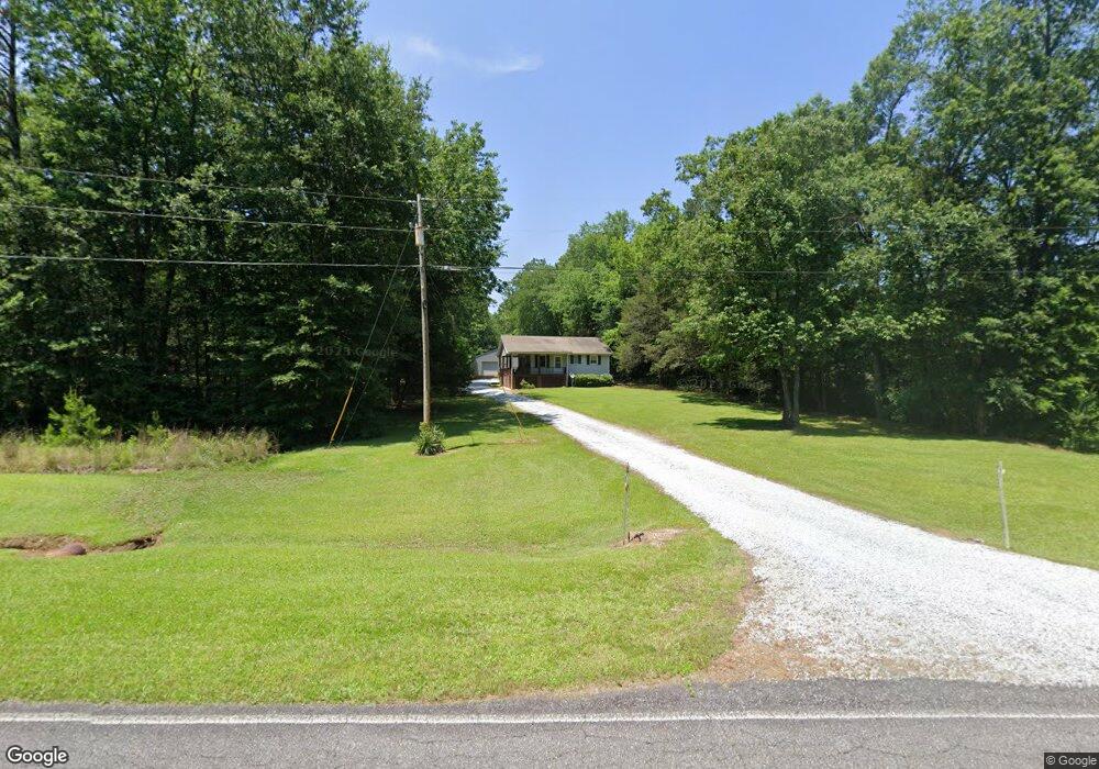
1948 Sam Tate Rd Elberton, GA 30635
Estimated Value: $185,000 - $270,000
2
Beds
2
Baths
780
Sq Ft
$278/Sq Ft
Est. Value
About This Home
This home is located at 1948 Sam Tate Rd, Elberton, GA 30635 and is currently estimated at $216,547, approximately $277 per square foot. 1948 Sam Tate Rd is a home located in Elbert County with nearby schools including Elbert County Primary School, Elbert County Elementary School, and Elbert County Middle School.
Ownership History
Date
Name
Owned For
Owner Type
Purchase Details
Closed on
Jul 15, 2016
Sold by
Larry B
Bought by
Moon Carson T
Current Estimated Value
Home Financials for this Owner
Home Financials are based on the most recent Mortgage that was taken out on this home.
Original Mortgage
$90,995
Outstanding Balance
$72,548
Interest Rate
3.54%
Estimated Equity
$143,999
Purchase Details
Closed on
Jul 1, 1994
Purchase Details
Closed on
Feb 1, 1992
Purchase Details
Closed on
Mar 1, 1991
Purchase Details
Closed on
Sep 1, 1982
Create a Home Valuation Report for This Property
The Home Valuation Report is an in-depth analysis detailing your home's value as well as a comparison with similar homes in the area
Home Values in the Area
Average Home Value in this Area
Purchase History
| Date | Buyer | Sale Price | Title Company |
|---|---|---|---|
| Moon Carson T | $87,000 | -- | |
| -- | -- | -- | |
| -- | $14,500 | -- | |
| -- | $13,000 | -- | |
| -- | -- | -- |
Source: Public Records
Mortgage History
| Date | Status | Borrower | Loan Amount |
|---|---|---|---|
| Open | Moon Carson T | $90,995 |
Source: Public Records
Tax History Compared to Growth
Tax History
| Year | Tax Paid | Tax Assessment Tax Assessment Total Assessment is a certain percentage of the fair market value that is determined by local assessors to be the total taxable value of land and additions on the property. | Land | Improvement |
|---|---|---|---|---|
| 2024 | $1,247 | $52,012 | $7,782 | $44,230 |
| 2023 | $1,247 | $52,012 | $7,782 | $44,230 |
| 2022 | $940 | $39,215 | $4,632 | $34,583 |
| 2021 | $942 | $39,215 | $4,632 | $34,583 |
| 2020 | $915 | $33,664 | $3,706 | $29,958 |
| 2019 | $951 | $33,664 | $3,706 | $29,958 |
| 2018 | $979 | $33,664 | $3,706 | $29,958 |
| 2017 | $991 | $31,556 | $3,706 | $27,850 |
| 2016 | $926 | $31,556 | $3,706 | $27,850 |
| 2015 | -- | $31,556 | $3,706 | $27,850 |
| 2014 | -- | $31,556 | $3,706 | $27,850 |
| 2013 | -- | $31,556 | $3,706 | $27,850 |
Source: Public Records
Map
Nearby Homes
- 2557 Washington Hwy
- 2724 Bells Ferry Rd
- 1464 Rousey Rd
- 2470 Dr George Ward Rd
- 0 Addison Rd
- 2211 Indian Hill Rd
- 1987 Indian Hill Rd
- 1709 Bullards Ferry Rd
- 1703 Bullards Ferry Rd
- 0 Cherokee Rd Unit 10576301
- 0 Mauldin Rd Unit 10657411
- 1943 Mauldin Rd
- 0 Jaudon Rd Unit 25452604
- 0 Jaudon Rd Unit 10657787
- 0 Flatwoods Rd Unit 10649821
- 1385 Lincolnton Hwy
- 1628 Melody Ln
- 2688 Calhoun Falls Hwy
- 1318 Lincolnton Hwy
- 0 Lexington Hwy Unit 10565392
- 1950 Sam Tate Rd
- 1927 Sam Tate Rd
- 1915 Sam Tate Rd
- 2000 Sam Tate Rd
- 2420 Slay Rd
- 1879 Sam Tate Rd
- 2018 Sam Tate Rd
- 2539 Washington Hwy
- 2535 Washington Hwy
- 2452 Slay Rd
- 2515 Washington Hwy
- 2556 Slay Rd
- 2567 Washington Hwy
- 2579 Washington Hwy
- 1834 Sam Tate Rd
- 0000 Slay Rd
- 2571 Slay Rd
- 2616 Washington Hwy
- 2617 Washington Hwy
- 2649 Washington Hwy