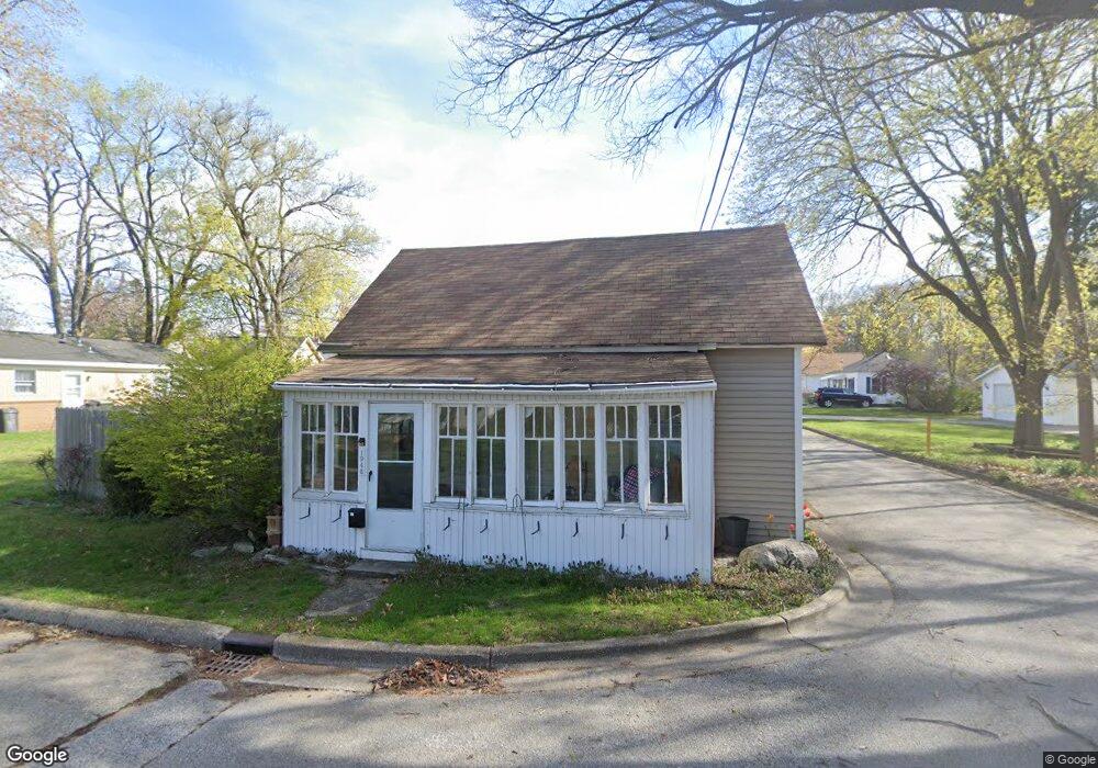
1948 Vanderlinde St Muskegon, MI 49441
Nims NeighborhoodEstimated Value: $126,000 - $147,000
2
Beds
1
Bath
768
Sq Ft
$179/Sq Ft
Est. Value
About This Home
This home is located at 1948 Vanderlinde St, Muskegon, MI 49441 and is currently estimated at $137,809, approximately $179 per square foot. 1948 Vanderlinde St is a home located in Muskegon County with nearby schools including Muskegon Catholic Central School, St. Michael Elementary School, and St. Francis De Sales Elementary School.
Ownership History
Date
Name
Owned For
Owner Type
Purchase Details
Closed on
Aug 16, 2022
Sold by
Don Jensen
Bought by
Jensen Don and Klevering-Jensen Katie
Current Estimated Value
Purchase Details
Closed on
Jan 10, 2012
Sold by
Jensen Katie Klevening
Bought by
Jensen Don
Purchase Details
Closed on
Jul 31, 2008
Sold by
Blackburn Michael and Blackburn Robert Todd
Bought by
Jensen Donald M and Klevering Jensen Katie
Home Financials for this Owner
Home Financials are based on the most recent Mortgage that was taken out on this home.
Original Mortgage
$38,500
Interest Rate
6.51%
Mortgage Type
Unknown
Create a Home Valuation Report for This Property
The Home Valuation Report is an in-depth analysis detailing your home's value as well as a comparison with similar homes in the area
Home Values in the Area
Average Home Value in this Area
Purchase History
| Date | Buyer | Sale Price | Title Company |
|---|---|---|---|
| Jensen Don | -- | Parmenter Law | |
| Jensen Don | -- | None Available | |
| Jensen Donald M | $38,500 | None Available |
Source: Public Records
Mortgage History
| Date | Status | Borrower | Loan Amount |
|---|---|---|---|
| Previous Owner | Jensen Donald M | $38,500 |
Source: Public Records
Tax History Compared to Growth
Tax History
| Year | Tax Paid | Tax Assessment Tax Assessment Total Assessment is a certain percentage of the fair market value that is determined by local assessors to be the total taxable value of land and additions on the property. | Land | Improvement |
|---|---|---|---|---|
| 2025 | $957 | $37,400 | $0 | $0 |
| 2024 | $177 | $30,300 | $0 | $0 |
| 2023 | $169 | $26,400 | $0 | $0 |
| 2022 | $879 | $21,900 | $0 | $0 |
| 2021 | $866 | $19,300 | $0 | $0 |
| 2020 | $847 | $16,900 | $0 | $0 |
| 2019 | $832 | $15,000 | $0 | $0 |
| 2018 | $813 | $14,000 | $0 | $0 |
| 2017 | $789 | $13,300 | $0 | $0 |
| 2016 | $144 | $12,700 | $0 | $0 |
| 2015 | -- | $12,800 | $0 | $0 |
| 2014 | $142 | $12,800 | $0 | $0 |
| 2013 | -- | $12,100 | $0 | $0 |
Source: Public Records
Map
Nearby Homes
- 1794 Lakeshore Dr
- 2058 Blodgett St
- 1819 Fair Ave
- 1151 W Dale Ave
- 1878 Lakeshore Dr
- 1135 W Dale Ave
- 1270 Palmer Ave
- 952 Boardwalk Cove Dr
- 1564 Ridge Ave
- 2260 Estes St
- 1408 Lexington Ave
- 1965 Harrison Ave
- 988 W Larch Ave
- 1636 Franklin St
- 1555 Beardsley Ave
- 2293 Torrent St
- 972 W Dale Ave
- 2135 Dowd St
- 1465 Barclay St
- 2405 Estes St
- 1488 Nolan Ave
- 1517 Montgomery Ave
- 1511 Montgomery Ave
- 1491 Nolan Ave
- 1505 Montgomery Ave
- 1531 Montgomery Ave
- 1485 Nolan Ave
- 1928 Vanderlinde St
- 1512 Montgomery Ave
- 1539 Montgomery Ave
- 1899 Robinson St
- 1504 Montgomery Ave
- 1477 Nolan St
- 1538 Montgomery Ave
- 1921 Vanderlinde St
- 1541 Montgomery Ave
- 1889 Robinson St
- 1925 Vanderlinde St
- 1469 Nolan St
- 1469 Nolan Ave