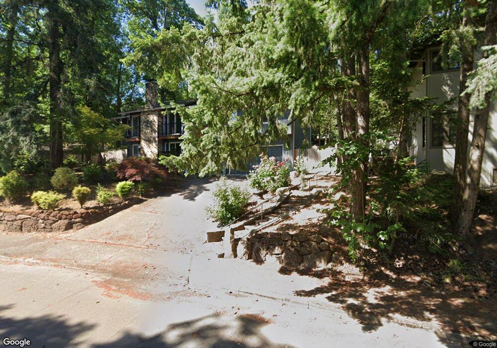
19481 Wilderness Dr West Linn, OR 97068
Robinwood NeighborhoodEstimated Value: $737,768 - $872,000
4
Beds
3
Baths
2,488
Sq Ft
$320/Sq Ft
Est. Value
About This Home
This home is located at 19481 Wilderness Dr, West Linn, OR 97068 and is currently estimated at $796,692, approximately $320 per square foot. 19481 Wilderness Dr is a home located in Clackamas County with nearby schools including Cedaroak Park Primary School, West Linn High School, and Harmony Academy.
Ownership History
Date
Name
Owned For
Owner Type
Purchase Details
Closed on
Aug 30, 2007
Sold by
Miller Robert T and Miller Sandra L
Bought by
Miller Robert T
Current Estimated Value
Home Financials for this Owner
Home Financials are based on the most recent Mortgage that was taken out on this home.
Original Mortgage
$190,000
Interest Rate
6.35%
Mortgage Type
Stand Alone Refi Refinance Of Original Loan
Create a Home Valuation Report for This Property
The Home Valuation Report is an in-depth analysis detailing your home's value as well as a comparison with similar homes in the area
Home Values in the Area
Average Home Value in this Area
Purchase History
| Date | Buyer | Sale Price | Title Company |
|---|---|---|---|
| Miller Robert T | -- | None Available |
Source: Public Records
Mortgage History
| Date | Status | Borrower | Loan Amount |
|---|---|---|---|
| Closed | Miller Robert T | $190,000 |
Source: Public Records
Tax History Compared to Growth
Tax History
| Year | Tax Paid | Tax Assessment Tax Assessment Total Assessment is a certain percentage of the fair market value that is determined by local assessors to be the total taxable value of land and additions on the property. | Land | Improvement |
|---|---|---|---|---|
| 2025 | $6,999 | $363,187 | -- | -- |
| 2024 | $6,737 | $352,609 | -- | -- |
| 2023 | $6,737 | $342,339 | $0 | $0 |
| 2022 | $6,359 | $332,368 | $0 | $0 |
| 2021 | $6,036 | $322,688 | $0 | $0 |
| 2020 | $6,077 | $313,290 | $0 | $0 |
| 2019 | $5,796 | $304,166 | $0 | $0 |
| 2018 | $5,537 | $295,307 | $0 | $0 |
| 2017 | $5,318 | $286,706 | $0 | $0 |
| 2016 | $5,098 | $278,355 | $0 | $0 |
| 2015 | $4,830 | $270,248 | $0 | $0 |
| 2014 | $4,567 | $262,377 | $0 | $0 |
Source: Public Records
Map
Nearby Homes
- 19770 Wildwood Dr
- 3784 Ridgewood Way
- 19788 Wildwood Dr
- 3780 Ridgewood Way
- 18711 Willamette Dr
- 19885 Willamette Dr
- 3893 Cedaroak Dr
- 3262 Fairview Way
- 19661 Sun Cir
- 3710 Mohawk Way
- 2005 Carriage Way
- 20030 Marigold Ct Unit 15
- 4400 Calaroga Dr
- 2041 Marylhurst Dr
- 20120 Larkspur Ln Unit 85
- 3340 Arbor Dr
- 6233 Meridian Cir
- 19155 Nixon Ave
- 2636 Maria Ct
- 4622 Mapleton Dr
- 3270 Forest Ct
- 3264 Forest Ct
- 19419 Wilderness Dr
- 19423 Wilderness Dr
- 19486 Wilderness Dr
- 19491 Wilderness Dr
- 3258 Forest Ct
- 19415 Wilderness Dr
- 19480 Wilderness Dr
- 19490 Wilderness Dr
- 19427 Wilderness Dr
- 3269 Forest Ct
- 19476 Wilderness Dr
- 19494 Wilderness Dr
- 19411 Wilderness Dr
- 19495 Wilderness Dr
- 3250 Forest Ct
- 3263 Forest Ct
- 19496 Wilderness Dr
- 19472 Wilderness Dr