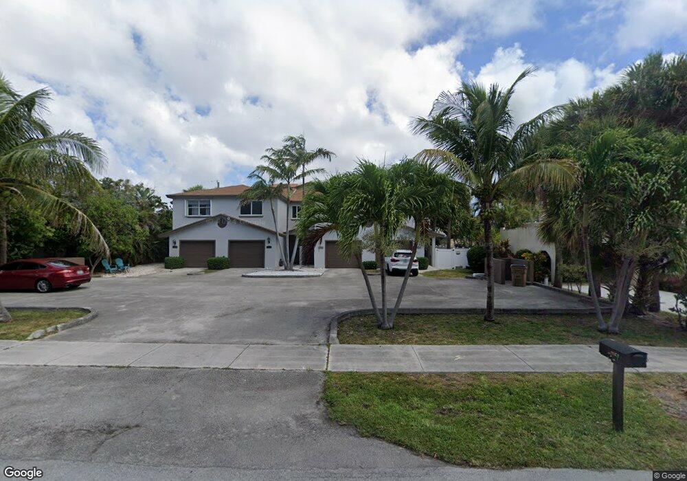
1949 1949 Ne 5th St # 1 Unit 1 Deerfield Beach, FL 33441
Deerfield Beach Island NeighborhoodEstimated Value: $471,160 - $678,000
3
Beds
3
Baths
1,413
Sq Ft
$410/Sq Ft
Est. Value
About This Home
This home is located at 1949 1949 Ne 5th St # 1 Unit 1, Deerfield Beach, FL 33441 and is currently estimated at $579,790, approximately $410 per square foot. 1949 1949 Ne 5th St # 1 Unit 1 is a home located in Broward County with nearby schools including Deerfield Beach Elementary School, Deerfield Beach Middle School, and Deerfield Beach High School.
Ownership History
Date
Name
Owned For
Owner Type
Purchase Details
Closed on
Oct 6, 2017
Sold by
Noel Patrick
Bought by
Giles Kevin Patrick and Giles Jennifer Lynn
Current Estimated Value
Home Financials for this Owner
Home Financials are based on the most recent Mortgage that was taken out on this home.
Original Mortgage
$284,250
Outstanding Balance
$237,683
Interest Rate
3.86%
Mortgage Type
New Conventional
Estimated Equity
$342,107
Purchase Details
Closed on
Oct 5, 2017
Sold by
Noel Patrick and The P & L Land Trust
Bought by
Gelis Kevin Patrick and Gelis Jenifer Lynn
Home Financials for this Owner
Home Financials are based on the most recent Mortgage that was taken out on this home.
Original Mortgage
$284,250
Outstanding Balance
$237,683
Interest Rate
3.86%
Mortgage Type
New Conventional
Estimated Equity
$342,107
Purchase Details
Closed on
Mar 1, 2017
Bought by
P&L Land Tr
Purchase Details
Closed on
Feb 1, 2016
Bought by
P&L Land Tr
Purchase Details
Closed on
Dec 15, 2015
Sold by
Garcia Fabian and Osborn Scott
Bought by
Bank Of America National Association
Purchase Details
Closed on
Jan 16, 2004
Sold by
Argyropoulos Dora
Bought by
Disciascio Louis Michael
Home Financials for this Owner
Home Financials are based on the most recent Mortgage that was taken out on this home.
Original Mortgage
$275,500
Interest Rate
7.6%
Mortgage Type
Purchase Money Mortgage
Purchase Details
Closed on
Dec 12, 2003
Sold by
Argyropoulos Dora
Bought by
Disciascio Louis Michael
Home Financials for this Owner
Home Financials are based on the most recent Mortgage that was taken out on this home.
Original Mortgage
$275,500
Interest Rate
7.6%
Mortgage Type
Purchase Money Mortgage
Purchase Details
Closed on
Jan 1, 1991
Sold by
Available Not
Bought by
Available Not
Create a Home Valuation Report for This Property
The Home Valuation Report is an in-depth analysis detailing your home's value as well as a comparison with similar homes in the area
Home Values in the Area
Average Home Value in this Area
Purchase History
| Date | Buyer | Sale Price | Title Company |
|---|---|---|---|
| Giles Kevin Patrick | $399,000 | Security Title & Escrow Inc | |
| Gelis Kevin Patrick | -- | Security Title & Escrow Inc | |
| P&L Land Tr | $311,800 | -- | |
| Noel Patrick | $311,709 | Premium Title Services Inc | |
| P&L Land Tr | -- | -- | |
| Bank Of America National Association | $256,300 | None Available | |
| Disciascio Louis Michael | -- | Ac Title & Escrow Inc | |
| Disciascio Louis Michael | $290,000 | -- | |
| Available Not | $105,521 | -- |
Source: Public Records
Mortgage History
| Date | Status | Borrower | Loan Amount |
|---|---|---|---|
| Open | Giles Kevin Patrick | $284,250 | |
| Previous Owner | Disciascio Louis Michael | $275,500 |
Source: Public Records
Tax History Compared to Growth
Tax History
| Year | Tax Paid | Tax Assessment Tax Assessment Total Assessment is a certain percentage of the fair market value that is determined by local assessors to be the total taxable value of land and additions on the property. | Land | Improvement |
|---|---|---|---|---|
| 2025 | $8,162 | $395,470 | -- | -- |
| 2024 | $7,356 | $395,470 | -- | -- |
| 2023 | $7,356 | $326,840 | $0 | $0 |
| 2022 | $6,388 | $297,130 | $26,360 | $270,770 |
| 2021 | $6,202 | $289,960 | $26,360 | $263,600 |
| 2020 | $6,524 | $305,840 | $52,710 | $253,130 |
| 2019 | $6,512 | $303,320 | $52,710 | $250,610 |
| 2018 | $6,099 | $288,170 | $52,710 | $235,460 |
| 2017 | $5,075 | $234,770 | $0 | $0 |
| 2016 | $5,043 | $227,910 | $0 | $0 |
| 2015 | $4,405 | $188,720 | $0 | $0 |
| 2014 | $4,166 | $171,570 | $0 | $0 |
| 2013 | -- | $155,980 | $43,930 | $112,050 |
Source: Public Records
Map
Nearby Homes
- 1962 NE 6th St Unit 3B
- 1944 NE 5th St
- 1912 NE 6th St
- 549 NE 19th Ave
- 505 NE 20th Ave Unit 118
- 609 NE 19th Ave
- 1998 NE 7th St Unit 101
- 811 SE 31st St
- 1980 NE 7th St Unit 104
- 333 NE 21 Ave Unit 414
- 3097 Banyan Rd Unit N
- 3093 Banyan Rd
- 783 Valencia Dr
- 333 NE 19th Ave Unit 202
- 462 NE 21st Ave Unit (N. Ocean Drive)
- 333 NE 21st Ave Unit 516
- 333 NE 21st Ave Unit 206
- 333 NE 21st Ave Unit 1106
- 333 NE 21st Ave Unit 1614
- 333 NE 21st Ave Unit 608
- 1949 NE 5th St Unit 1
- 1949 NE 5th St
- 1951 NE 5th St
- 1945 NE 5th St
- 1947 NE 5th St
- 1957 NE 5th St
- 1939 NE 5th St Unit A
- 1939 NE 5th St
- 1940 NE 6th St Unit B
- 1940 NE 6th St
- 1942 NE 6th St Unit C
- 1938 NE 6th St Unit B
- 1938 NE 6th St Unit A
- 1938 NE 6th St
- 1950 NE 6th St
- 1950 NE 6th St Unit 1-2
- 1933 NE 5th St
- 1933 NE 5th St Unit F
- 1933 NE 5th St Unit 1
- 1932 NE 6th St