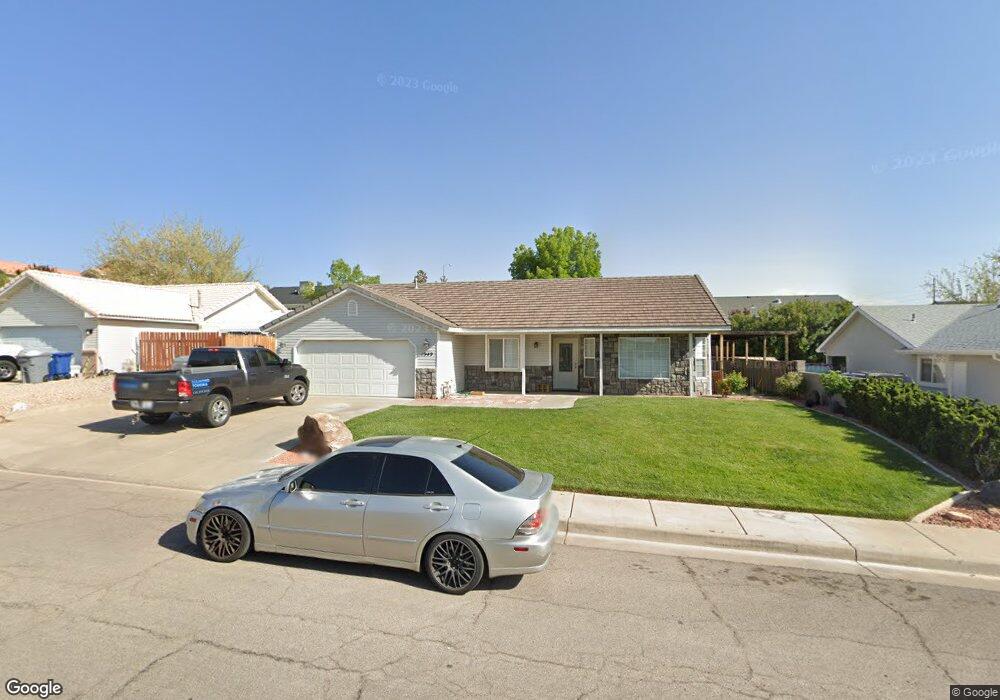
1949 E 10 North Cir Saint George, UT 84790
Estimated Value: $386,245 - $445,000
3
Beds
2
Baths
1,437
Sq Ft
$296/Sq Ft
Est. Value
About This Home
This home is located at 1949 E 10 North Cir, Saint George, UT 84790 and is currently estimated at $424,811, approximately $295 per square foot. 1949 E 10 North Cir is a home located in Washington County with nearby schools including Panorama School, Pine View Middle School, and Fossil Ridge Intermediate School.
Ownership History
Date
Name
Owned For
Owner Type
Purchase Details
Closed on
Dec 17, 2025
Sold by
Sullivan Michael Sean and Sullivan Kristin C
Bought by
Sharkboy Llc
Current Estimated Value
Purchase Details
Closed on
Jan 18, 2022
Sold by
Sullivan Kristin C
Bought by
Sullivan Michael Sean and Sullivan Kristin C
Home Financials for this Owner
Home Financials are based on the most recent Mortgage that was taken out on this home.
Original Mortgage
$296,000
Interest Rate
3.11%
Mortgage Type
New Conventional
Purchase Details
Closed on
Oct 22, 2021
Sold by
Laird Sheri and Laird Sherri
Bought by
Sullivan Kristin C
Purchase Details
Closed on
Aug 10, 2010
Sold by
Campbell Evan C and Campbell Janessa J
Bought by
Laird Sherri
Create a Home Valuation Report for This Property
The Home Valuation Report is an in-depth analysis detailing your home's value as well as a comparison with similar homes in the area
Purchase History
We collect this data history from publicly available records. To have your information removed, we recommend requesting removal directly through your county’s website.
| Date | Buyer | Sale Price | Title Company |
|---|---|---|---|
| Sharkboy Llc | -- | None Listed On Document | |
| Sullivan Michael Sean | -- | Dixie Title Comapny | |
| Sullivan Kristin C | -- | Eagle Gate Ttl Ins Agcy Inc | |
| Laird Sherri | -- | Mountain View Title St Georg |
Source: Public Records
Mortgage History
We collect this data history from publicly available records. To have your information removed, we recommend requesting removal directly through your county’s website.
| Date | Status | Borrower | Loan Amount |
|---|---|---|---|
| Previous Owner | Sullivan Michael Sean | $296,000 |
Source: Public Records
Tax History
| Year | Tax Paid | Tax Assessment Tax Assessment Total Assessment is a certain percentage of the fair market value that is determined by local assessors to be the total taxable value of land and additions on the property. | Land | Improvement |
|---|---|---|---|---|
| 2025 | $1,407 | $206,525 | $49,500 | $157,025 |
| 2023 | $1,463 | $397,400 | $80,000 | $317,400 |
| 2022 | $2,833 | $398,000 | $80,000 | $318,000 |
| 2021 | $1,395 | $292,400 | $70,000 | $222,400 |
| 2020 | $1,262 | $249,000 | $55,000 | $194,000 |
| 2019 | $1,239 | $238,900 | $55,000 | $183,900 |
| 2018 | $1,197 | $115,720 | $0 | $0 |
| 2017 | $1,025 | $99,110 | $0 | $0 |
| 2016 | $1,073 | $95,920 | $0 | $0 |
| 2015 | $1,035 | $88,715 | $0 | $0 |
| 2014 | $950 | $81,950 | $0 | $0 |
Source: Public Records
Map
Nearby Homes
- 1908 E 40 South Cir
- 77 S 2000 E
- 210 N Mall Dr Unit 35
- 145 N Mall Dr Unit 57
- 24 S Arroyo Dr
- 204 N 2000 E
- 86 S Acantilado Dr
- 201 S 2020 East Cir
- 232 S Acantilado Cir
- 4204 S Crimson Cir Unit 10
- 4186 S Crimson Cir Unit 13
- 2163 E 170 South Cir
- 1651 E 90 South Cir
- 1646 E 90 Cir S
- 0 Null Unit 26-269072
- 5664 S Carnelian Pkwy
- 711 W Juniper Hill Dr
- 1684 E 290 S
- 188 S Eastridge Dr
- 365 S 1750 E
- 1949 E 10 Cir N
- 1963 E 10 North Cir
- 1933 E 10 North Cir
- 1942 E 40 N
- 1970 Circle
- 1970 Circle Unit Lot 4
- 1954 E 40 N
- 1930 E 40 N
- 1975 E 10 Cir N
- 1946 E 10 North Cir
- 1975 E 10 North Cir
- 1960 E 10 Cir N
- 1925 E 10 North Cir
- 1925 E 10 Cir N
- 1960 E 10 North Cir
- 1966 E 40 N
- 1934 E 10 North Cir
- 1934 E 10 Cir N
- 1918 E 40 N
- 1922 E 10 North Cir
Your Personal Tour Guide
Ask me questions while you tour the home.