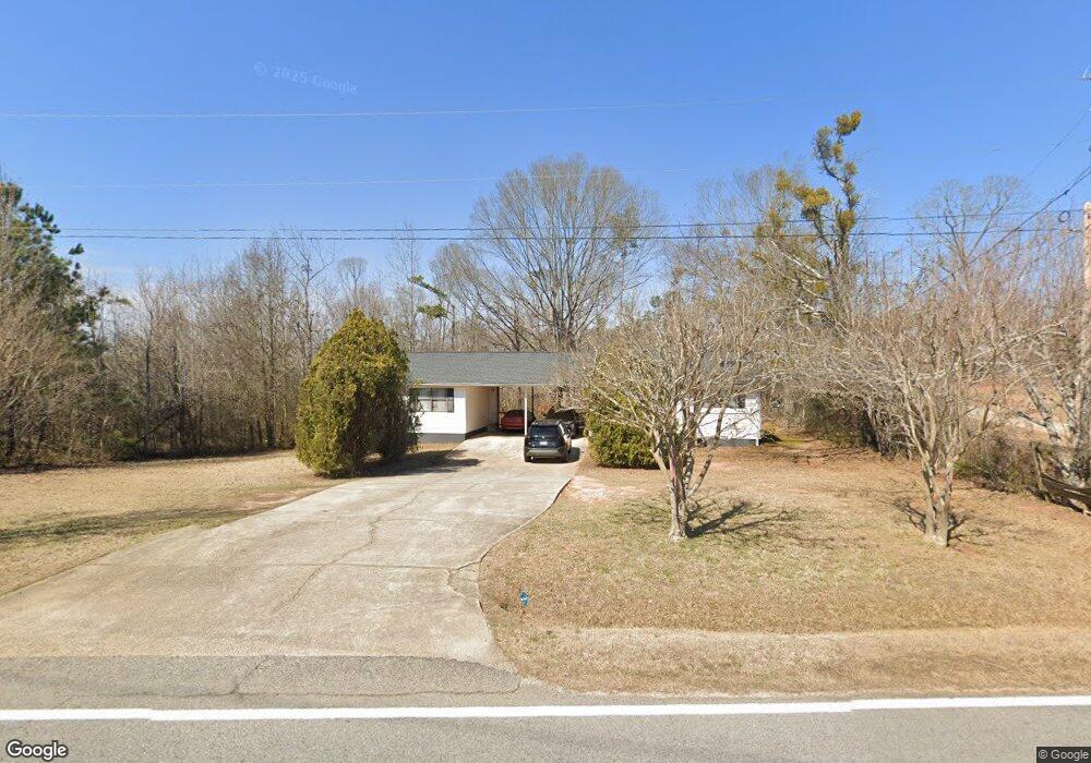
1949 E Mcintosh Rd Griffin, GA 30223
Spalding County NeighborhoodEstimated Value: $132,000 - $167,000
--
Bed
2
Baths
1,512
Sq Ft
$99/Sq Ft
Est. Value
About This Home
This home is located at 1949 E Mcintosh Rd, Griffin, GA 30223 and is currently estimated at $149,397, approximately $98 per square foot. 1949 E Mcintosh Rd is a home located in Spalding County with nearby schools including Jackson Road Elementary School, Kennedy Road Middle School, and Spalding High School.
Ownership History
Date
Name
Owned For
Owner Type
Purchase Details
Closed on
Dec 23, 2014
Sold by
Us Bank National Association T
Bought by
Sisco Rita
Current Estimated Value
Purchase Details
Closed on
Jun 3, 2014
Sold by
Neel Michael L
Bought by
Us Bank National Association T and Abfc 2007 Wmc1 Trust
Purchase Details
Closed on
Jan 9, 2007
Sold by
Neel Michael L
Bought by
Neel Michael L and Neel Nikki
Home Financials for this Owner
Home Financials are based on the most recent Mortgage that was taken out on this home.
Original Mortgage
$75,700
Interest Rate
8.25%
Mortgage Type
New Conventional
Create a Home Valuation Report for This Property
The Home Valuation Report is an in-depth analysis detailing your home's value as well as a comparison with similar homes in the area
Home Values in the Area
Average Home Value in this Area
Purchase History
| Date | Buyer | Sale Price | Title Company |
|---|---|---|---|
| Sisco Rita | $31,649 | -- | |
| Us Bank National Association T | -- | -- | |
| Neel Michael L | -- | -- |
Source: Public Records
Mortgage History
| Date | Status | Borrower | Loan Amount |
|---|---|---|---|
| Previous Owner | Neel Michael L | $75,700 |
Source: Public Records
Tax History Compared to Growth
Tax History
| Year | Tax Paid | Tax Assessment Tax Assessment Total Assessment is a certain percentage of the fair market value that is determined by local assessors to be the total taxable value of land and additions on the property. | Land | Improvement |
|---|---|---|---|---|
| 2024 | $1,514 | $42,784 | $8,148 | $34,636 |
| 2023 | $1,556 | $42,784 | $8,148 | $34,636 |
| 2022 | $1,354 | $37,226 | $7,458 | $29,768 |
| 2021 | $1,161 | $31,924 | $7,458 | $24,466 |
| 2020 | $906 | $29,205 | $7,458 | $21,747 |
| 2019 | $1,087 | $29,205 | $7,458 | $21,747 |
| 2018 | $1,036 | $27,109 | $7,458 | $19,651 |
| 2017 | $1,008 | $27,109 | $7,458 | $19,651 |
| 2016 | $872 | $27,109 | $7,458 | $19,651 |
| 2015 | $493 | $27,109 | $7,458 | $19,651 |
| 2014 | $1,078 | $27,109 | $7,458 | $19,651 |
Source: Public Records
Map
Nearby Homes
- 583 Hamil Rd
- 112 Woodhollow Dr
- 55 Smoak Rd
- 117 Woodhollow Dr
- 195 Hamil Rd
- 0 Hamil Rd Unit 6.21 AC 10578337
- 235 Cecil Jackson Rd
- 221 Hamil Rd Unit 12.5 AC
- 243 Hamil Rd Unit 13.18 AC
- 243 Hamil Rd
- 265 Hamil Rd Unit 31.89 AC
- 1445 E Mcintosh Rd
- 2524 E Mcintosh Rd
- 221 Little Gem Ct
- 1339 N 2nd St
- 1534 Cabin Creek Trail
- 1517 Cabin Creek Trail
- 226 English Ivy Dr
- 128 Crape Myrtle Dr
- 329 Sandy Springs Dr
- 1756 E Mcintosh Rd
- 1979 E Mcintosh Rd
- 1999 E Mcintosh Rd
- 1989 E Mcintosh Rd
- 1962 E Mcintosh Rd
- 1950 E Mcintosh Rd
- 1980 E Mcintosh Rd
- 1938 E Mcintosh Rd
- 1792 E Mcintosh Rd Unit LOT 4
- 1786 E Mcintosh Rd Unit LOT 1
- 1786 E Mcintosh Rd
- 1796 E Mcintosh Rd Unit MI-6
- 2009 E Mcintosh Rd
- 1992 E Mcintosh Rd
- 2019 E Mcintosh Rd
- 2010 E Mcintosh Rd
- 2023 E Mcintosh Rd
- 1875 E Mcintosh Rd
- 2027 E Mcintosh Rd
- 2035 E Mcintosh Rd