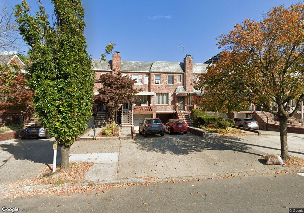
1949 Gerritsen Ave Brooklyn, NY 11229
Marine Park NeighborhoodEstimated Value: $725,000 - $994,000
Studio
--
Bath
1,120
Sq Ft
$728/Sq Ft
Est. Value
About This Home
This home is located at 1949 Gerritsen Ave, Brooklyn, NY 11229 and is currently estimated at $814,969, approximately $727 per square foot. 1949 Gerritsen Ave is a home located in Kings County with nearby schools including P.S. 194 Raoul Wallenberg, J.H.S. 278 Marine Park, and James Madison High School.
Ownership History
Date
Name
Owned For
Owner Type
Purchase Details
Closed on
Jan 18, 2023
Sold by
Pomerantz Anna
Bought by
Pomerantz Anna
Current Estimated Value
Purchase Details
Closed on
Jan 27, 2017
Sold by
Cohen Jacob
Bought by
Glantz As Co & Trustee Tikva and Irrevocable Trust
Purchase Details
Closed on
Oct 23, 1995
Sold by
Desimone Pasquale
Bought by
Cohen Jacob and Pomerantz Anna
Home Financials for this Owner
Home Financials are based on the most recent Mortgage that was taken out on this home.
Original Mortgage
$148,500
Interest Rate
7.47%
Create a Home Valuation Report for This Property
The Home Valuation Report is an in-depth analysis detailing your home's value as well as a comparison with similar homes in the area
Home Values in the Area
Average Home Value in this Area
Purchase History
| Date | Buyer | Sale Price | Title Company |
|---|---|---|---|
| Pomerantz Anna | -- | -- | |
| Anna Pomerantz Irrevocable Trust | -- | -- | |
| Glantz As Co & Trustee Tikva | -- | -- | |
| Cohen Jacob | $165,000 | First American Title Ins Co |
Source: Public Records
Mortgage History
| Date | Status | Borrower | Loan Amount |
|---|---|---|---|
| Previous Owner | Cohen Jacob | $148,500 |
Source: Public Records
Tax History
| Year | Tax Paid | Tax Assessment Tax Assessment Total Assessment is a certain percentage of the fair market value that is determined by local assessors to be the total taxable value of land and additions on the property. | Land | Improvement |
|---|---|---|---|---|
| 2025 | $5,432 | $51,120 | $7,320 | $43,800 |
| 2024 | $5,432 | $44,880 | $7,320 | $37,560 |
| 2023 | $5,451 | $49,200 | $7,320 | $41,880 |
| 2022 | $5,055 | $49,260 | $7,320 | $41,940 |
| 2021 | $5,027 | $38,280 | $7,320 | $30,960 |
| 2019 | $4,714 | $39,360 | $7,320 | $32,040 |
| 2016 | $3,358 | $19,906 | $5,741 | $14,165 |
| 2015 | $2,477 | $18,780 | $8,100 | $10,680 |
| 2014 | $2,477 | $18,780 | $8,100 | $10,680 |
Source: Public Records
Map
Nearby Homes
- 1882 Batchelder St
- 1908 Gerritsen Ave
- 2012 Stuart St
- 1927 Batchelder St
- 1921 Haring St
- 1848 Haring St
- 1837 Burnett St
- 3203 Nostrand Ave Unit 5T
- 3203 Nostrand Ave Unit 5E
- 3203 Nostrand Ave Unit LB
- 3165 Nostrand Ave Unit 1G
- 3165 Nostrand Ave Unit 1N
- 3165 Nostrand Ave Unit 4V
- 3165 Nostrand Ave Unit 1S
- 3019 Avenue T
- 1934 Haring St
- 1802 Stuart St
- 3202 Nostrand Ave Unit 1G
- 1817 Madison Place
- 3178 Nostrand Ave Unit 1C
- 1947 Gerritsen Ave
- 1951 Gerritsen Ave
- 1945 Gerritsen Ave
- 1953 Gerritsen Ave
- 1943 Gerritsen Ave
- 1955 Gerritsen Ave
- 1941 Gerritsen Ave
- 1957 Gerritsen Ave
- 1939 Gerritsen Ave
- 1939 Gerritsen Ave Unit Building
- 1937 Gerritsen Ave
- 1959 Gerritsen Ave
- 1956 Stuart St
- 1952 Stuart St
- 1958 Stuart St
- 1950 Stuart St
- 1960 Stuart St
- 1935 Gerritsen Ave
- 1961 Gerritsen Ave
- 1948 Stuart St
Your Personal Tour Guide
Ask me questions while you tour the home.