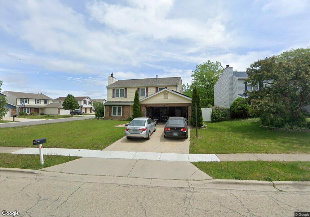
1949 Harvest Ln Unit 18 Glendale Heights, IL 60139
Estimated Value: $395,000 - $418,000
4
Beds
3
Baths
2,276
Sq Ft
$179/Sq Ft
Est. Value
About This Home
This home is located at 1949 Harvest Ln Unit 18, Glendale Heights, IL 60139 and is currently estimated at $408,369, approximately $179 per square foot. 1949 Harvest Ln Unit 18 is a home located in DuPage County with nearby schools including Americana Intermediate School, Glenside Middle School, and Glenbard North High School.
Ownership History
Date
Name
Owned For
Owner Type
Purchase Details
Closed on
Oct 26, 2010
Sold by
Federal Home Loan Mortgage Corporation
Bought by
Bedwal Harbhajan S and Badwal Darshan
Current Estimated Value
Home Financials for this Owner
Home Financials are based on the most recent Mortgage that was taken out on this home.
Original Mortgage
$137,360
Interest Rate
4.84%
Mortgage Type
FHA
Purchase Details
Closed on
Jun 4, 2010
Sold by
Aguilar Michael
Bought by
Federal Home Loan Mortgage Corp
Purchase Details
Closed on
Jan 7, 2002
Sold by
Ronning Jack C and Ronning Judith L
Bought by
Aguilar Michael
Home Financials for this Owner
Home Financials are based on the most recent Mortgage that was taken out on this home.
Original Mortgage
$203,203
Interest Rate
7.16%
Mortgage Type
FHA
Create a Home Valuation Report for This Property
The Home Valuation Report is an in-depth analysis detailing your home's value as well as a comparison with similar homes in the area
Home Values in the Area
Average Home Value in this Area
Purchase History
| Date | Buyer | Sale Price | Title Company |
|---|---|---|---|
| Bedwal Harbhajan S | $170,000 | Atg | |
| Federal Home Loan Mortgage Corp | -- | None Available | |
| Aguilar Michael | $210,000 | -- |
Source: Public Records
Mortgage History
| Date | Status | Borrower | Loan Amount |
|---|---|---|---|
| Previous Owner | Bedwal Harbhajan S | $137,360 | |
| Previous Owner | Aguilar Michael | $203,203 |
Source: Public Records
Tax History Compared to Growth
Tax History
| Year | Tax Paid | Tax Assessment Tax Assessment Total Assessment is a certain percentage of the fair market value that is determined by local assessors to be the total taxable value of land and additions on the property. | Land | Improvement |
|---|---|---|---|---|
| 2024 | $7,101 | $111,110 | $23,313 | $87,797 |
| 2023 | $7,557 | $101,610 | $21,320 | $80,290 |
| 2022 | $8,289 | $100,990 | $21,180 | $79,810 |
| 2021 | $8,287 | $95,950 | $20,120 | $75,830 |
| 2020 | $8,688 | $93,610 | $19,630 | $73,980 |
| 2019 | $8,183 | $87,630 | $18,860 | $68,770 |
| 2018 | $8,586 | $82,330 | $18,370 | $63,960 |
| 2017 | $8,340 | $76,310 | $17,030 | $59,280 |
| 2016 | $8,032 | $70,620 | $15,760 | $54,860 |
| 2015 | $7,894 | $65,900 | $14,710 | $51,190 |
| 2014 | $7,962 | $65,900 | $14,710 | $51,190 |
| 2013 | $6,402 | $56,670 | $15,210 | $41,460 |
Source: Public Records
Map
Nearby Homes
- 1890 Harvest Ln
- 39 Mill Pond Dr
- 1713 Schmale Rd
- 241 Army Trail Rd
- 2018 Stonefield Dr
- 89 Stonefield Dr
- 10 W Schubert Ave
- 10 W Drummond Ave
- 1760 Lombard Ct
- 187 W Army Trail Rd
- 25 W Wrightwood Ave
- 133 Harding Ct
- 10 W Nevada Ave
- 152 W Montana Ave
- 134 W Montana Ave
- 475 W Army Trail Rd
- 200 Ahmed Ct
- 169 E Lake Ridge Dr Unit 21
- 2257 Lake Ridge Dr Unit 74
- 258 Thrasher St
- 1943 Harvest Ln Unit 18
- 149 Appleby Dr
- 156 Appleby Dr
- 1937 Harvest Ln
- 167 Appleby Dr
- 150 Appleby Dr
- 143 Appleby Dr
- 146 Appleby Dr
- 1931 Harvest Ln
- 166 Appleby Dr
- 1944 Harvest Ln
- 1938 Harvest Ln
- 173 Appleby Dr
- 1936 Brockton Ln
- 1932 Brockton Ln
- 140 Appleby Dr Unit 18
- 153 Mill Pond Dr
- 147 Mill Pond Dr
- 170 Appleby Dr
- 1946 Brockton Ln