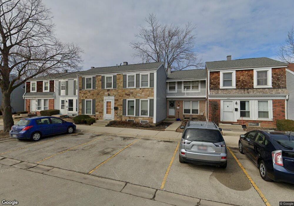
1949 Holbrook Ln Unit 2 Hoffman Estates, IL 60169
South Hoffman Estates NeighborhoodEstimated Value: $242,000 - $295,000
3
Beds
2
Baths
1,276
Sq Ft
$213/Sq Ft
Est. Value
About This Home
This home is located at 1949 Holbrook Ln Unit 2, Hoffman Estates, IL 60169 and is currently estimated at $271,963, approximately $213 per square foot. 1949 Holbrook Ln Unit 2 is a home located in Cook County with nearby schools including John Muir Literacy Academy, Dwight D Eisenhower Junior High School, and Hoffman Estates High School.
Ownership History
Date
Name
Owned For
Owner Type
Purchase Details
Closed on
May 24, 1996
Sold by
Ripes Alan and Ripes Jill S
Bought by
Casal Saskya T and Casal Gerino M
Current Estimated Value
Home Financials for this Owner
Home Financials are based on the most recent Mortgage that was taken out on this home.
Original Mortgage
$79,650
Outstanding Balance
$2,477
Interest Rate
6.5%
Estimated Equity
$269,486
Purchase Details
Closed on
Feb 16, 1994
Sold by
Gray Kathryn P Marine and Gray Gary L
Bought by
Ripes Alan and Ripes Jill S
Home Financials for this Owner
Home Financials are based on the most recent Mortgage that was taken out on this home.
Original Mortgage
$65,500
Interest Rate
7.32%
Create a Home Valuation Report for This Property
The Home Valuation Report is an in-depth analysis detailing your home's value as well as a comparison with similar homes in the area
Home Values in the Area
Average Home Value in this Area
Purchase History
| Date | Buyer | Sale Price | Title Company |
|---|---|---|---|
| Casal Saskya T | $132,750 | 1St American Title | |
| Ripes Alan | $57,000 | -- |
Source: Public Records
Mortgage History
| Date | Status | Borrower | Loan Amount |
|---|---|---|---|
| Open | Casal Saskya T | $79,650 | |
| Previous Owner | Ripes Alan | $65,500 |
Source: Public Records
Tax History
| Year | Tax Paid | Tax Assessment Tax Assessment Total Assessment is a certain percentage of the fair market value that is determined by local assessors to be the total taxable value of land and additions on the property. | Land | Improvement |
|---|---|---|---|---|
| 2025 | $4,506 | $23,000 | $3,200 | $19,800 |
| 2024 | $4,506 | $18,000 | $3,000 | $15,000 |
| 2023 | $4,330 | $18,000 | $3,000 | $15,000 |
| 2022 | $4,330 | $18,000 | $3,000 | $15,000 |
| 2021 | $3,641 | $14,199 | $2,520 | $11,679 |
| 2020 | $3,631 | $14,199 | $2,520 | $11,679 |
| 2019 | $3,615 | $15,777 | $2,520 | $13,257 |
| 2018 | $3,699 | $14,778 | $2,200 | $12,578 |
| 2017 | $3,652 | $14,778 | $2,200 | $12,578 |
| 2016 | $3,659 | $14,778 | $2,200 | $12,578 |
| 2015 | $3,403 | $13,218 | $1,920 | $11,298 |
| 2014 | $3,360 | $13,218 | $1,920 | $11,298 |
| 2013 | $3,255 | $13,218 | $1,920 | $11,298 |
Source: Public Records
Map
Nearby Homes
- 1965 Blackberry Ln Unit 101
- 2267 Briar Ct Unit 65
- 2051 Kettering Rd Unit 2
- 2080 Sutherland Place Unit 1
- 1792 Williamsburg Dr
- 1836 Stockton Dr Unit 3312
- 2021 Kensington Ln Unit 3004
- 2027 Kensington Ln Unit 3001
- 2025 Kensington Ln Unit 3002
- 2023 Kensington Ln Unit 3003
- 1797 Queensbury Cir Unit 5764
- 1840 Huntington Blvd Unit BW511
- 1840 Huntington Blvd Unit 203
- 1576 Poplar Creek Dr
- 1587 Brookside Dr
- 1722 Fayette Walk Unit E
- 1975 Kenilworth Cir Unit B
- 2222 Seaver Ln
- 1776 Bristol Walk Unit 1776
- 1769 Sessions Walk Unit C
- 1951 Holbrook Ln Unit 2
- 1947 Holbrook Ln Unit 2
- 1953 Holbrook Ln Unit 2
- 1945 Holbrook Ln Unit 2
- 1957 Holbrook Ln Unit 2
- 1959 Holbrook Ln Unit 2
- 1961 Holbrook Ln
- 1963 Holbrook Ln
- 1950 Holbrook Ln Unit 2
- 2161 Greystone Place
- 1952 Holbrook Ln Unit 2
- 1948 Holbrook Ln Unit 2
- 1954 Holbrook Ln
- 1946 Holbrook Ln Unit 2
- 1956 Holbrook Ln
- 1965 Holbrook Ln
- 1982 Holbrook Ln Unit 2
- 1958 Holbrook Ln
- 2157 Greystone Place Unit 2
- 1960 Holbrook Ln Unit 2
Your Personal Tour Guide
Ask me questions while you tour the home.