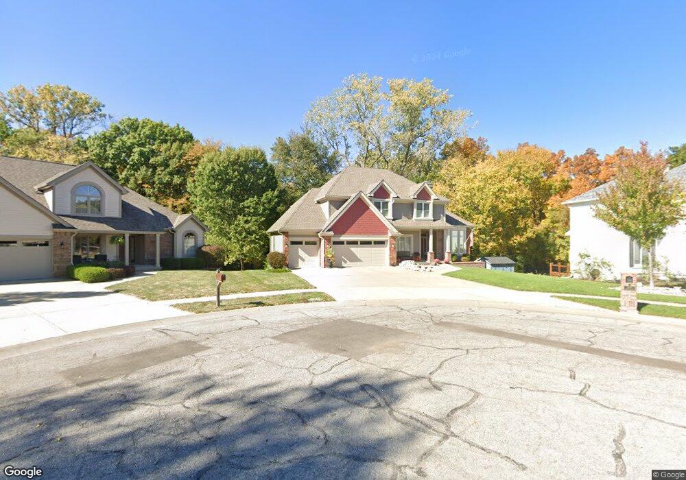
1949 Marvel Ln Liberty, MO 64068
Estimated Value: $433,000 - $553,000
4
Beds
5
Baths
2,510
Sq Ft
$195/Sq Ft
Est. Value
About This Home
This home is located at 1949 Marvel Ln, Liberty, MO 64068 and is currently estimated at $490,657, approximately $195 per square foot. 1949 Marvel Ln is a home located in Clay County with nearby schools including Alexander Doniphan Elementary School, Discovery Middle School, and Liberty High School.
Ownership History
Date
Name
Owned For
Owner Type
Purchase Details
Closed on
Mar 17, 2021
Sold by
Rohlfs Robert M and Rohlfs Christina K
Bought by
Rohlfs Robert Mathew and Rohlfs Christina Kay
Current Estimated Value
Purchase Details
Closed on
Oct 18, 2004
Sold by
Burkholder Scott G and Burkholder Davijean
Bought by
Rohlfs Robert M and Rohlfs Christina K
Home Financials for this Owner
Home Financials are based on the most recent Mortgage that was taken out on this home.
Original Mortgage
$266,799
Outstanding Balance
$121,849
Interest Rate
4.62%
Mortgage Type
Purchase Money Mortgage
Estimated Equity
$368,808
Create a Home Valuation Report for This Property
The Home Valuation Report is an in-depth analysis detailing your home's value as well as a comparison with similar homes in the area
Home Values in the Area
Average Home Value in this Area
Purchase History
| Date | Buyer | Sale Price | Title Company |
|---|---|---|---|
| Rohlfs Robert Mathew | -- | None Available | |
| Rohlfs Robert M | -- | Thomson Title Corporation |
Source: Public Records
Mortgage History
| Date | Status | Borrower | Loan Amount |
|---|---|---|---|
| Open | Rohlfs Robert M | $266,799 |
Source: Public Records
Tax History Compared to Growth
Tax History
| Year | Tax Paid | Tax Assessment Tax Assessment Total Assessment is a certain percentage of the fair market value that is determined by local assessors to be the total taxable value of land and additions on the property. | Land | Improvement |
|---|---|---|---|---|
| 2025 | $5,651 | $82,180 | -- | -- |
| 2024 | $5,651 | $73,470 | -- | -- |
| 2023 | $5,746 | $73,470 | $0 | $0 |
| 2022 | $5,250 | $66,270 | $0 | $0 |
| 2021 | $5,209 | $66,272 | $7,600 | $58,672 |
| 2020 | $4,975 | $59,430 | $0 | $0 |
| 2019 | $4,973 | $59,430 | $0 | $0 |
| 2018 | $4,619 | $54,190 | $0 | $0 |
| 2017 | $4,444 | $54,190 | $5,700 | $48,490 |
| 2016 | $4,444 | $52,630 | $5,700 | $46,930 |
| 2015 | $4,445 | $52,630 | $5,700 | $46,930 |
| 2014 | $4,365 | $51,280 | $5,320 | $45,960 |
Source: Public Records
Map
Nearby Homes
- 509 Belmont St
- 415 Monterey Ave
- 420 Belmont St
- 1323 Amesbury Ave
- 1507 Amesbury Ave
- 1124 Amesbury Ave
- 1218 Canterbury Ln
- 1733 Welleslay Ln
- 918 Amesbury Ave
- 862 Amesbury Ave
- 1537 Canterbury Ln
- 716 Bristol Ct
- 1331 Park Ln
- 1327 Easton Ct
- 1304 Wellington Way
- 1317 Park Ln
- Lot 2 Bent Oaks Dr
- 2116 Winding Woods Dr
- Lot 2A Oak Crest Dr
- 11852 N Kentucky Ave
- 1314 Old Trail Rd
- 1945 Marvel Ln
- 1310 Old Trail Rd
- 1941 Marvel Ln
- 1937 Marvel Ln
- 1306 Old Trail Rd
- 1311 Old Trail Rd
- 1934 Marvel Ln
- 1933 Marvel Ln
- 513 Wilshire Blvd
- 517 Wilshire Blvd
- 1302 Old Trail Rd
- 509 Wilshire Blvd
- 601 Wilshire Blvd
- 1930 Marvel Ln
- 605 Wilshire Blvd
- 1929 Marvel Ln
- 501 Wilshire Blvd
- 1940 High Dr
- 505 Wilshire Blvd