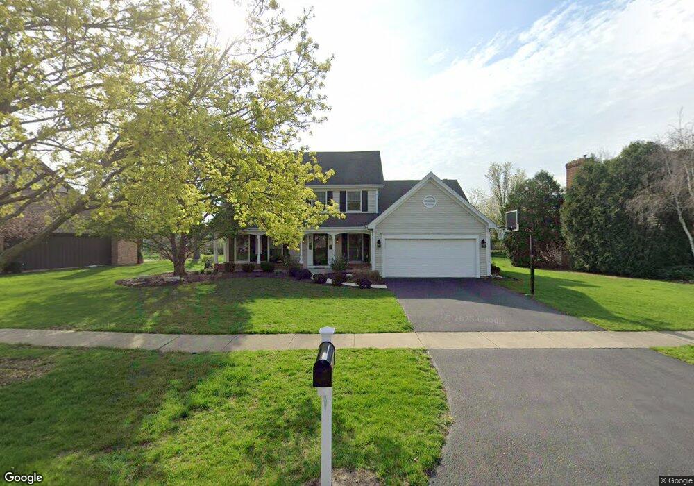
1949 Middleton Dr Wheaton, IL 60189
Stonehedge NeighborhoodEstimated Value: $666,159 - $817,000
4
Beds
3
Baths
2,646
Sq Ft
$290/Sq Ft
Est. Value
About This Home
This home is located at 1949 Middleton Dr, Wheaton, IL 60189 and is currently estimated at $767,790, approximately $290 per square foot. 1949 Middleton Dr is a home located in DuPage County with nearby schools including Whittier Elementary School, Edison Middle School, and Wheaton Warrenville South High School.
Ownership History
Date
Name
Owned For
Owner Type
Purchase Details
Closed on
Nov 7, 2012
Sold by
Burnside Judith A
Bought by
Burnside Judith A and Judith A Burnside Trust
Current Estimated Value
Purchase Details
Closed on
Mar 25, 2004
Sold by
Burnside Sonny K
Bought by
Burnside Judy A
Home Financials for this Owner
Home Financials are based on the most recent Mortgage that was taken out on this home.
Original Mortgage
$120,000
Interest Rate
5.48%
Mortgage Type
Stand Alone Refi Refinance Of Original Loan
Create a Home Valuation Report for This Property
The Home Valuation Report is an in-depth analysis detailing your home's value as well as a comparison with similar homes in the area
Home Values in the Area
Average Home Value in this Area
Purchase History
| Date | Buyer | Sale Price | Title Company |
|---|---|---|---|
| Burnside Judith A | -- | None Available | |
| Burnside Judy A | -- | Ctic |
Source: Public Records
Mortgage History
| Date | Status | Borrower | Loan Amount |
|---|---|---|---|
| Closed | Burnside Judy A | $120,000 |
Source: Public Records
Tax History
| Year | Tax Paid | Tax Assessment Tax Assessment Total Assessment is a certain percentage of the fair market value that is determined by local assessors to be the total taxable value of land and additions on the property. | Land | Improvement |
|---|---|---|---|---|
| 2024 | $11,738 | $198,127 | $51,778 | $146,349 |
| 2023 | $11,243 | $182,370 | $47,660 | $134,710 |
| 2022 | $11,174 | $172,350 | $45,040 | $127,310 |
| 2021 | $11,130 | $168,260 | $43,970 | $124,290 |
| 2020 | $11,093 | $166,690 | $43,560 | $123,130 |
| 2019 | $10,831 | $162,290 | $42,410 | $119,880 |
| 2018 | $10,966 | $162,410 | $39,960 | $122,450 |
| 2017 | $10,793 | $156,420 | $38,490 | $117,930 |
| 2016 | $10,637 | $150,170 | $36,950 | $113,220 |
| 2015 | $11,267 | $152,370 | $35,250 | $117,120 |
| 2014 | $10,575 | $136,420 | $34,740 | $101,680 |
| 2013 | $10,302 | $136,830 | $34,840 | $101,990 |
Source: Public Records
Map
Nearby Homes
- 30 Danada Dr
- 141 Loretto Ct
- 25W773 Sunnyridge Ct
- 2631 Weatherbee Ln
- 2S671 Arrowhead Dr
- 1127 Hibbard Rd
- 570 Riva Ct
- 1601 W Wiesbrook Rd
- 1028 Lodalia Ct
- 1605 Burning Trail
- Lot 1 Foothill Dr
- 953 Cordova Ct
- 1265 Windsor Dr
- 1620 Hemstock Ave
- 1021 Greenwood Dr
- 1612 Stonebridge Trail
- 1110 S Gables Blvd
- 2110 Weatherbee Ln
- 1315 Underwood Terrace
- 1129 Rhodes Ct
- 1955 Middleton Dr
- 1943 Middleton Dr
- 1966 Bedford Ct
- 1937 Middleton Dr
- 1961 Middleton Dr
- 1938 Middleton Ct
- 1954 Middleton Dr
- 1960 Bedford Ct
- 1972 Bedford Ct
- 1938 Chatham Dr
- 1939 Middleton Ct
- 1958 Middleton Dr
- 1932 Middleton Ct
- 1934 Chatham Dr
- 1944 Chatham Dr
- 1962 Middleton Dr
- 1934 Middleton Dr
- 1926 Middleton Ct Unit 2
- 2012 Somerset Ln
- 1969 Bedford Ct
Your Personal Tour Guide
Ask me questions while you tour the home.