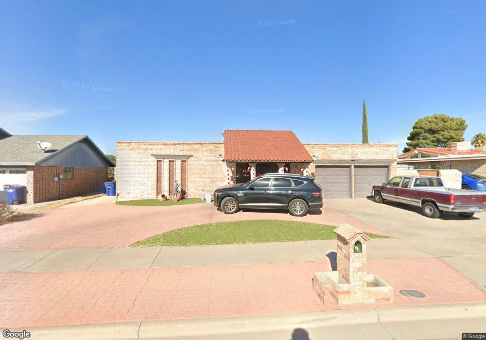
1949 Septiembre Dr El Paso, TX 79935
Vista Del Sol NeighborhoodEstimated Value: $293,000 - $307,259
3
Beds
2
Baths
2,058
Sq Ft
$146/Sq Ft
Est. Value
About This Home
This home is located at 1949 Septiembre Dr, El Paso, TX 79935 and is currently estimated at $300,315, approximately $145 per square foot. 1949 Septiembre Dr is a home located in El Paso County with nearby schools including Eastwood Heights Elementary School, Eastwood Middle School, and Eastwood High School.
Ownership History
Date
Name
Owned For
Owner Type
Purchase Details
Closed on
Nov 24, 2003
Sold by
Carroll Karen L and Carroll Karen Louise
Bought by
Mitchell Robert and Mitchell Lee Ann
Current Estimated Value
Home Financials for this Owner
Home Financials are based on the most recent Mortgage that was taken out on this home.
Original Mortgage
$124,000
Outstanding Balance
$56,847
Interest Rate
5.84%
Mortgage Type
Purchase Money Mortgage
Estimated Equity
$243,468
Create a Home Valuation Report for This Property
The Home Valuation Report is an in-depth analysis detailing your home's value as well as a comparison with similar homes in the area
Home Values in the Area
Average Home Value in this Area
Purchase History
| Date | Buyer | Sale Price | Title Company |
|---|---|---|---|
| Mitchell Robert | -- | -- |
Source: Public Records
Mortgage History
| Date | Status | Borrower | Loan Amount |
|---|---|---|---|
| Open | Mitchell Robert | $124,000 |
Source: Public Records
Tax History Compared to Growth
Tax History
| Year | Tax Paid | Tax Assessment Tax Assessment Total Assessment is a certain percentage of the fair market value that is determined by local assessors to be the total taxable value of land and additions on the property. | Land | Improvement |
|---|---|---|---|---|
| 2025 | $4,158 | $278,974 | $38,523 | $240,451 |
| 2024 | $4,158 | $273,506 | -- | -- |
| 2023 | $4,071 | $248,642 | $0 | $0 |
| 2022 | $7,019 | $226,038 | $0 | $0 |
| 2021 | $6,679 | $205,489 | $38,523 | $166,966 |
| 2020 | $7,251 | $229,560 | $31,846 | $197,714 |
| 2018 | $6,928 | $222,797 | $31,846 | $190,951 |
| 2017 | $6,407 | $209,594 | $31,846 | $177,748 |
| 2016 | $6,407 | $209,594 | $31,846 | $177,748 |
| 2015 | $5,200 | $209,594 | $31,846 | $177,748 |
| 2014 | $5,200 | $210,950 | $31,846 | $179,104 |
Source: Public Records
Map
Nearby Homes
- 2105 Pacheco Dr
- 2109 Febrero Dr
- 1909 Crow Dr
- 2224 Escarpa Dr
- 1955 Trawood Dr Unit 12
- 10313 Byway Dr
- 10309 Woodruff Ct
- 10304 Woodruff Ct
- 2000 Solano Dr
- 10512 Album Ave
- 10233 Byway Dr
- 2412 Penwood Dr
- 2153 Trawood Dr
- 1730 Bara Dr
- 2705 Fierro Dr
- 2701 Brady Place
- 2201 Trawood Dr
- 2313 Frank Beard Dr
- 1644 Lomaland Dr Unit 169
- 2801 Brady Place
- 1953 Septiembre Dr
- 1945 Septiembre Dr
- 10604 Brian Mooney Ave
- 10608 Brian Mooney Ave
- 10600 Brian Mooney Ave
- 1957 Septiembre Dr
- 1941 Septiembre Dr
- 10612 Brian Mooney Ave
- 1948 Septiembre Dr
- 1952 Septiembre Dr
- 10540 Brian Mooney Ave
- 10540 Brian Mooney Ave Unit n/a
- 1944 Septiembre Dr
- 1956 Septiembre Dr
- 10616 Brian Mooney Ave
- 1961 Septiembre Dr
- 1937 Septiembre Dr
- 10609 Brian Mooney Ave
- 10609 Brian Mooney Ave Unit 38
- 10605 Brian Mooney Ave