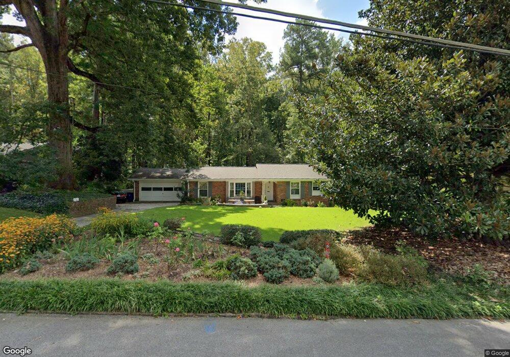
1949 Silvastone Dr Unit 2 Decatur, GA 30033
Estimated Value: $569,000 - $661,000
4
Beds
2
Baths
2,004
Sq Ft
$301/Sq Ft
Est. Value
About This Home
This home is located at 1949 Silvastone Dr Unit 2, Decatur, GA 30033 and is currently estimated at $603,450, approximately $301 per square foot. 1949 Silvastone Dr Unit 2 is a home located in DeKalb County with nearby schools including Briarlake Elementary School, Henderson Middle School, and Lakeside High School.
Ownership History
Date
Name
Owned For
Owner Type
Purchase Details
Closed on
Sep 25, 2001
Sold by
Eubank Thomas H
Bought by
Byrne Mark A and Byrne Stephanie L
Current Estimated Value
Home Financials for this Owner
Home Financials are based on the most recent Mortgage that was taken out on this home.
Original Mortgage
$221,600
Outstanding Balance
$85,656
Interest Rate
6.87%
Mortgage Type
New Conventional
Estimated Equity
$517,794
Create a Home Valuation Report for This Property
The Home Valuation Report is an in-depth analysis detailing your home's value as well as a comparison with similar homes in the area
Home Values in the Area
Average Home Value in this Area
Purchase History
| Date | Buyer | Sale Price | Title Company |
|---|---|---|---|
| Byrne Mark A | $277,000 | -- |
Source: Public Records
Mortgage History
| Date | Status | Borrower | Loan Amount |
|---|---|---|---|
| Open | Byrne Mark A | $221,600 |
Source: Public Records
Tax History Compared to Growth
Tax History
| Year | Tax Paid | Tax Assessment Tax Assessment Total Assessment is a certain percentage of the fair market value that is determined by local assessors to be the total taxable value of land and additions on the property. | Land | Improvement |
|---|---|---|---|---|
| 2025 | $6,452 | $229,120 | $88,000 | $141,120 |
| 2024 | $6,073 | $205,240 | $88,000 | $117,240 |
| 2023 | $6,073 | $196,480 | $88,000 | $108,480 |
| 2022 | $5,292 | $171,920 | $88,000 | $83,920 |
| 2021 | $4,928 | $156,120 | $88,000 | $68,120 |
| 2020 | $4,932 | $156,040 | $88,000 | $68,040 |
| 2019 | $4,414 | $135,680 | $88,000 | $47,680 |
| 2018 | $4,530 | $146,200 | $88,000 | $58,200 |
| 2017 | $5,098 | $158,200 | $52,040 | $106,160 |
| 2016 | $4,873 | $153,040 | $52,040 | $101,000 |
| 2014 | $3,441 | $101,904 | $52,120 | $49,784 |
Source: Public Records
Map
Nearby Homes
- 2793 Woodland Park Dr NE
- 1865 Briarlake Cir
- 1894 Breckenridge Dr NE
- 2994 E Ramble Ln
- 1818 Briarlake Cir
- 1791 Breckenridge Dr NE
- 1770 Lavista Oaks Dr
- 1807 E Ramble Ct
- 2888 Bonanza Dr
- 2906 Cartwright Dr
- 2875 Guinevere Dr NE
- 3825 Lavista Rd Unit Y3
- 3825 Lavista Rd Unit V4
- 2153 Starfire Dr NE
- 1811 Bedfordshire Dr
- 3060 Wilson Rd
- 2130 Starfire Dr NE
- 2106 Zelda Dr NE
- 1941 Silvastone Dr
- 1957 Silvastone Dr
- 1933 Silvastone Dr
- 1933 Silvastone Dr Unit 2
- 0 Silvastone Dr Unit 7346808
- 0 Silvastone Dr Unit 7289846
- 0 Silvastone Dr Unit 8004418
- 0 Silvastone Dr Unit 3158997
- 0 Silvastone Dr Unit 8938107
- 0 Silvastone Dr Unit 3160509
- 0 Silvastone Dr
- 2884 Woodland Park Dr NE
- 1944 Silvastone Dr
- 1954 Silvastone Dr
- 1936 Silvastone Dr
- 1925 Silvastone Dr Unit 2
- 2876 Woodland Park Dr NE
- 2890 Woodland Park Dr NE
- 1928 Silvastone Dr Unit 2
- 0 Briarlake Rd Unit 3256935