Estimated Value: $343,913 - $794,000
--
Bed
--
Bath
3,518
Sq Ft
$164/Sq Ft
Est. Value
About This Home
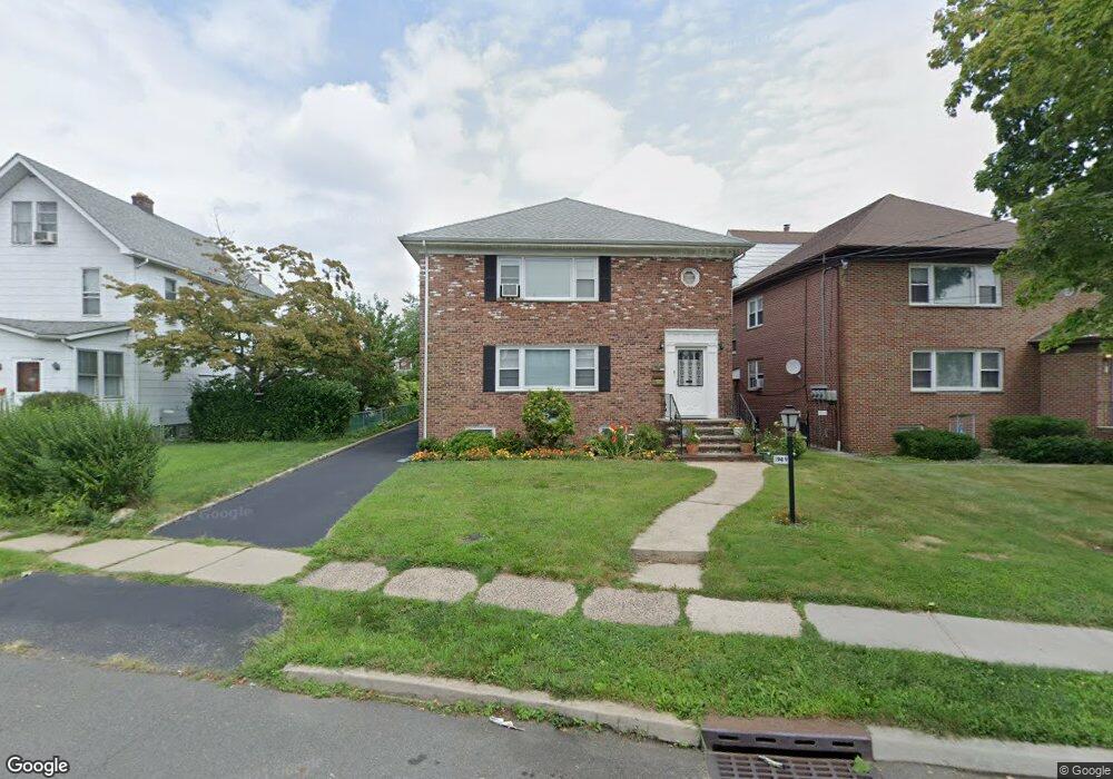
This home is located at 1949 Vauxhall Rd, Union, NJ 07083 and is currently estimated at $577,228, approximately $164 per square foot. 1949 Vauxhall Rd is a home located in Union County with nearby schools including Franklin Elementary School, Burnet Middle School, and Union High School.
Ownership History
Date
Name
Owned For
Owner Type
Purchase Details
Closed on
Feb 19, 2020
Sold by
Lopez Ricardo and Lopez Senaida
Bought by
Lopez Eric
Current Estimated Value
Purchase Details
Closed on
Dec 22, 2006
Sold by
Quagliato Julia
Bought by
Lopez Ricardo and Lopez Senaida
Home Financials for this Owner
Home Financials are based on the most recent Mortgage that was taken out on this home.
Original Mortgage
$335,000
Interest Rate
6.29%
Create a Home Valuation Report for This Property
The Home Valuation Report is an in-depth analysis detailing your home's value as well as a comparison with similar homes in the area
Home Values in the Area
Average Home Value in this Area
Purchase History
| Date | Buyer | Sale Price | Title Company |
|---|---|---|---|
| Lopez Eric | $260,000 | Main Street Title | |
| Lopez Ricardo | $585,000 | -- |
Source: Public Records
Mortgage History
| Date | Status | Borrower | Loan Amount |
|---|---|---|---|
| Previous Owner | Lopez Ricardo | $335,000 |
Source: Public Records
Tax History Compared to Growth
Tax History
| Year | Tax Paid | Tax Assessment Tax Assessment Total Assessment is a certain percentage of the fair market value that is determined by local assessors to be the total taxable value of land and additions on the property. | Land | Improvement |
|---|---|---|---|---|
| 2025 | $15,646 | $70,000 | $21,900 | $48,100 |
| 2024 | $15,168 | $70,000 | $21,900 | $48,100 |
| 2023 | $15,168 | $70,000 | $21,900 | $48,100 |
| 2022 | $14,641 | $70,000 | $21,900 | $48,100 |
| 2021 | $14,286 | $70,000 | $21,900 | $48,100 |
| 2020 | $14,001 | $70,000 | $21,900 | $48,100 |
| 2019 | $13,813 | $70,000 | $21,900 | $48,100 |
| 2018 | $13,578 | $70,000 | $21,900 | $48,100 |
| 2017 | $13,377 | $70,000 | $21,900 | $48,100 |
| 2016 | $13,051 | $70,000 | $21,900 | $48,100 |
| 2015 | $12,835 | $70,000 | $21,900 | $48,100 |
| 2014 | $12,547 | $70,000 | $21,900 | $48,100 |
Source: Public Records
Map
Nearby Homes
- 1244 Grandview Ave
- 1263 Coolidge Ave
- 987 Floyd Terrace
- 152 Glenwood Ct
- 1239 Victor Ave
- 2010 Gless Ave
- 1249 Plane St
- 7 Jessica Ln
- 843 Boyd Ave
- 1893 Arbor Ln
- 1287 Oxford Ln
- 1084 Pine Ave
- 1329 Camden Ct
- 1035 Pine Ave
- 926 Floyd Terrace
- 1848 Portsmouth Way
- 1871 Pilgrim Way
- 2112 Gless Ave
- 2021 Tyler St
- 1231 Glenn Ave
- 1955 Vauxhall Rd
- 1943 Vauxhall Rd
- 1961 Vauxhall Rd
- 1209 Grandview Ave
- 1956 Haines Ave
- 1213 Grandview Ave
- 1203 Grandview Ave
- 1950 Haines Ave
- 1939 Vauxhall Rd
- 1939 Vauxhall Rd Unit 1R
- 1939 Vauxhall Rd Unit 1-Lf
- 1939 Vauxhall Rd Unit 1L
- 1946 Haines Ave
- 1217 Grandview Ave
- 1942 Haines Ave
- 1219 Grandview Ave
- 1933 Vauxhall Rd
- 1960 Vauxhall Rd
- 1942 Vauxhall Rd
- 1221 Grandview Ave