Estimated Value: $203,114 - $372,000
3
Beds
4
Baths
1,260
Sq Ft
$225/Sq Ft
Est. Value
About This Home
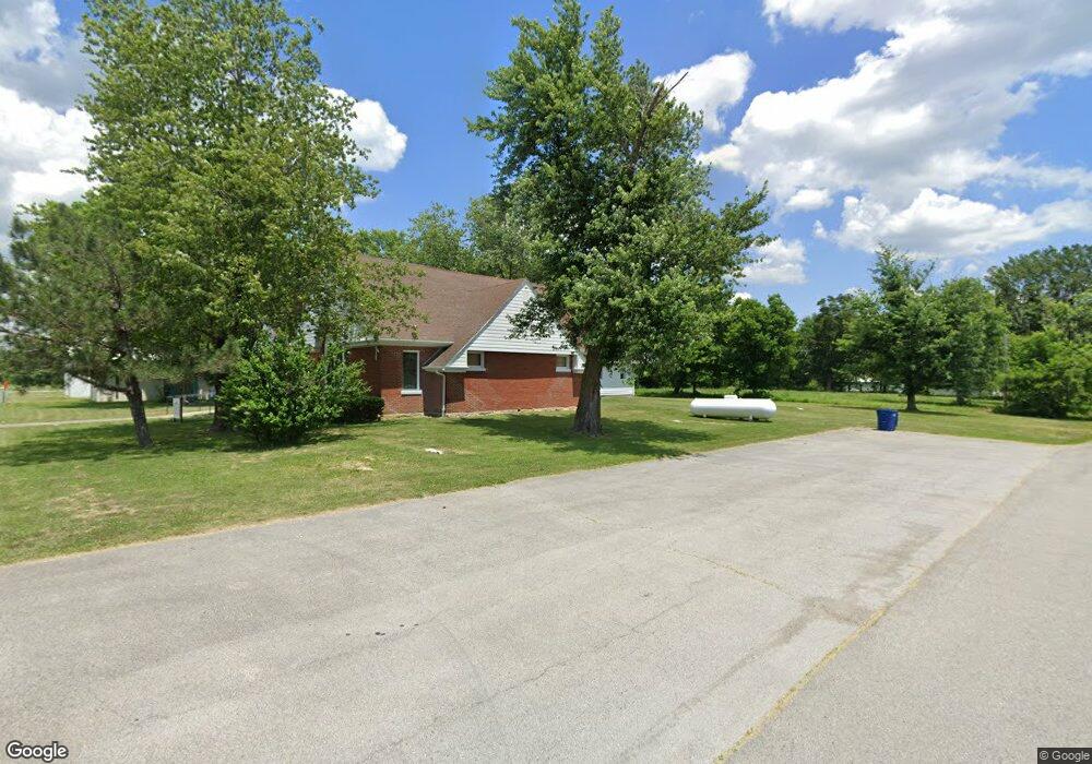
This home is located at 19490 Highway D, Eolia, MO 63344 and is currently estimated at $283,529, approximately $225 per square foot. 19490 Highway D is a home with nearby schools including Clopton Elementary School, Clopton High School, and Pike/Lincoln Technical Center.
Ownership History
Date
Name
Owned For
Owner Type
Purchase Details
Closed on
Jul 16, 2024
Sold by
Fox Dennis and Fox Mary Ann
Bought by
Ricks Tyler and Ricks Julie
Current Estimated Value
Home Financials for this Owner
Home Financials are based on the most recent Mortgage that was taken out on this home.
Original Mortgage
$216,400
Outstanding Balance
$213,835
Interest Rate
7.03%
Mortgage Type
New Conventional
Estimated Equity
$69,694
Create a Home Valuation Report for This Property
The Home Valuation Report is an in-depth analysis detailing your home's value as well as a comparison with similar homes in the area
Purchase History
| Date | Buyer | Sale Price | Title Company |
|---|---|---|---|
| Ricks Tyler | -- | None Listed On Document |
Source: Public Records
Mortgage History
| Date | Status | Borrower | Loan Amount |
|---|---|---|---|
| Open | Ricks Tyler | $216,400 |
Source: Public Records
Tax History
| Year | Tax Paid | Tax Assessment Tax Assessment Total Assessment is a certain percentage of the fair market value that is determined by local assessors to be the total taxable value of land and additions on the property. | Land | Improvement |
|---|---|---|---|---|
| 2025 | $1,245 | $19,650 | $3,120 | $16,530 |
| 2024 | $1,241 | $19,650 | $3,120 | $16,530 |
| 2023 | $1,241 | $19,650 | $3,120 | $16,530 |
| 2022 | $1,121 | $17,770 | $1,240 | $16,530 |
| 2021 | $1,120 | $17,770 | $1,240 | $16,530 |
| 2020 | $1,123 | $17,770 | $1,240 | $16,530 |
| 2019 | $1,124 | $17,770 | $1,240 | $16,530 |
| 2018 | $1,133 | $17,910 | $1,380 | $16,530 |
| 2017 | $1,128 | $17,910 | $1,380 | $16,530 |
| 2016 | $1,123 | $17,910 | $1,380 | $16,530 |
| 2015 | -- | $17,910 | $1,380 | $16,530 |
| 2011 | -- | $17,900 | $1,370 | $16,530 |
Source: Public Records
Map
Nearby Homes
- 21772 Highway D
- 00 Highway D (77 2 + - Acres ) Tract 1
- 0 Highway D - Tract 1 (77 2+ - Acres)
- State Highway D (22+ - Acres) Unit Tract 6
- 0 Highway D - Tract 6 (22+ - Acres) Unit MIS25073444
- 0 Highway D (15+ - Acres) Tract 11 Unit MIS25080783
- 0 Unit MIS25080681
- 0 Highway D - Tract 10 (14 4+ - Acres) Unit MIS25073139
- State Highway D (14 4+ - Acres)
- 0 Highway D - Tract 9 (24 7+ - Acres) Unit MIS25078045
- 26321 Highway H
- 612 N Main St
- 21505 Highway 61
- 28 Ac + - Pike 224
- 0 Pike 224 Unit MAR25021843
- 214 College Cir
- 120 Willow Ln
- 17620 Highway F
- 207 Golden Ct
- 16197 Highway Nn
- 19469 Highway D
- 19411 Highway D
- 0 Hwy D Unit 10041437
- 0 Hwy D Unit MIS25069947
- 19365 Highway D
- 19329 Highway D
- 19328 Highway D
- 19581 Highway D
- 19637 Pike 266
- 19663 Pike 266
- 19607 Pike 266
- 19651 Pike 266
- 19675 Pike 266
- 76 + - Acres Hwy D
- 20158 Highway D
- 19314 Pike 266
- 3 Acres M L Hwy D
- 19626 Pike 266
- 19660 Pike 266
- 19600 Pike 266
Your Personal Tour Guide
Ask me questions while you tour the home.