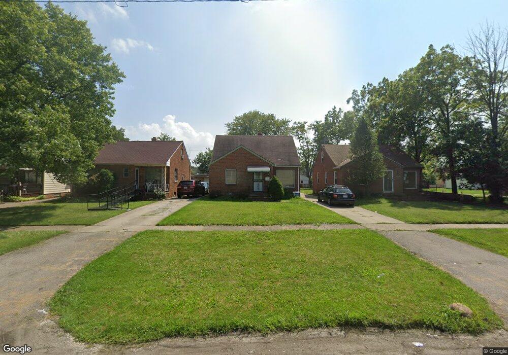
19490 Mccracken Rd Maple Heights, OH 44137
Estimated Value: $129,043 - $167,000
4
Beds
1
Bath
1,603
Sq Ft
$87/Sq Ft
Est. Value
About This Home
This home is located at 19490 Mccracken Rd, Maple Heights, OH 44137 and is currently estimated at $139,761, approximately $87 per square foot. 19490 Mccracken Rd is a home located in Cuyahoga County with nearby schools including Abraham Lincoln Elementary School, Rockside/ J.F. Kennedy School, and Italy High School.
Ownership History
Date
Name
Owned For
Owner Type
Purchase Details
Closed on
Nov 15, 2020
Sold by
Williams Fannie L and Williams Jerome
Bought by
Brock Darling Nakita
Current Estimated Value
Purchase Details
Closed on
Oct 22, 1998
Sold by
Keller Susan L
Bought by
Clark Fannie L
Home Financials for this Owner
Home Financials are based on the most recent Mortgage that was taken out on this home.
Original Mortgage
$71,400
Interest Rate
11.65%
Purchase Details
Closed on
Mar 30, 1985
Sold by
Teschke Robert E and Teschke Lillian R
Bought by
Teschke Robert E
Purchase Details
Closed on
Jan 1, 1975
Bought by
Teschke Robert E and Teschke Lillian R
Create a Home Valuation Report for This Property
The Home Valuation Report is an in-depth analysis detailing your home's value as well as a comparison with similar homes in the area
Home Values in the Area
Average Home Value in this Area
Purchase History
| Date | Buyer | Sale Price | Title Company |
|---|---|---|---|
| Brock Darling Nakita | -- | None Available | |
| Clark Fannie L | $84,000 | Title Xperts Agency Inc | |
| Teschke Robert E | -- | -- | |
| Teschke Robert E | -- | -- |
Source: Public Records
Mortgage History
| Date | Status | Borrower | Loan Amount |
|---|---|---|---|
| Previous Owner | Clark Fannie L | $71,400 |
Source: Public Records
Tax History Compared to Growth
Tax History
| Year | Tax Paid | Tax Assessment Tax Assessment Total Assessment is a certain percentage of the fair market value that is determined by local assessors to be the total taxable value of land and additions on the property. | Land | Improvement |
|---|---|---|---|---|
| 2024 | $3,609 | $39,585 | $6,790 | $32,795 |
| 2023 | $2,360 | $21,530 | $3,890 | $17,640 |
| 2022 | $2,351 | $21,525 | $3,885 | $17,640 |
| 2021 | $2,508 | $21,530 | $3,890 | $17,640 |
| 2020 | $2,249 | $16,310 | $2,940 | $13,370 |
| 2019 | $2,843 | $46,600 | $8,400 | $38,200 |
| 2018 | $2,075 | $16,310 | $2,940 | $13,370 |
| 2017 | $2,106 | $14,840 | $2,730 | $12,110 |
| 2016 | $1,891 | $14,840 | $2,730 | $12,110 |
| 2015 | $1,889 | $14,840 | $2,730 | $12,110 |
| 2014 | $1,889 | $16,310 | $3,010 | $13,300 |
Source: Public Records
Map
Nearby Homes
- 20120 Mccracken Rd
- 19309 Nitra Ave
- 5165 Camden Rd
- 19807 Gardenview Dr
- 19520 Maple Heights Blvd
- 20715 Watson Rd
- 19806 Mountville Dr
- 20814 Watson Rd
- 20907 Watson Rd
- 5265 Bellview St
- 20107 Libby Rd
- 20510 Mountville Dr
- 19812 Stockton Ave
- 19289 Stafford Ave
- 21102 Raymond St
- 19221 Stafford Ave
- 20701 Kenyon Dr
- 5234 Erwin St
- 20814 Kenyon Dr
- 21207 Franklin Rd
- 19500 Mccracken Rd
- 19470 Mccracken Rd
- 19530 Mccracken Rd
- 19450 Mccracken Rd
- 19550 Mccracken Rd
- 19430 Mccracken Rd
- 19417 Fairway Ave
- 19501 Fairway Ave
- 19413 Fairway Ave
- 19505 Fairway Ave
- 19409 Fairway Ave
- 19410 Mccracken Rd
- 19570 Mccracken Rd
- 19509 Fairway Ave
- 19405 Fairway Ave
- 19390 Mccracken Rd
- 19401 Fairway Ave
- 19513 Fairway Ave
- 19616 Mccracken Rd
- 19370 Mccracken Rd