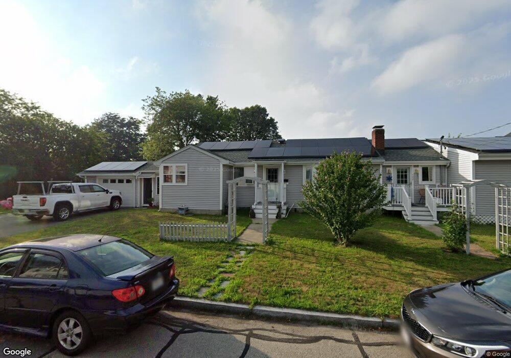
195 Bellevue St Unit 197 New Bedford, MA 02744
The South End NeighborhoodEstimated Value: $479,000 - $567,000
2
Beds
2
Baths
1,566
Sq Ft
$331/Sq Ft
Est. Value
About This Home
This home is located at 195 Bellevue St Unit 197, New Bedford, MA 02744 and is currently estimated at $517,931, approximately $330 per square foot. 195 Bellevue St Unit 197 is a home located in Bristol County with nearby schools including William H. Taylor Elementary School, Roosevelt Middle School, and New Bedford High School.
Ownership History
Date
Name
Owned For
Owner Type
Purchase Details
Closed on
Apr 28, 2021
Sold by
Barksdale Ellen F
Bought by
Barksdale Jason T
Current Estimated Value
Purchase Details
Closed on
Aug 23, 2018
Sold by
Barksdale Andrew H and Barksdale Ellen F
Bought by
Barksdale Ellen F and Barksdale Andrew H
Purchase Details
Closed on
Sep 16, 1999
Sold by
Carreiro Maria I
Bought by
Baksdale Ellen F and Barksdale Andrew H
Home Financials for this Owner
Home Financials are based on the most recent Mortgage that was taken out on this home.
Original Mortgage
$111,000
Interest Rate
7.83%
Mortgage Type
Purchase Money Mortgage
Create a Home Valuation Report for This Property
The Home Valuation Report is an in-depth analysis detailing your home's value as well as a comparison with similar homes in the area
Home Values in the Area
Average Home Value in this Area
Purchase History
| Date | Buyer | Sale Price | Title Company |
|---|---|---|---|
| Barksdale Jason T | -- | None Available | |
| Barksdale Jason T | -- | None Available | |
| Barksdale Ellen F | -- | -- | |
| Barksdale Ellen F | -- | -- | |
| Baksdale Ellen F | $117,000 | -- | |
| Baksdale Ellen F | $117,000 | -- |
Source: Public Records
Mortgage History
| Date | Status | Borrower | Loan Amount |
|---|---|---|---|
| Previous Owner | Baksdale Ellen F | $100,000 | |
| Previous Owner | Baksdale Ellen F | $111,000 | |
| Previous Owner | Baksdale Ellen F | $60,000 |
Source: Public Records
Tax History Compared to Growth
Tax History
| Year | Tax Paid | Tax Assessment Tax Assessment Total Assessment is a certain percentage of the fair market value that is determined by local assessors to be the total taxable value of land and additions on the property. | Land | Improvement |
|---|---|---|---|---|
| 2025 | $5,647 | $499,300 | $155,800 | $343,500 |
| 2024 | $4,728 | $394,000 | $135,500 | $258,500 |
| 2023 | $4,343 | $303,900 | $117,400 | $186,500 |
| 2022 | $4,008 | $257,900 | $108,400 | $149,500 |
| 2021 | $4,021 | $257,900 | $108,400 | $149,500 |
| 2020 | $3,953 | $244,600 | $101,600 | $143,000 |
| 2019 | $3,902 | $236,900 | $101,600 | $135,300 |
| 2018 | $3,745 | $225,200 | $99,400 | $125,800 |
| 2017 | $3,505 | $210,000 | $99,400 | $110,600 |
| 2016 | $3,400 | $206,200 | $97,100 | $109,100 |
| 2015 | $3,111 | $197,800 | $97,100 | $100,700 |
| 2014 | $2,266 | $149,500 | $48,100 | $101,400 |
Source: Public Records
Map
Nearby Homes
- 319 Brock Ave
- 325 Brock Ave
- 293 Brock Ave
- 202 Aquidneck St
- 194 Aquidneck St
- 306 Brock Ave
- 314 Brock Ave
- 208 Aquidneck St
- 211 Bellevue St
- 324 Brock Ave
- 214 Bellevue St
- 294 Brock Ave
- 217 Bellevue St
- 172 Aquidneck St
- 332 Brock Ave Unit 334
- 193 Aquidneck St
- 216 Bellevue St
- 165 Bellevue St
- 168 Aquidneck St
- 174 Bellevue St