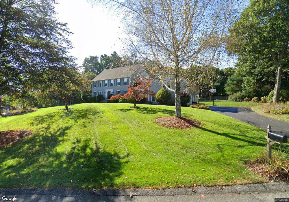
195 Candlestick Rd North Andover, MA 01845
Estimated Value: $1,127,818 - $1,371,000
4
Beds
3
Baths
3,653
Sq Ft
$343/Sq Ft
Est. Value
About This Home
This home is located at 195 Candlestick Rd, North Andover, MA 01845 and is currently estimated at $1,254,455, approximately $343 per square foot. 195 Candlestick Rd is a home located in Essex County with nearby schools including Annie L Sargent Elementary School, North Andover Middle School, and North Andover High School.
Ownership History
Date
Name
Owned For
Owner Type
Purchase Details
Closed on
Aug 24, 2020
Sold by
Pickrell Don H and Cetlin-Pickrell Jane
Bought by
195 Candlestick Road Rt
Current Estimated Value
Purchase Details
Closed on
May 9, 1991
Sold by
Medford Sb
Bought by
Pickrell Don H
Home Financials for this Owner
Home Financials are based on the most recent Mortgage that was taken out on this home.
Original Mortgage
$191,250
Interest Rate
9.41%
Mortgage Type
Purchase Money Mortgage
Create a Home Valuation Report for This Property
The Home Valuation Report is an in-depth analysis detailing your home's value as well as a comparison with similar homes in the area
Home Values in the Area
Average Home Value in this Area
Purchase History
| Date | Buyer | Sale Price | Title Company |
|---|---|---|---|
| 195 Candlestick Road Rt | -- | None Available | |
| Pickrell Don H | $330,000 | -- |
Source: Public Records
Mortgage History
| Date | Status | Borrower | Loan Amount |
|---|---|---|---|
| Previous Owner | Pickrell Don H | $240,000 | |
| Previous Owner | Pickrell Don H | $191,000 | |
| Previous Owner | Pickrell Don H | $191,250 | |
| Previous Owner | Pickrell Don H | $191,250 |
Source: Public Records
Tax History
| Year | Tax Paid | Tax Assessment Tax Assessment Total Assessment is a certain percentage of the fair market value that is determined by local assessors to be the total taxable value of land and additions on the property. | Land | Improvement |
|---|---|---|---|---|
| 2025 | $11,946 | $1,060,900 | $435,600 | $625,300 |
| 2024 | $11,385 | $1,026,600 | $413,800 | $612,800 |
| 2023 | $10,708 | $874,800 | $331,100 | $543,700 |
| 2022 | $10,252 | $757,700 | $287,500 | $470,200 |
| 2021 | $9,867 | $696,300 | $261,400 | $434,900 |
| 2020 | $9,476 | $689,700 | $254,800 | $434,900 |
| 2019 | $9,249 | $689,700 | $254,800 | $434,900 |
| 2018 | $10,021 | $689,700 | $254,800 | $434,900 |
| 2017 | $10,507 | $735,800 | $230,900 | $504,900 |
| 2016 | $9,960 | $698,000 | $235,200 | $462,800 |
| 2015 | $9,923 | $689,600 | $219,700 | $469,900 |
Source: Public Records
Map
Nearby Homes
- 122 Forest St
- 94 Boxford St
- 50 Boxford St
- Lot 10 Stonecleave Rd
- 626 Forest St
- 224 Raleigh Tavern Ln
- 590 Foster St
- 94 Lawrence Rd
- 71 Regency Place
- 851 Forest St
- 61 Abbott St
- Lot 2 (31) Lawrence Rd
- 49 Windsor Ln
- 45 Thistle Rd
- 37 Sullivan St
- 991 Johnson St
- 66 Compass Point Unit 66
- 445 Salem St
- 335 Salem St
- 36 Kieran Rd
- 211 Candlestick Rd
- 174 Candlestick Rd
- 186 Candlestick Rd
- 175 Candlestick Rd
- 200 Candlestick Rd
- 210 Candlestick Rd
- 160 Candlestick Rd
- 271 Candlestick Rd
- 295 Candlestick Rd
- 235 Candlestick Rd
- 220 Candlestick Rd
- 263 Candlestick Rd
- 148 Candlestick Rd
- 151 Candlestick Rd
- 232 Candlestick Rd
- 285 Candlestick Rd
- 357 Candlestick Rd
- 345 Candlestick Rd
- 135 Candlestick Rd
- 134 Candlestick Rd
Your Personal Tour Guide
Ask me questions while you tour the home.