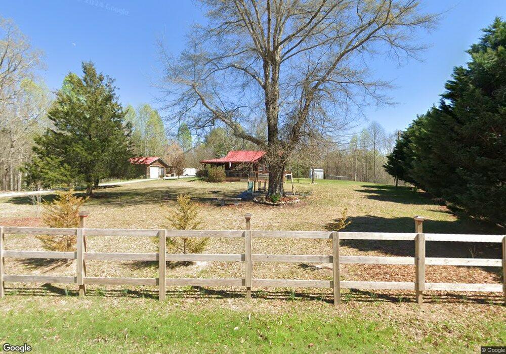
195 Cassidy Bridge Rd Mountain Rest, SC 29664
Estimated Value: $175,124 - $265,000
2
Beds
2
Baths
1,334
Sq Ft
$152/Sq Ft
Est. Value
About This Home
This home is located at 195 Cassidy Bridge Rd, Mountain Rest, SC 29664 and is currently estimated at $202,281, approximately $151 per square foot. 195 Cassidy Bridge Rd is a home located in Oconee County with nearby schools including James M. Brown Elementary School, Walhalla Middle School, and Walhalla High School.
Ownership History
Date
Name
Owned For
Owner Type
Purchase Details
Closed on
Jul 9, 2020
Sold by
Stewart Sonya and Estate Of Thomas Eugene Moore
Bought by
Landers John
Current Estimated Value
Purchase Details
Closed on
Jul 24, 2014
Sold by
Estate Of Ara Lenora Stewart
Bought by
Moore Sonya Renee Stewart and Stewart Sonya Renee
Purchase Details
Closed on
Feb 10, 2011
Sold by
Averill Challen G
Bought by
Moore Thomas and Stewart Sonya
Home Financials for this Owner
Home Financials are based on the most recent Mortgage that was taken out on this home.
Original Mortgage
$76,000
Interest Rate
4.66%
Mortgage Type
New Conventional
Purchase Details
Closed on
Mar 30, 2007
Sold by
C R S Llc
Bought by
Averill Challen G
Purchase Details
Closed on
Mar 1, 2007
Sold by
Barkley Natasha Dawn
Bought by
Crs Llc
Create a Home Valuation Report for This Property
The Home Valuation Report is an in-depth analysis detailing your home's value as well as a comparison with similar homes in the area
Home Values in the Area
Average Home Value in this Area
Purchase History
| Date | Buyer | Sale Price | Title Company |
|---|---|---|---|
| Landers John | $84,500 | None Available | |
| Moore Sonya Renee Stewart | -- | -- | |
| Moore Thomas | $95,000 | -- | |
| Averill Challen G | $81,900 | None Available | |
| Crs Llc | $81,200 | None Available |
Source: Public Records
Mortgage History
| Date | Status | Borrower | Loan Amount |
|---|---|---|---|
| Previous Owner | Moore Thomas | $76,000 |
Source: Public Records
Tax History Compared to Growth
Tax History
| Year | Tax Paid | Tax Assessment Tax Assessment Total Assessment is a certain percentage of the fair market value that is determined by local assessors to be the total taxable value of land and additions on the property. | Land | Improvement |
|---|---|---|---|---|
| 2025 | $1,236 | $3,831 | $897 | $2,934 |
| 2024 | $1,236 | $3,831 | $897 | $2,934 |
| 2023 | $1,236 | $3,831 | $897 | $2,934 |
| 2022 | $1,253 | $3,831 | $897 | $2,934 |
| 2021 | $405 | $3,643 | $857 | $2,786 |
| 2020 | $405 | $3,643 | $857 | $2,786 |
| 2019 | $405 | $0 | $0 | $0 |
| 2018 | $808 | $0 | $0 | $0 |
| 2017 | $400 | $0 | $0 | $0 |
| 2016 | $400 | $0 | $0 | $0 |
| 2015 | -- | $0 | $0 | $0 |
| 2014 | -- | $3,812 | $1,508 | $2,304 |
| 2013 | -- | $0 | $0 | $0 |
Source: Public Records
Map
Nearby Homes
- 283 Cassidy Bridge Rd
- 00 Cassidy Bridge and Buckeye Ridge Rd
- 614 Village Dr
- 00 Homeland Dr
- 00 Homeland (5 04 Acres) Dr
- 00 Dr
- 251 Oak Haven Dr
- 315 Valley Dr
- 0 C H 68
- 494 Old Bear Ln
- 237 Hickory Ridge
- 1399 Lake Jemiki Rd
- LOT 13 Right Branch Dr
- 31 A Bonner Rd
- 46 Mason Dr
- 8650 Highlands Hwy
- 545 Knollington Dr
- 1050 Highlands Hwy
- 147 Lakeside Dr
- 525 Blueberry Ln
- 229 Cassidy Bridge Rd
- 450 Eagle Claw Dr
- 236 Cassidy Bridge Rd
- 440 Old Yellow Branch Rd
- 450 Old Yellow Branch Rd
- 00 Old Yellow Branch Rd
- None Old Yellow Branch Rd
- 255 Cassidy Bridge Rd
- 00 Cassidy Bridge Rd Unit Tract B
- 00 Cassidy Bridge Rd
- 479 Old Yellow Branch Rd
- 180 Caleb Dr
- 469 Old Yellow Branch Rd
- 240 Cassidy Bridge Rd
- 131 Cassidy Bridge Rd
- 425 Old Yellow Branch Rd
- 591 Old Yellow Branch Rd
- 505 Old Yellow Branch Rd
- 380 Honeysuckle Dr
- 260 Cassidy Bridge Rd