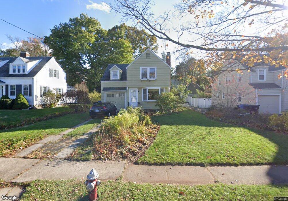
195 Commonwealth Ave New Britain, CT 06053
Estimated Value: $269,247 - $298,000
3
Beds
1
Bath
1,094
Sq Ft
$254/Sq Ft
Est. Value
About This Home
This home is located at 195 Commonwealth Ave, New Britain, CT 06053 and is currently estimated at $277,812, approximately $253 per square foot. 195 Commonwealth Ave is a home located in Hartford County with nearby schools including Holmes School, Pulaski Middle School, and Mountain Laurel Sudbury School.
Ownership History
Date
Name
Owned For
Owner Type
Purchase Details
Closed on
Dec 16, 1987
Sold by
Lawson Raymond C
Bought by
Farmer Maureen W
Current Estimated Value
Home Financials for this Owner
Home Financials are based on the most recent Mortgage that was taken out on this home.
Original Mortgage
$100,000
Interest Rate
10.78%
Create a Home Valuation Report for This Property
The Home Valuation Report is an in-depth analysis detailing your home's value as well as a comparison with similar homes in the area
Home Values in the Area
Average Home Value in this Area
Purchase History
| Date | Buyer | Sale Price | Title Company |
|---|---|---|---|
| Farmer Maureen W | $128,000 | -- |
Source: Public Records
Mortgage History
| Date | Status | Borrower | Loan Amount |
|---|---|---|---|
| Closed | Farmer Maureen W | $66,000 | |
| Closed | Farmer Maureen W | $97,400 | |
| Closed | Farmer Maureen W | $100,000 |
Source: Public Records
Tax History Compared to Growth
Tax History
| Year | Tax Paid | Tax Assessment Tax Assessment Total Assessment is a certain percentage of the fair market value that is determined by local assessors to be the total taxable value of land and additions on the property. | Land | Improvement |
|---|---|---|---|---|
| 2025 | $5,373 | $137,130 | $66,990 | $70,140 |
| 2024 | $5,429 | $137,130 | $66,990 | $70,140 |
| 2023 | $5,249 | $137,130 | $66,990 | $70,140 |
| 2022 | $4,290 | $86,660 | $30,870 | $55,790 |
| 2021 | $4,290 | $86,660 | $30,870 | $55,790 |
| 2020 | $4,376 | $86,660 | $30,870 | $55,790 |
| 2019 | $4,376 | $86,660 | $30,870 | $55,790 |
| 2018 | $4,376 | $86,660 | $30,870 | $55,790 |
| 2017 | $3,864 | $76,510 | $28,140 | $48,370 |
| 2016 | $3,864 | $76,510 | $28,140 | $48,370 |
| 2015 | $3,749 | $76,510 | $28,140 | $48,370 |
| 2014 | $3,749 | $76,510 | $28,140 | $48,370 |
Source: Public Records
Map
Nearby Homes
- 108 Commonwealth Ave
- 34 Oneida St
- 394 Mcclintock St
- 258 Eddy Glover Blvd
- 335 Commonwealth Ave
- 154 Allen St
- 290 Lawlor St
- 107 Allen St
- 55 Allen St
- 262 Tremont St
- 91 Brighton St
- 410 Farmington Ave Unit O6
- 53 Park Dr
- 34 Concord St
- 67 Eastwick Rd
- 83 Kim Dr
- 50 Curtin Ave
- 220 Lasalle St Unit B4
- 426 Allen St
- 234 Pierremount Ave
- 203 Commonwealth Ave
- 189 Commonwealth Ave
- 209 Commonwealth Ave
- 405 Francis St
- 409 Francis St
- 399 Francis St
- 415 Francis St
- 393 Francis St
- 215 Commonwealth Ave
- 200 Commonwealth Ave
- 419 Francis St
- 206 Commonwealth Ave
- 387 Francis St
- 212 Commonwealth Ave
- 425 Francis St
- 369 Eddy Glover Blvd
- 385 Francis St
- 218 Commonwealth Ave
- 363 Eddy Glover Blvd
- 227 Commonwealth Ave