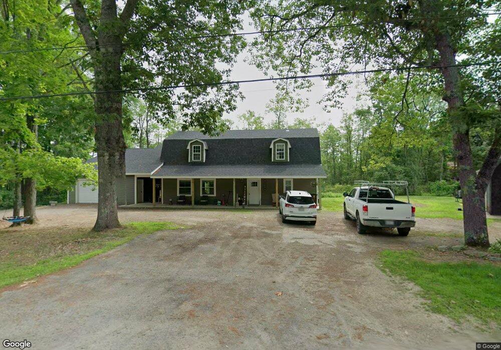
195 Eames Rd Winslow, ME 04901
Estimated Value: $452,000 - $481,614
4
Beds
3
Baths
2,553
Sq Ft
$182/Sq Ft
Est. Value
About This Home
This home is located at 195 Eames Rd, Winslow, ME 04901 and is currently estimated at $465,404, approximately $182 per square foot. 195 Eames Rd is a home with nearby schools including Winslow Elementary School, Winslow Junior High School, and Winslow High School.
Ownership History
Date
Name
Owned For
Owner Type
Purchase Details
Closed on
Apr 13, 2010
Sold by
Garrett Peter and Garrett Jean A
Bought by
Schmidt Caleb P
Current Estimated Value
Home Financials for this Owner
Home Financials are based on the most recent Mortgage that was taken out on this home.
Original Mortgage
$43,500
Outstanding Balance
$29,144
Interest Rate
5.12%
Mortgage Type
Purchase Money Mortgage
Estimated Equity
$436,260
Create a Home Valuation Report for This Property
The Home Valuation Report is an in-depth analysis detailing your home's value as well as a comparison with similar homes in the area
Home Values in the Area
Average Home Value in this Area
Purchase History
| Date | Buyer | Sale Price | Title Company |
|---|---|---|---|
| Schmidt Caleb P | -- | -- |
Source: Public Records
Mortgage History
| Date | Status | Borrower | Loan Amount |
|---|---|---|---|
| Open | Schmidt Caleb P | $43,500 |
Source: Public Records
Tax History
| Year | Tax Paid | Tax Assessment Tax Assessment Total Assessment is a certain percentage of the fair market value that is determined by local assessors to be the total taxable value of land and additions on the property. | Land | Improvement |
|---|---|---|---|---|
| 2024 | $6,230 | $415,300 | $39,100 | $376,200 |
| 2023 | $4,004 | $266,900 | $39,100 | $227,800 |
| 2022 | $3,085 | $169,800 | $26,600 | $143,200 |
| 2021 | $2,909 | $169,000 | $26,600 | $142,400 |
| 2020 | $3,181 | $169,000 | $26,600 | $142,400 |
| 2019 | $3,150 | $169,000 | $26,600 | $142,400 |
| 2018 | $3,032 | $169,000 | $26,600 | $142,400 |
| 2017 | $1,982 | $151,400 | $26,600 | $124,800 |
| 2016 | $2,185 | $138,800 | $26,600 | $112,200 |
| 2015 | $1,707 | $110,100 | $27,200 | $82,900 |
| 2014 | $1,473 | $95,000 | $27,200 | $67,800 |
Source: Public Records
Map
Nearby Homes
- 65 Old Eames Rd
- 183 Eames Rd
- 4960 Eames Rd
- 5030 Eames Rd
- 202 Eames Rd
- 220 Eames Rd
- 123 Eames Rd
- 0 Old Eames Rd
- 0 Eames Rd
- 143 Eames Rd
- 249 Eames Rd
- 130 Eames Rd
- 115 Eames Rd
- 118 Eames Rd
- 6 Fairview Dr Unit 132
- 6 Fairview Dr Unit 123
- 6 Fairview Dr Unit 122
- 6 Fairview Dr Unit 121
- 6 Fairview Dr Unit 113
- 6 Fairview Dr Unit 111
Your Personal Tour Guide
Ask me questions while you tour the home.