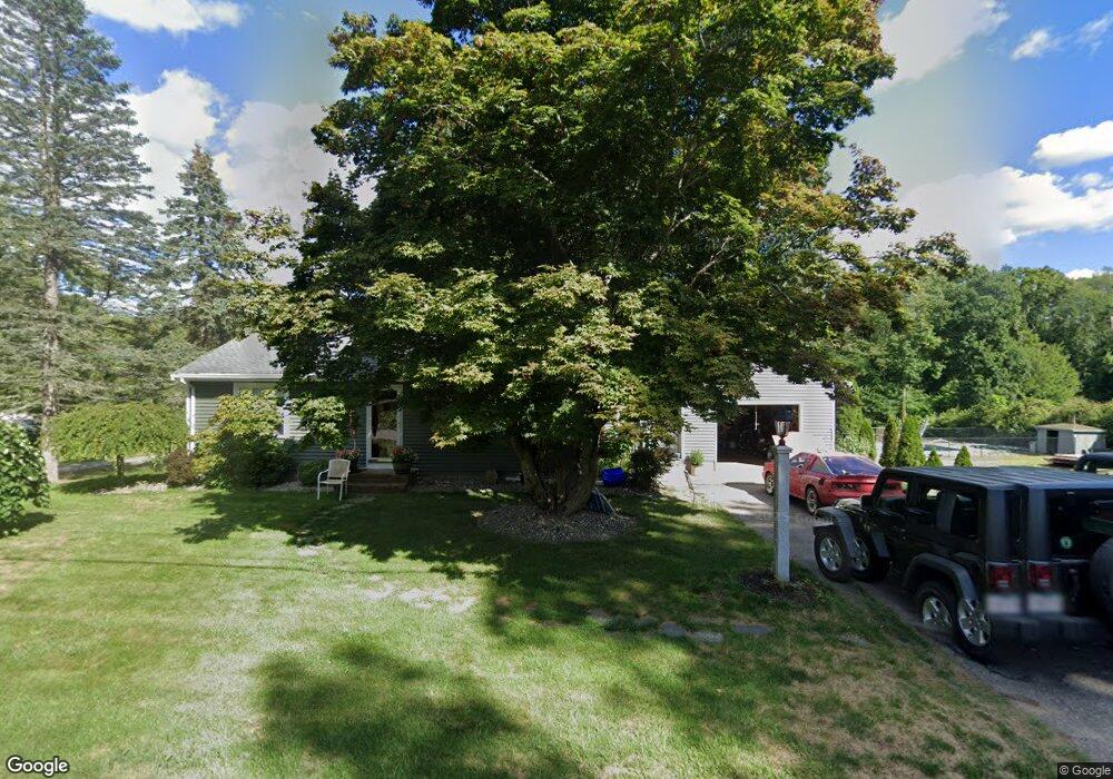
195 Forest St North Dighton, MA 02764
Estimated Value: $381,000 - $498,000
2
Beds
1
Bath
864
Sq Ft
$502/Sq Ft
Est. Value
About This Home
This home is located at 195 Forest St, North Dighton, MA 02764 and is currently estimated at $433,943, approximately $502 per square foot. 195 Forest St is a home located in Bristol County with nearby schools including Dighton-Rehoboth Regional High School and Our Lady of Lourdes School.
Ownership History
Date
Name
Owned For
Owner Type
Purchase Details
Closed on
Apr 15, 2021
Sold by
Munro Thomas O
Bought by
Munro Deborah and Munro Thomas O
Current Estimated Value
Purchase Details
Closed on
Oct 1, 1993
Sold by
Simmons Carlton A
Bought by
Munro Thomas O
Home Financials for this Owner
Home Financials are based on the most recent Mortgage that was taken out on this home.
Original Mortgage
$107,350
Interest Rate
7%
Mortgage Type
Purchase Money Mortgage
Create a Home Valuation Report for This Property
The Home Valuation Report is an in-depth analysis detailing your home's value as well as a comparison with similar homes in the area
Home Values in the Area
Average Home Value in this Area
Purchase History
| Date | Buyer | Sale Price | Title Company |
|---|---|---|---|
| Munro Deborah | -- | None Available | |
| Munro Thomas O | $113,000 | -- |
Source: Public Records
Mortgage History
| Date | Status | Borrower | Loan Amount |
|---|---|---|---|
| Previous Owner | Munro Thomas O | $131,032 | |
| Previous Owner | Munro Thomas O | $5,000 | |
| Previous Owner | Munro Thomas O | $107,350 |
Source: Public Records
Tax History Compared to Growth
Tax History
| Year | Tax Paid | Tax Assessment Tax Assessment Total Assessment is a certain percentage of the fair market value that is determined by local assessors to be the total taxable value of land and additions on the property. | Land | Improvement |
|---|---|---|---|---|
| 2025 | $3,841 | $305,800 | $115,800 | $190,000 |
| 2024 | $3,855 | $281,800 | $115,800 | $166,000 |
| 2023 | $3,689 | $264,600 | $115,800 | $148,800 |
| 2022 | $3,554 | $248,700 | $112,400 | $136,300 |
| 2021 | $3,363 | $226,800 | $101,800 | $125,000 |
| 2020 | $3,414 | $227,900 | $113,800 | $114,100 |
| 2019 | $3,220 | $214,800 | $113,800 | $101,000 |
| 2018 | $2,925 | $196,700 | $96,500 | $100,200 |
| 2017 | $2,907 | $194,600 | $112,300 | $82,300 |
| 2016 | $2,926 | $192,100 | $115,700 | $76,400 |
| 2015 | $2,827 | $191,000 | $119,100 | $71,900 |
| 2014 | $2,843 | $186,700 | $119,100 | $67,600 |
Source: Public Records
Map
Nearby Homes
- 876 Autumn St
- 0 Summer St
- 233-R Summer St
- 343 Forest St
- 221 Summer St
- 698 School St Unit 698
- 441 Forest St
- 238 Andrews St
- 0 Andrews St
- 810 Tremont St
- 1026 Tremont St
- 1401 Tremont St
- 1421 Tremont St
- 424 Winthrop St
- 593 Williams St
- 15 Shetland Rd
- 1472 Somerset Ave
- 0 Range Ave Unit 72771508
- 0 Range Ave Unit 72771509
- 1565 Maple St