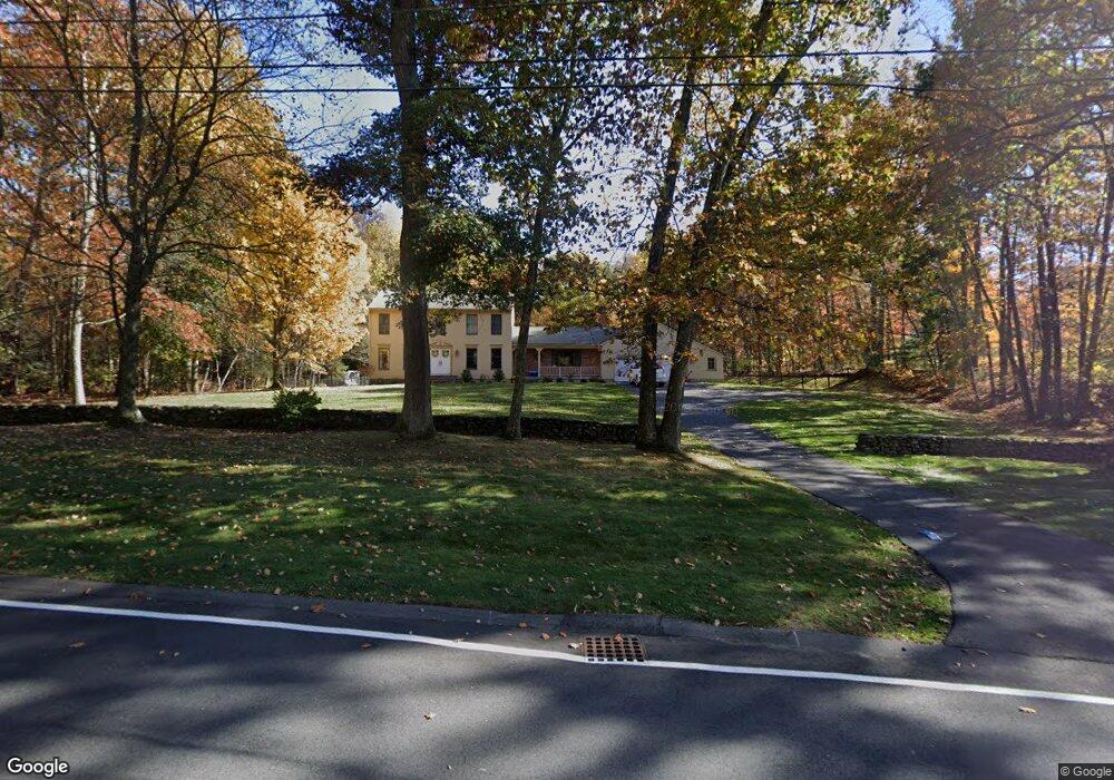
195 Maynard Rd Wilbraham, MA 01095
Estimated Value: $548,804 - $796,000
4
Beds
4
Baths
2,408
Sq Ft
$265/Sq Ft
Est. Value
About This Home
This home is located at 195 Maynard Rd, Wilbraham, MA 01095 and is currently estimated at $637,451, approximately $264 per square foot. 195 Maynard Rd is a home located in Hampden County with nearby schools including Minnechaug Regional High School, St John The Baptist School, and Wilbraham & Monson Academy.
Ownership History
Date
Name
Owned For
Owner Type
Purchase Details
Closed on
May 14, 2010
Sold by
Tabb Barry M and Tabb Patricia A
Bought by
Tabb Patrick B and Tabb Jennifer A
Current Estimated Value
Home Financials for this Owner
Home Financials are based on the most recent Mortgage that was taken out on this home.
Original Mortgage
$295,000
Outstanding Balance
$198,307
Interest Rate
5.11%
Mortgage Type
Purchase Money Mortgage
Estimated Equity
$439,144
Purchase Details
Closed on
May 16, 1988
Sold by
Reilly Avdoulos
Bought by
Tabb Barry M
Purchase Details
Closed on
Jun 29, 1987
Sold by
Deer Run Prop Inc
Bought by
Reilly Avdoulos
Create a Home Valuation Report for This Property
The Home Valuation Report is an in-depth analysis detailing your home's value as well as a comparison with similar homes in the area
Home Values in the Area
Average Home Value in this Area
Purchase History
| Date | Buyer | Sale Price | Title Company |
|---|---|---|---|
| Tabb Patrick B | $369,000 | -- | |
| Tabb Barry M | $240,000 | -- | |
| Reilly Avdoulos | $35,000 | -- |
Source: Public Records
Mortgage History
| Date | Status | Borrower | Loan Amount |
|---|---|---|---|
| Open | Tabb Patrick B | $295,000 | |
| Previous Owner | Reilly Avdoulos | $3,614,000 | |
| Previous Owner | Reilly Avdoulos | $1,330,000 | |
| Previous Owner | Reilly Avdoulos | $170,000 |
Source: Public Records
Tax History
| Year | Tax Paid | Tax Assessment Tax Assessment Total Assessment is a certain percentage of the fair market value that is determined by local assessors to be the total taxable value of land and additions on the property. | Land | Improvement |
|---|---|---|---|---|
| 2025 | $9,446 | $528,300 | $96,400 | $431,900 |
| 2024 | $9,479 | $512,400 | $96,400 | $416,000 |
| 2023 | $8,632 | $463,100 | $96,400 | $366,700 |
| 2022 | $8,632 | $421,300 | $96,400 | $324,900 |
| 2021 | $8,523 | $371,200 | $98,100 | $273,100 |
| 2020 | $8,307 | $371,200 | $98,100 | $273,100 |
| 2019 | $8,092 | $371,200 | $98,100 | $273,100 |
| 2018 | $8,069 | $356,400 | $98,100 | $258,300 |
| 2017 | $7,841 | $356,400 | $98,100 | $258,300 |
| 2016 | $7,759 | $359,200 | $108,600 | $250,600 |
| 2015 | $7,500 | $359,200 | $108,600 | $250,600 |
Source: Public Records
Map
Nearby Homes
- 38 King Dr
- 44 Balsam Hill Rd
- Lot 88 Turning Leaf Equinox Pass
- 37 Balsam Hill Rd
- 80 Elizabeth Dr
- 5 Silver St
- 36 Maple St
- 30 Red Bridge Rd Land Lot 3
- 30 Red Bridge Rd Land Lot 1
- 30 Red Bridge Rd Land Lot 6
- 30 Red Bridge Rd Land Lot 8
- 30 Red Bridge Rd Land Lot 4
- 30 Red Bridge Rd Land Lot 5
- 30 Red Bridge Rd Land Lot 7
- 1172 East St
- 235 James St
- 229 Miller St Unit F-13
- 229 Miller St Unit C-1
- 229 Miller St Unit E-6
- 229 Miller St Unit 3 G
Your Personal Tour Guide
Ask me questions while you tour the home.