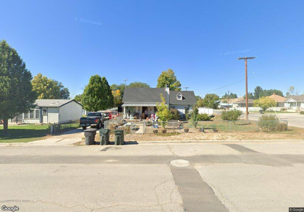
195 N 100 E Wellington, UT 84542
Estimated Value: $142,000 - $239,711
5
Beds
2
Baths
1,558
Sq Ft
$120/Sq Ft
Est. Value
About This Home
This home is located at 195 N 100 E, Wellington, UT 84542 and is currently estimated at $186,928, approximately $119 per square foot. 195 N 100 E is a home located in Carbon County with nearby schools including Wellington School, Mont Harmon Junior High School, and Carbon High School.
Ownership History
Date
Name
Owned For
Owner Type
Purchase Details
Closed on
Oct 30, 2018
Sold by
Federal National Mortgage Association
Bought by
Lofley Robbie and Lofley Martha Rene
Current Estimated Value
Purchase Details
Closed on
Jun 21, 2018
Sold by
Alley Kris and Alley Natalie
Bought by
Federal National Mortgage Association
Purchase Details
Closed on
Dec 31, 2007
Sold by
Hadden Francis Dean
Bought by
Alley Kris and Alley Natalie
Home Financials for this Owner
Home Financials are based on the most recent Mortgage that was taken out on this home.
Original Mortgage
$77,250
Interest Rate
6.21%
Mortgage Type
New Conventional
Create a Home Valuation Report for This Property
The Home Valuation Report is an in-depth analysis detailing your home's value as well as a comparison with similar homes in the area
Purchase History
We collect this data history from publicly available records. To have your information removed, we recommend requesting removal directly through your county’s website.
| Date | Buyer | Sale Price | Title Company |
|---|---|---|---|
| Lofley Robbie | -- | Etitle Insurance Agency | |
| Federal National Mortgage Association | $34,900 | Etitle Insurance Agency | |
| Alley Kris | -- | South Eastern Utah Title Co |
Source: Public Records
Mortgage History
We collect this data history from publicly available records. To have your information removed, we recommend requesting removal directly through your county’s website.
| Date | Status | Borrower | Loan Amount |
|---|---|---|---|
| Previous Owner | Alley Kris | $77,250 |
Source: Public Records
Tax History
| Year | Tax Paid | Tax Assessment Tax Assessment Total Assessment is a certain percentage of the fair market value that is determined by local assessors to be the total taxable value of land and additions on the property. | Land | Improvement |
|---|---|---|---|---|
| 2025 | $815 | $58,830 | $18,919 | $39,911 |
| 2024 | $1,039 | $84,660 | $8,662 | $75,998 |
| 2023 | $1,142 | $98,481 | $10,839 | $87,642 |
| 2022 | $1,084 | $82,541 | $8,078 | $74,462 |
| 2021 | $934 | $111,392 | $14,688 | $96,704 |
| 2020 | $633 | $37,762 | $0 | $0 |
| 2019 | $511 | $31,538 | $0 | $0 |
| 2018 | $499 | $31,538 | $0 | $0 |
| 2017 | $491 | $31,538 | $0 | $0 |
| 2016 | $417 | $31,538 | $0 | $0 |
| 2015 | $417 | $31,538 | $0 | $0 |
| 2014 | $504 | $38,504 | $0 | $0 |
| 2013 | $510 | $38,504 | $0 | $0 |
Source: Public Records
Map
Nearby Homes
Your Personal Tour Guide
Ask me questions while you tour the home.