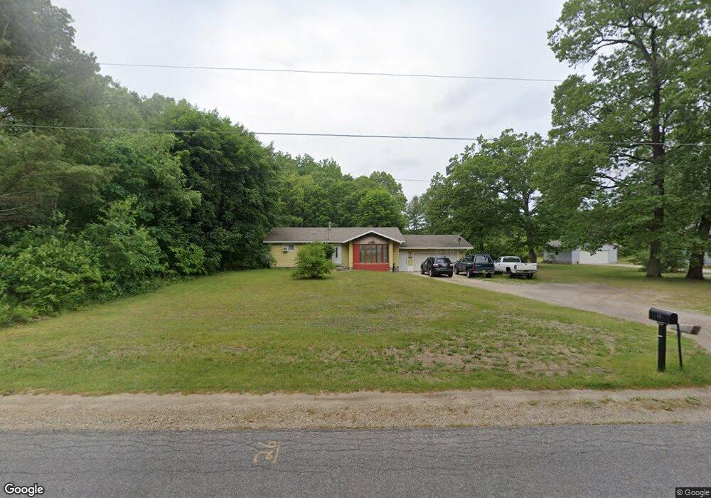
195 N Broton Rd Muskegon, MI 49442
Estimated Value: $222,867 - $280,000
3
Beds
1
Bath
1,274
Sq Ft
$197/Sq Ft
Est. Value
About This Home
This home is located at 195 N Broton Rd, Muskegon, MI 49442 and is currently estimated at $250,717, approximately $196 per square foot. 195 N Broton Rd is a home located in Muskegon County with nearby schools including Oakridge Lower Elementary School, Oakridge Middle School, and Oakridge Upper Elementary School.
Ownership History
Date
Name
Owned For
Owner Type
Purchase Details
Closed on
Aug 31, 2009
Sold by
Wheeler Barbara J
Bought by
Westbrook Donald W and Westbrook Carla M
Current Estimated Value
Home Financials for this Owner
Home Financials are based on the most recent Mortgage that was taken out on this home.
Original Mortgage
$62,124
Outstanding Balance
$40,794
Interest Rate
5.27%
Mortgage Type
FHA
Estimated Equity
$209,923
Create a Home Valuation Report for This Property
The Home Valuation Report is an in-depth analysis detailing your home's value as well as a comparison with similar homes in the area
Home Values in the Area
Average Home Value in this Area
Purchase History
| Date | Buyer | Sale Price | Title Company |
|---|---|---|---|
| Westbrook Donald W | $67,840 | Lighthouse Title Inc |
Source: Public Records
Mortgage History
| Date | Status | Borrower | Loan Amount |
|---|---|---|---|
| Open | Westbrook Donald W | $62,124 |
Source: Public Records
Tax History Compared to Growth
Tax History
| Year | Tax Paid | Tax Assessment Tax Assessment Total Assessment is a certain percentage of the fair market value that is determined by local assessors to be the total taxable value of land and additions on the property. | Land | Improvement |
|---|---|---|---|---|
| 2025 | $1,463 | $87,900 | $0 | $0 |
| 2024 | $479 | $82,400 | $0 | $0 |
| 2023 | $458 | $70,000 | $0 | $0 |
| 2022 | $1,335 | $59,500 | $0 | $0 |
| 2021 | $1,301 | $54,700 | $0 | $0 |
| 2020 | $1,288 | $51,700 | $0 | $0 |
| 2019 | $1,223 | $47,500 | $0 | $0 |
| 2018 | $1,194 | $42,300 | $0 | $0 |
| 2017 | $1,169 | $40,500 | $0 | $0 |
| 2016 | $390 | $37,500 | $0 | $0 |
| 2015 | -- | $39,200 | $0 | $0 |
| 2014 | -- | $34,000 | $0 | $0 |
| 2013 | -- | $32,500 | $0 | $0 |
Source: Public Records
Map
Nearby Homes
- 7100 Annabell Dr
- 85 S Hilton Park Rd
- 464 Grover Rd
- 408 Sabine Dr Unit 10
- 403 Sabine Dr Unit 30
- 5893 White Rd
- 5748 Richmond Ave
- 481 Hazel Ct
- 535 Hazel Ct
- 5664 Hall Rd
- 93 N Michigan St
- 6959 E Apple Ave
- 46 N Kensington St
- 6666 Minard Dr
- 897 Van Eyck St
- 57 N Stewart St
- 60 N Wilson St
- 5532 Russ Ave
- 1135 Woodridge St
- 1179 Brian Dr
- 245 N Broton Rd
- 190 N Broton Rd
- 275 N Broton Rd
- 173 N Broton Rd
- 160 N Broton Rd
- 295 N Broton Rd
- 315 N Broton Rd
- 335 N Broton Rd
- 343 N Broton Rd
- 6835 Bailey Ln
- 25 N Broton Rd
- 6839 Bailey Ln
- 415 N Broton Rd
- 21 S Broton Rd
- 21 S Broton Rd
- 459 N Broton Rd
- 453 N Broton Rd
- 51 S Broton Rd
- 81 S Broton Rd
- 495 N Broton Rd