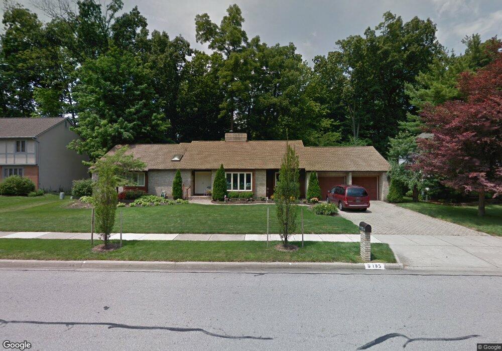
195 N Hempstead Rd Westerville, OH 43081
Estimated Value: $463,358 - $489,000
2
Beds
3
Baths
2,246
Sq Ft
$211/Sq Ft
Est. Value
About This Home
This home is located at 195 N Hempstead Rd, Westerville, OH 43081 and is currently estimated at $472,840, approximately $210 per square foot. 195 N Hempstead Rd is a home located in Franklin County with nearby schools including Mark Twain Elementary School, Walnut Springs Middle School, and Westerville-North High School.
Ownership History
Date
Name
Owned For
Owner Type
Purchase Details
Closed on
Apr 14, 2016
Sold by
Bruno Judy and Woodbury Judeth G
Bought by
Woodbury Judeth G and Woodbury Thomas E
Current Estimated Value
Purchase Details
Closed on
Jul 6, 2007
Sold by
K & K Development Llc
Bought by
Bruno Judy
Purchase Details
Closed on
Jul 13, 2006
Sold by
Varga Mary Jane
Bought by
K & K Development Llc
Purchase Details
Closed on
Jul 7, 1986
Bought by
Varga Varga J and Varga Mary J
Create a Home Valuation Report for This Property
The Home Valuation Report is an in-depth analysis detailing your home's value as well as a comparison with similar homes in the area
Home Values in the Area
Average Home Value in this Area
Purchase History
| Date | Buyer | Sale Price | Title Company |
|---|---|---|---|
| Woodbury Judeth G | -- | Talon Title Agency | |
| Bruno Judy | $212,000 | Talon Group | |
| K & K Development Llc | $200,000 | Talon Group | |
| Varga Varga J | $42,000 | -- |
Source: Public Records
Tax History Compared to Growth
Tax History
| Year | Tax Paid | Tax Assessment Tax Assessment Total Assessment is a certain percentage of the fair market value that is determined by local assessors to be the total taxable value of land and additions on the property. | Land | Improvement |
|---|---|---|---|---|
| 2024 | $7,217 | $126,980 | $36,750 | $90,230 |
| 2023 | $7,063 | $126,980 | $36,750 | $90,230 |
| 2022 | $8,301 | $113,930 | $31,750 | $82,180 |
| 2021 | $8,370 | $113,930 | $31,750 | $82,180 |
| 2020 | $7,705 | $113,930 | $31,750 | $82,180 |
| 2019 | $6,676 | $94,780 | $26,460 | $68,320 |
| 2018 | $6,280 | $94,780 | $26,460 | $68,320 |
| 2017 | $6,566 | $94,780 | $26,460 | $68,320 |
| 2016 | $6,210 | $82,820 | $31,260 | $51,560 |
| 2015 | $6,015 | $82,820 | $31,260 | $51,560 |
| 2014 | $6,019 | $82,820 | $31,260 | $51,560 |
| 2013 | $2,845 | $78,855 | $29,750 | $49,105 |
Source: Public Records
Map
Nearby Homes
- 73 Keethler Dr S
- 974 Lakeland Dr
- 912 Lakeway Ct E
- 1155 Ashford Ct
- 90 Spring Creek Dr
- 768 Collingwood Dr
- 718 Sugar Ct
- 192 Buckeye Ct
- 200 Matthew Ave
- 8369 Manitou Dr
- 589 E College Ave
- 969 Farrington Dr
- 150 Matthew Ave
- 547 County Line Rd
- 182 Hillcrest Dr
- 656 Olde Mill Dr
- 1368 Nutmeg Ct
- 368 E College Ave
- 371 Delaware Dr
- 754 Kingsmead Rd Unit 18754
- 173 N Hempstead Rd
- 172 Fawn Ct
- 192 N Hempstead Rd
- 165 N Hempstead Rd
- 1136 Oakwood Ln
- 157 N Hempstead Rd
- 175 Fawn Ct
- 164 N Hempstead Rd
- 158 Fawn Ct
- 1133 Oakwood Ln
- 1144 Oakwood Ln
- 169 Fawn Ct
- 1116 Marie Lou Dr
- 1108 Marie Lou Dr
- 1141 Oakwood Ln
- 1100 Marie Lou Dr
- 161 Fawn Ct
- 1119 Hoover Lake Ct
- 1152 Oakwood Ln
- 1085 Lakegrove Ct