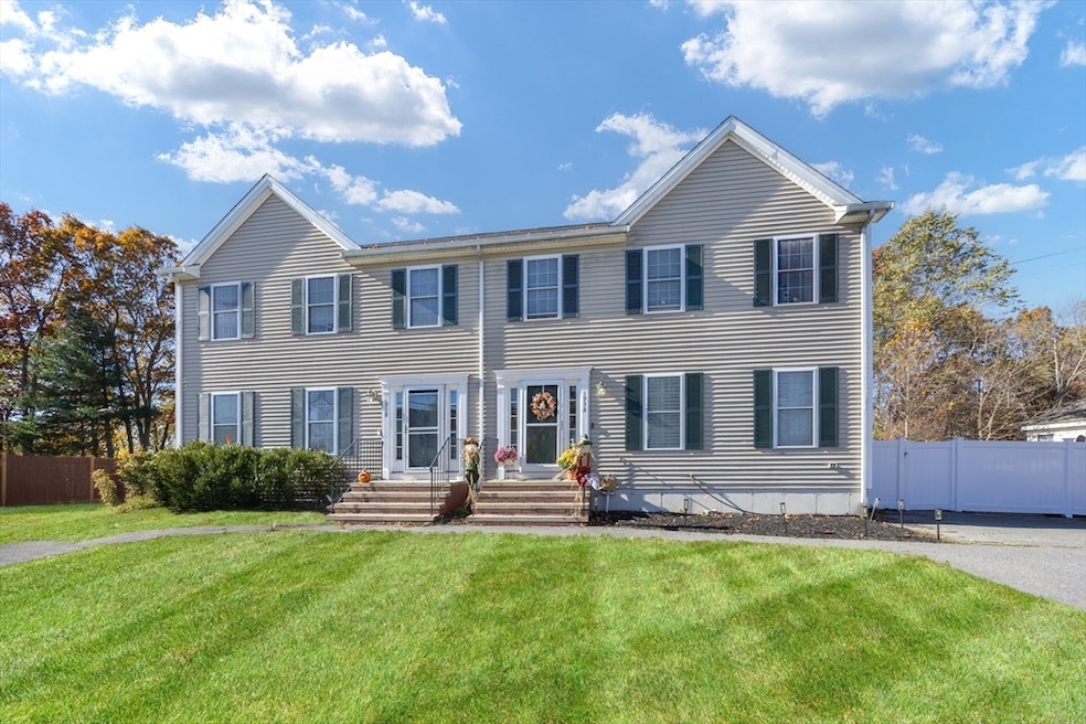
195 Pratt St Unit A Taunton, MA 02780
Weir Village NeighborhoodEstimated payment $2,801/month
Highlights
- Golf Course Community
- Deck
- Wood Flooring
- Medical Services
- Property is near public transit
- Solid Surface Countertops
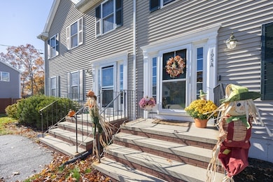
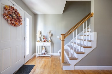
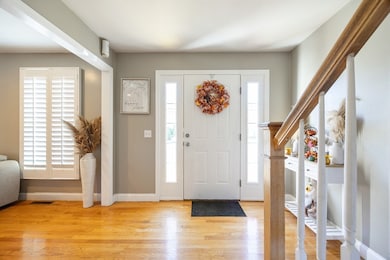
About This Home
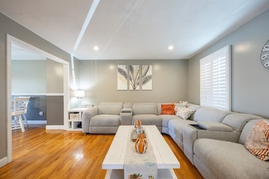
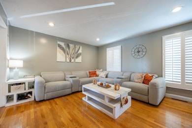
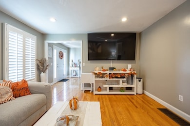
Beautiful Colonial style duplex that offers 3 levels of spacious living, located on the Taunton/Berkley line & minutes from shopping, restaurants, rt 24 & 138 & has NO HOA fee! The 1st floor is an all-hardwood open floor plan consisting of the kitchen, complete with granite countertops, stainless appliances, dovetail soft close cabinetry & a large island. The spacious dining area has sliders out to a composite deck that leads out to a private, fully fenced in yard with a heated, self-cleaning pool (w/warranty). The bright & airy living room is a relaxing space w/ beautiful shutter blinds & let's not forget the convenient, FULL bath to finish off the main level. Upstairs there are 3 bedrooms w/ good sized closets & hardwood floors. The primary bedroom also features a walk-in closet, & access to a full bath that can also be entered into through the main hallway. The basement is a fully finished multi use open area w/ a wet bar & half bath.
Listing Agent
Carla Ramsey
Coldwell Banker Realty - Westwood Listed on: 11/05/2025

Co-Listing Agent
Kristin Brannon
Coldwell Banker Realty - Westwood
Townhouse Details
Home Type
- Townhome
Est. Annual Taxes
- $3,193
Year Built
- Built in 2007
Lot Details
- Fenced Yard
Home Design
- Entry on the 1st floor
- Frame Construction
- Shingle Roof
Interior Spaces
- 2-Story Property
- Wet Bar
- Chair Railings
- Recessed Lighting
- Light Fixtures
- Window Screens
- Sliding Doors
- Game Room
- Basement
- Laundry in Basement
Kitchen
- Range
- Microwave
- Stainless Steel Appliances
- Kitchen Island
- Solid Surface Countertops
Flooring
- Wood
- Laminate
- Ceramic Tile
Bedrooms and Bathrooms
- 3 Bedrooms
- Primary bedroom located on second floor
- Walk-In Closet
- Double Vanity
- Bidet
- Separate Shower
Laundry
- Laundry in Bathroom
- Dryer
- Washer
Parking
- 6 Car Parking Spaces
- Paved Parking
- Open Parking
Outdoor Features
- Deck
- Outdoor Storage
Location
- Property is near public transit
- Property is near schools
Schools
- East Taunton Elementary School
- Benjamin A. Friedman Middle School
- Taunton High School
Utilities
- Forced Air Heating and Cooling System
- 1 Cooling Zone
- 1 Heating Zone
- Heating System Uses Propane
- 100 Amp Service
- Internet Available
Listing and Financial Details
- Assessor Parcel Number 4688072
Community Details
Overview
- 2 Units
Amenities
- Medical Services
- Shops
- Coin Laundry
Recreation
- Golf Course Community
- Park
Pet Policy
- Pets Allowed
Map
Home Values in the Area
Average Home Value in this Area
Tax History
| Year | Tax Paid | Tax Assessment Tax Assessment Total Assessment is a certain percentage of the fair market value that is determined by local assessors to be the total taxable value of land and additions on the property. | Land | Improvement |
|---|---|---|---|---|
| 2025 | $3,193 | $291,900 | $0 | $291,900 |
| 2024 | $3,093 | $276,400 | $0 | $276,400 |
| 2023 | $3,155 | $261,800 | $0 | $261,800 |
| 2022 | $3,017 | $228,900 | $0 | $228,900 |
| 2021 | $3,270 | $230,300 | $0 | $230,300 |
| 2020 | $3,179 | $213,900 | $0 | $213,900 |
| 2019 | $3,444 | $218,500 | $0 | $218,500 |
| 2018 | $3,374 | $214,600 | $0 | $214,600 |
| 2017 | $2,977 | $189,500 | $0 | $189,500 |
| 2016 | $2,912 | $185,700 | $0 | $185,700 |
| 2015 | $2,681 | $178,600 | $0 | $178,600 |
| 2014 | $2,609 | $178,600 | $0 | $178,600 |
Property History
| Date | Event | Price | List to Sale | Price per Sq Ft |
|---|---|---|---|---|
| 11/14/2025 11/14/25 | For Sale | $479,999 | 0.0% | $330 / Sq Ft |
| 11/09/2025 11/09/25 | Pending | -- | -- | -- |
| 11/05/2025 11/05/25 | For Sale | $479,999 | -- | $330 / Sq Ft |
Purchase History
| Date | Type | Sale Price | Title Company |
|---|---|---|---|
| Condominium Deed | $360,000 | None Available | |
| Deed | $266,000 | -- |
Mortgage History
| Date | Status | Loan Amount | Loan Type |
|---|---|---|---|
| Previous Owner | $266,000 | Purchase Money Mortgage |
Source: MLS Property Information Network (MLS PIN)
MLS Number: 73451774
APN: TAUN-000106-000184-000001
Disclaimer: Certain information contained herein is derived from information provided by parties other than Homes.com. All information provided is deemed reliable, but is not guaranteed to be accurate and should be independently verified.
![]() The property listing data and information, or the Images, set forth herein were provided to MLS Property Information Network, Inc. from third party sources, including sellers, lessors and public records, and were compiled by MLS Property Information Network, Inc. The property listing data and information, and the Images, are for the personal, non-commercial use of consumers having a good faith interest in purchasing or leasing listed properties of the type displayed to them and may not be used for any purpose other than to identify prospective properties which such consumers may have a good faith interest in purchasing or leasing. MLS Property Information Network, Inc. and its subscribers disclaim any and all representations and warranties as to the accuracy of the property listing data and information, or as to the accuracy of any of the Images, set forth herein.
The property listing data and information, or the Images, set forth herein were provided to MLS Property Information Network, Inc. from third party sources, including sellers, lessors and public records, and were compiled by MLS Property Information Network, Inc. The property listing data and information, and the Images, are for the personal, non-commercial use of consumers having a good faith interest in purchasing or leasing listed properties of the type displayed to them and may not be used for any purpose other than to identify prospective properties which such consumers may have a good faith interest in purchasing or leasing. MLS Property Information Network, Inc. and its subscribers disclaim any and all representations and warranties as to the accuracy of the property listing data and information, or as to the accuracy of any of the Images, set forth herein.
- 11 Talbot Ave
- 70 Landing Dr Unit 5-L
- 90 E Water St
- 8 Herbert St
- 41 Hart Ave
- 450 Somerset Ave Unit 2-7
- 450 Somerset Ave Unit 6-6
- 29 Williams Ave
- 1 Fayal Ave
- 16 Billings St
- 24 1st St
- 4 Parkin Ct
- 252 Somerset Ave
- 71 Linden St
- 1301 Carriage Ln Unit 1301
- 38 Cranesbill Rd
- 59 Linden St Unit 308
- 4 Lawton St Unit A
- 4 A Lawton St Unit A
- 65 Bridget Dr
- 92 E Water St Unit 2nd Flr
- 63 Plain St Unit 2
- 71 Plain St Unit 2
- 61 Plain St Unit 1F
- 13 Plain St Unit 2
- 13 Plain St Unit 3
- 450 Somerset Ave Unit 601
- 8 Marvel St Unit 2
- 26 Winslow Dr
- 819 County St
- 240 High St
- 10 Bryant St Unit 2
- 840 County St
- 210 County St Unit 2
- 1 Spring St
- 161 High St Unit 2
- 5 Spring St
- 19 Spring St
- 10 Spring St Unit 2
- 165 Winthrop St