V
Landlord's Agent in 2021
Vonda Landrum
LGM L.L.C.
(706) 549-6165
79 Total Sales
Estimated Value: $221,919 - $340,000
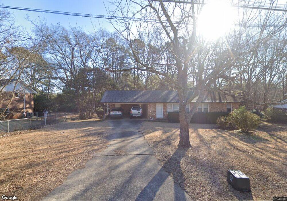
Super convenient brick ranch located near UGA and VET School. This home has a fenced backyard. Owner/manager is a licensed Realtor in the State of Georgia. Available 8/2/21.
| Date | Buyer | Sale Price | Title Company |
|---|---|---|---|
| Landrum Vonda E | -- | -- | |
| Vonda E Landrum Inc | -- | -- | |
| Landrum Vonda E | $70,000 | -- | |
| J Ronnie Huff Inc | $63,000 | -- | |
| Bowman Bruce E | $59,700 | -- |
| Date | Event | Price | List to Sale | Price per Sq Ft |
|---|---|---|---|---|
| 02/26/2021 02/26/21 | Rented | -- | -- | -- |
| 02/26/2021 02/26/21 | For Rent | -- | -- | -- |
| 06/17/2013 06/17/13 | Rented | -- | -- | -- |
| 06/17/2013 06/17/13 | For Rent | -- | -- | -- |
| Year | Tax Paid | Tax Assessment Tax Assessment Total Assessment is a certain percentage of the fair market value that is determined by local assessors to be the total taxable value of land and additions on the property. | Land | Improvement |
|---|---|---|---|---|
| 2025 | $2,619 | $84,340 | $12,000 | $72,340 |
| 2024 | $2,443 | $78,161 | $12,000 | $66,161 |
| 2023 | $2,443 | $73,761 | $12,000 | $61,761 |
| 2022 | $2,047 | $64,158 | $12,000 | $52,158 |
| 2021 | $1,771 | $52,551 | $12,000 | $40,551 |
| 2020 | $1,658 | $49,210 | $12,000 | $37,210 |
| 2019 | $1,590 | $46,828 | $12,000 | $34,828 |
| 2018 | $1,528 | $45,012 | $12,000 | $33,012 |
| 2017 | $1,346 | $39,641 | $12,000 | $27,641 |
| 2016 | $1,358 | $39,992 | $12,000 | $27,992 |
| 2015 | $1,351 | $39,723 | $12,000 | $27,723 |
| 2014 | $1,381 | $40,551 | $12,000 | $28,551 |
V
Landlord's Agent in 2021
Vonda Landrum
LGM L.L.C.
(706) 549-6165
79 Total Sales
Source: Savannah Multi-List Corporation
MLS Number: CM980000
APN: 182A4-E-001
Disclaimer: Certain information contained herein is derived from information provided by parties other than Homes.com. All information provided is deemed reliable, but is not guaranteed to be accurate and should be independently verified.
![]() IDX information is provided exclusively for personal, non-commercial use, and may not be used for any purpose other than to identify prospective properties consumers may be interested in purchasing.
IDX information is provided exclusively for personal, non-commercial use, and may not be used for any purpose other than to identify prospective properties consumers may be interested in purchasing.
Information is deemed reliable but not guaranteed.
