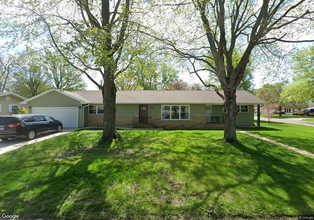
195 Southgate St Lincoln, IL 62656
Estimated Value: $165,679 - $183,000
3
Beds
--
Bath
1,532
Sq Ft
$114/Sq Ft
Est. Value
About This Home
This home is located at 195 Southgate St, Lincoln, IL 62656 and is currently estimated at $174,420, approximately $113 per square foot. 195 Southgate St is a home located in Logan County with nearby schools including Washington-Monroe Elementary School, Adams Elementary School, and Lincoln Junior High School.
Ownership History
Date
Name
Owned For
Owner Type
Purchase Details
Closed on
Apr 24, 2010
Sold by
Branson Richard K and Branson Deborah K
Bought by
Boyd Luke B and Boyd Elizabeth K
Current Estimated Value
Home Financials for this Owner
Home Financials are based on the most recent Mortgage that was taken out on this home.
Original Mortgage
$70,500
Outstanding Balance
$47,072
Interest Rate
5.05%
Mortgage Type
Stand Alone First
Estimated Equity
$127,348
Create a Home Valuation Report for This Property
The Home Valuation Report is an in-depth analysis detailing your home's value as well as a comparison with similar homes in the area
Home Values in the Area
Average Home Value in this Area
Purchase History
| Date | Buyer | Sale Price | Title Company |
|---|---|---|---|
| Boyd Luke B | $94,000 | -- |
Source: Public Records
Mortgage History
| Date | Status | Borrower | Loan Amount |
|---|---|---|---|
| Open | Boyd Luke B | $70,500 |
Source: Public Records
Tax History Compared to Growth
Tax History
| Year | Tax Paid | Tax Assessment Tax Assessment Total Assessment is a certain percentage of the fair market value that is determined by local assessors to be the total taxable value of land and additions on the property. | Land | Improvement |
|---|---|---|---|---|
| 2024 | $1,293 | $49,750 | $13,810 | $35,940 |
| 2023 | $1,349 | $46,070 | $12,790 | $33,280 |
| 2022 | $1,349 | $38,050 | $11,950 | $26,100 |
| 2021 | $1,354 | $36,530 | $11,470 | $25,060 |
| 2020 | $3,061 | $36,850 | $11,300 | $25,550 |
| 2019 | $2,984 | $36,130 | $11,080 | $25,050 |
| 2018 | $2,950 | $35,420 | $10,860 | $24,560 |
| 2017 | $293 | $35,420 | $10,860 | $24,560 |
| 2016 | $2,856 | $35,390 | $10,850 | $24,540 |
| 2015 | $2,513 | $32,630 | $10,690 | $21,940 |
| 2014 | $2,513 | $32,630 | $10,690 | $21,940 |
| 2013 | $2,513 | $30,300 | $10,150 | $20,150 |
| 2012 | $2,513 | $30,840 | $10,330 | $20,510 |
Source: Public Records
Map
Nearby Homes
- 145 Half Moon St
- 180 Regent St
- 102 Crestwood Dr
- 103 Crestwood Dr
- 1503 N Kankakee St
- 1019 N Mclean St
- 1354 Airport Rd
- 1431 N Ottawa St
- 1208 N Kankakee St
- 1204 N Ottawa St
- 1107 N Kankakee St
- 2294 Railsplitter Ave
- 311 Davenport St
- 2354 Railsplitter Ave
- 915 Peoria St
- 6 Meadow Ln
- 315 N Sherman St
- 620 Tremont St
- 1624 Delavan St
- 1225 Delavan St
- 205 Southgate St
- 190 Southgate St
- 200 Southgate St
- 215 Southgate St
- 210 Southgate St
- 110 Bond St
- 225 Southgate St
- 160 Eaton Dr
- 185 Southgate St
- 180 Southgate St
- 120 Bond St
- 175 Southgate St
- 170 Eaton Dr
- 220 Southgate St
- 145 Regent St
- 115 Bond St
- 170 Southgate St
- 150 Eaton Dr
- 165 Regent St
- 135 Regent St