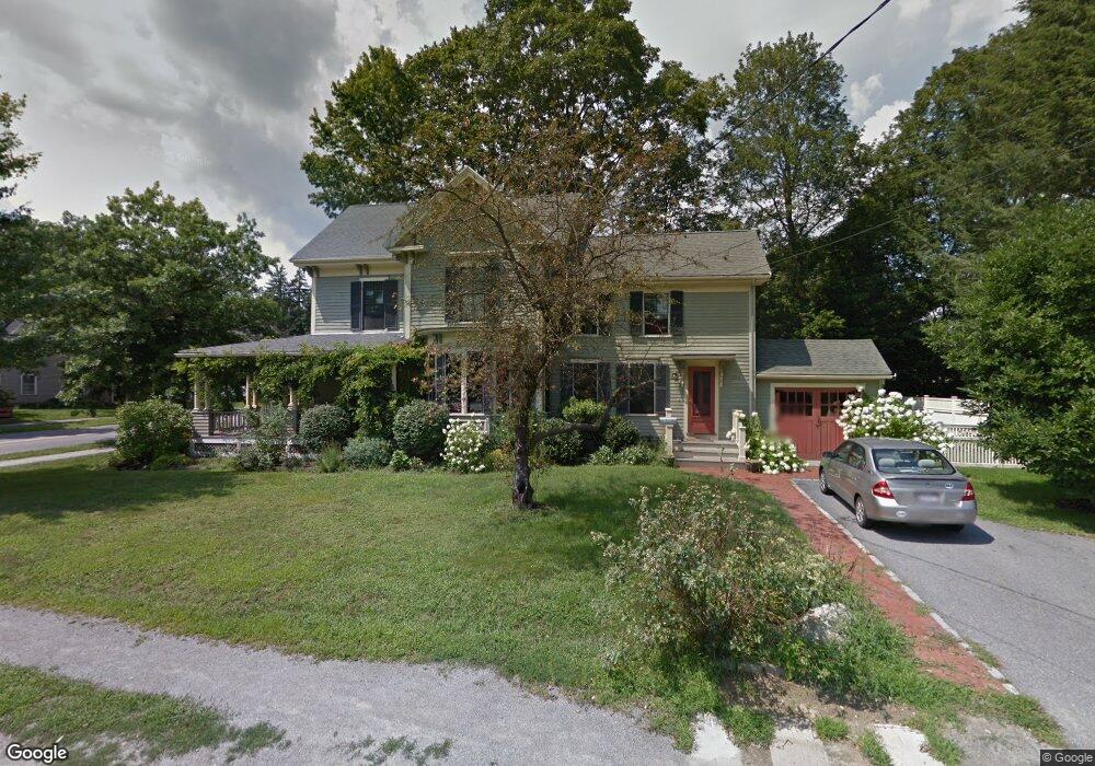
195 Thoreau St Concord, MA 01742
Estimated Value: $1,969,323 - $2,239,000
4
Beds
3
Baths
2,642
Sq Ft
$788/Sq Ft
Est. Value
About This Home
This home is located at 195 Thoreau St, Concord, MA 01742 and is currently estimated at $2,082,831, approximately $788 per square foot. 195 Thoreau St is a home located in Middlesex County with nearby schools including Alcott Elementary School, Concord Middle School, and Concord Carlisle High School.
Ownership History
Date
Name
Owned For
Owner Type
Purchase Details
Closed on
Mar 31, 2025
Sold by
Mckee Nicholas A
Bought by
Mckee Kelly J
Current Estimated Value
Purchase Details
Closed on
Aug 24, 2018
Sold by
Robertson Scot J and Robertson Theresa M
Bought by
Mckee Nicholas A and Johnston-Mckee Kelly
Home Financials for this Owner
Home Financials are based on the most recent Mortgage that was taken out on this home.
Original Mortgage
$1,015,200
Interest Rate
4.5%
Mortgage Type
Unknown
Purchase Details
Closed on
Jan 17, 2013
Sold by
Lowell Road Rt and Earle
Bought by
Robertson Scot J and Robertson Theresa M
Home Financials for this Owner
Home Financials are based on the most recent Mortgage that was taken out on this home.
Original Mortgage
$340,000
Interest Rate
3.39%
Mortgage Type
New Conventional
Purchase Details
Closed on
Jun 17, 2010
Sold by
Austen Christopher M and Austen Penelope F
Bought by
Lowell Road Rt and Nelson
Purchase Details
Closed on
Jun 6, 2006
Sold by
Mclean Lisa Spear and Mclean Marshall A
Bought by
Austen Christopher M and Austen Penelope F
Home Financials for this Owner
Home Financials are based on the most recent Mortgage that was taken out on this home.
Original Mortgage
$800,000
Interest Rate
6.55%
Mortgage Type
Purchase Money Mortgage
Purchase Details
Closed on
Feb 20, 2001
Sold by
Wesselhoeft Robert and Wesselhoeft Dianne E
Bought by
Mclean Marshall A and Mclean Lisa Spear
Home Financials for this Owner
Home Financials are based on the most recent Mortgage that was taken out on this home.
Original Mortgage
$275,000
Interest Rate
7.08%
Mortgage Type
Purchase Money Mortgage
Purchase Details
Closed on
May 9, 1994
Sold by
Nitzsche John K
Bought by
Wesselhoeft Robert and Weeselhoeft Dianne E
Create a Home Valuation Report for This Property
The Home Valuation Report is an in-depth analysis detailing your home's value as well as a comparison with similar homes in the area
Home Values in the Area
Average Home Value in this Area
Purchase History
| Date | Buyer | Sale Price | Title Company |
|---|---|---|---|
| Mckee Kelly J | -- | None Available | |
| Mckee Kelly J | -- | None Available | |
| Mckee Nicholas A | $1,269,000 | -- | |
| Mckee Nicholas A | $1,269,000 | -- | |
| Robertson Scot J | $1,175,000 | -- | |
| Robertson Scot J | $1,175,000 | -- | |
| Lowell Road Rt | $1,200,000 | -- | |
| Lowell Road Rt | $1,200,000 | -- | |
| Austen Christopher M | $1,436,000 | -- | |
| Austen Christopher M | $1,436,000 | -- | |
| Mclean Marshall A | $780,000 | -- | |
| Wesselhoeft Robert | $395,000 | -- | |
| Wesselhoeft Robert | $395,000 | -- |
Source: Public Records
Mortgage History
| Date | Status | Borrower | Loan Amount |
|---|---|---|---|
| Previous Owner | Mckee Nicholas A | $1,015,200 | |
| Previous Owner | Robertson Scot J | $340,000 | |
| Previous Owner | Austen Christopher M | $800,000 | |
| Previous Owner | Wesselhoeft Robert | $275,000 |
Source: Public Records
Tax History
| Year | Tax Paid | Tax Assessment Tax Assessment Total Assessment is a certain percentage of the fair market value that is determined by local assessors to be the total taxable value of land and additions on the property. | Land | Improvement |
|---|---|---|---|---|
| 2025 | $25,718 | $1,939,500 | $1,143,700 | $795,800 |
| 2024 | $25,068 | $1,909,200 | $1,143,700 | $765,500 |
| 2023 | $21,633 | $1,669,200 | $1,039,700 | $629,500 |
| 2022 | $21,346 | $1,446,200 | $756,200 | $690,000 |
| 2021 | $20,920 | $1,421,200 | $812,900 | $608,300 |
| 2020 | $20,282 | $1,425,300 | $812,900 | $612,400 |
| 2019 | $21,431 | $1,510,300 | $844,300 | $666,000 |
| 2018 | $19,514 | $1,365,600 | $769,200 | $596,400 |
| 2017 | $18,945 | $1,346,500 | $732,600 | $613,900 |
| 2016 | $17,369 | $1,247,800 | $666,000 | $581,800 |
| 2015 | $16,075 | $1,124,900 | $601,200 | $523,700 |
Source: Public Records
Map
Nearby Homes
- 150 Hubbard St Unit B
- 165 Everett St
- 143 Everett St
- 46 Sudbury Rd
- 34 Thoreau St
- 34 Thoreau St Unit 34
- 181 Stow St
- 32 Thoreau St Unit 32
- 22 Belknap Ct
- 105 Lexington Rd
- 265 Elsinore St
- 61B Walden St
- 236 Fairhaven Rd
- 49 Willard Common
- 29 Willard Common
- 25 Fairhaven Rd
- 50 Wayside Rd
- 212 Hawthorne Ln
- 96 Independence Rd
- 315 Musketaquid Rd
- 184 Hubbard St
- 172 Hubbard St
- 183 Hubbard St
- 196 Hubbard St
- 5 Thoreau Ct
- 5 Thoreau Ct Unit 1,1
- 7 Thoreau Ct
- 9 Thoreau Ct
- 196 Thoreau St
- 166 Hubbard St
- 166 Hubbard St Unit 166
- 173 Hubbard St
- 206 Thoreau St
- 208 Thoreau St
- 180 Thoreau St
- 174 Thoreau St
- 212 Thoreau St
- 204 Hubbard St
- 158 Hubbard St
- 218 Thoreau St
Your Personal Tour Guide
Ask me questions while you tour the home.