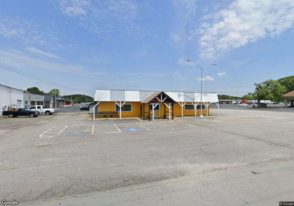
195 W Athens St Winder, GA 30680
--
Bed
--
Bath
2,598
Sq Ft
0.6
Acres
About This Home
This home is located at 195 W Athens St, Winder, GA 30680. 195 W Athens St is a home located in Barrow County with nearby schools including County Line Elementary School, Russell Middle School, and Winder-Barrow High School.
Ownership History
Date
Name
Owned For
Owner Type
Purchase Details
Closed on
Dec 10, 2014
Sold by
Shinham Bank America
Bought by
J & J Promise Property Grp Llc
Purchase Details
Closed on
Sep 2, 2014
Sold by
Kim Eun Gu
Bought by
Shinham Bank America
Purchase Details
Closed on
Dec 29, 2006
Sold by
Holly Hill & Del Ltd
Bought by
Kim Eun G
Home Financials for this Owner
Home Financials are based on the most recent Mortgage that was taken out on this home.
Original Mortgage
$424,000
Interest Rate
6.1%
Mortgage Type
Commercial
Create a Home Valuation Report for This Property
The Home Valuation Report is an in-depth analysis detailing your home's value as well as a comparison with similar homes in the area
Home Values in the Area
Average Home Value in this Area
Purchase History
| Date | Buyer | Sale Price | Title Company |
|---|---|---|---|
| J & J Promise Property Grp Llc | $127,000 | -- | |
| Shinham Bank America | -- | -- | |
| Kim Eun G | $530,000 | -- |
Source: Public Records
Mortgage History
| Date | Status | Borrower | Loan Amount |
|---|---|---|---|
| Previous Owner | Kim Eun G | $424,000 |
Source: Public Records
Tax History Compared to Growth
Tax History
| Year | Tax Paid | Tax Assessment Tax Assessment Total Assessment is a certain percentage of the fair market value that is determined by local assessors to be the total taxable value of land and additions on the property. | Land | Improvement |
|---|---|---|---|---|
| 2024 | $2,668 | $93,426 | $30,520 | $62,906 |
| 2023 | $4,295 | $102,906 | $40,000 | $62,906 |
| 2022 | $3,553 | $102,906 | $40,000 | $62,906 |
| 2021 | $3,742 | $120,132 | $40,000 | $80,132 |
| 2020 | $4,115 | $120,132 | $40,000 | $80,132 |
| 2019 | $4,666 | $120,132 | $40,000 | $80,132 |
| 2018 | $5,441 | $158,880 | $50,000 | $108,880 |
| 2017 | $4,699 | $157,504 | $50,000 | $107,504 |
| 2016 | $3,454 | $103,017 | $50,000 | $53,017 |
| 2015 | $1,730 | $103,017 | $50,000 | $53,017 |
| 2014 | $2,746 | $81,017 | $28,000 | $53,017 |
| 2013 | -- | $75,428 | $24,500 | $50,928 |
Source: Public Records
Map
Nearby Homes
- 0 Bill Rutledge Rd Unit 10591503
- 0 Bill Rutledge Rd Unit 7630436
- 221 Highway 211 NW
- 128 Mcneal Rd
- 42 Horton St
- 110 Mears St
- 281 Springdale Dr
- 87 Clifton Dr
- 254 Partridge Trail
- 132 Circle Dr
- The Cary A Plan at Lake Shore
- The Marion A Plan at Lake Shore
- 263 Elks St
- 244 Bayou Ln Unit 1
- 217 Bellview St
- 121 Cannondale Dr
- 108 Cannondale Dr
- 98 Cannondale Dr
- 2036 Massey Ln
- 24 Caison Dr
- 0 Mcneal Rd
- 0 Mcneal Rd Unit 10354541
- 0 Mcneal Rd Unit 7434956
- 0 Mcneal Rd Unit 10293379
- 0 Mcneal Rd Unit 8436837
- 0 Mcneal Rd Unit 7284522
- 0 Mcneal Rd Unit 7534324
- 0 Mcneal Rd Unit 7080022
- 0 Mcneal Rd Unit 8963727
- 0 Mcneal Rd Unit 8717704
- 0 Mcneal Rd Unit 8715092
- 0 Hwy 211nw
- 0 Highway 211 NW Unit 8639609
- 0 Highway 211 NW Unit 7026431
- 0 Highway 211 NW Unit 7592943
- 0 Highway 211 NW Unit 7526800
- 0 Highway 211 NW Unit 7364901
- 0 Highway 211 NW Unit 8186231
- 0 Highway 211 NW Unit 8370820
- 0 Highway 211 NW Unit 8967726