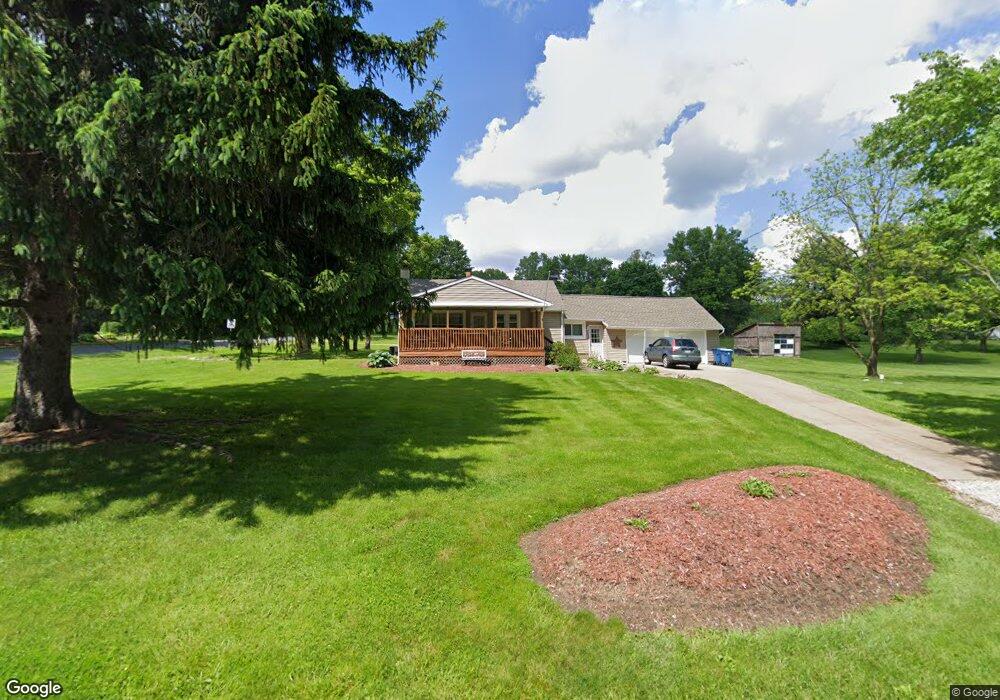
195 Yager Rd Clinton, OH 44216
Estimated Value: $216,000 - $251,995
3
Beds
1
Bath
1,104
Sq Ft
$213/Sq Ft
Est. Value
About This Home
This home is located at 195 Yager Rd, Clinton, OH 44216 and is currently estimated at $234,749, approximately $212 per square foot. 195 Yager Rd is a home located in Summit County.
Ownership History
Date
Name
Owned For
Owner Type
Purchase Details
Closed on
Dec 13, 2024
Sold by
Silveous Coretha J and Skeens Richard
Bought by
Sharpless Jon D and Sharpless Jennifer L
Current Estimated Value
Purchase Details
Closed on
Mar 1, 2004
Sold by
Va
Bought by
Silveous Coretha
Purchase Details
Closed on
May 19, 2003
Sold by
Ray Wade R
Bought by
Hud
Purchase Details
Closed on
Sep 14, 1998
Sold by
Spach Stephen T
Bought by
Ray Wade R
Home Financials for this Owner
Home Financials are based on the most recent Mortgage that was taken out on this home.
Original Mortgage
$81,600
Interest Rate
7.06%
Mortgage Type
VA
Purchase Details
Closed on
Aug 25, 1994
Sold by
Miller Paul D
Bought by
Spach Stephen T and Spach Debra J
Home Financials for this Owner
Home Financials are based on the most recent Mortgage that was taken out on this home.
Original Mortgage
$61,750
Interest Rate
8.72%
Mortgage Type
New Conventional
Create a Home Valuation Report for This Property
The Home Valuation Report is an in-depth analysis detailing your home's value as well as a comparison with similar homes in the area
Home Values in the Area
Average Home Value in this Area
Purchase History
| Date | Buyer | Sale Price | Title Company |
|---|---|---|---|
| Sharpless Jon D | -- | None Listed On Document | |
| Sharpless Jon D | -- | None Listed On Document | |
| Silveous Coretha | $78,000 | Fidelity Land Title Agency I | |
| Hud | $77,998 | -- | |
| Ray Wade R | $80,000 | -- | |
| Spach Stephen T | $65,000 | -- |
Source: Public Records
Mortgage History
| Date | Status | Borrower | Loan Amount |
|---|---|---|---|
| Previous Owner | Ray Wade R | $81,600 | |
| Previous Owner | Spach Stephen T | $61,750 |
Source: Public Records
Tax History Compared to Growth
Tax History
| Year | Tax Paid | Tax Assessment Tax Assessment Total Assessment is a certain percentage of the fair market value that is determined by local assessors to be the total taxable value of land and additions on the property. | Land | Improvement |
|---|---|---|---|---|
| 2025 | $3,391 | $66,564 | $24,770 | $41,794 |
| 2024 | $3,391 | $66,564 | $24,770 | $41,794 |
| 2023 | $3,391 | $66,564 | $24,770 | $41,794 |
| 2022 | $3,722 | $56,977 | $17,567 | $39,410 |
| 2021 | $3,416 | $52,098 | $17,567 | $34,531 |
| 2020 | $3,481 | $54,010 | $17,570 | $36,440 |
| 2019 | $3,063 | $42,500 | $14,170 | $28,330 |
| 2018 | $2,652 | $42,500 | $14,170 | $28,330 |
| 2017 | $2,610 | $42,500 | $14,170 | $28,330 |
| 2016 | $2,579 | $37,900 | $14,170 | $23,730 |
| 2015 | $2,610 | $37,900 | $14,170 | $23,730 |
| 2014 | $2,591 | $37,900 | $14,170 | $23,730 |
| 2013 | $2,659 | $39,140 | $14,170 | $24,970 |
Source: Public Records
Map
Nearby Homes
- 451 Yager Rd
- 6407 Southview Dr
- 0 W Comet Rd Unit 5079117
- 899 Loway Dr
- 7060 Manchester Rd
- 5776 Harter Home Dr
- 427 Center Rd
- 6090 Manchester Rd Unit 6096
- 715 Highland Park Dr
- 781 Leeman Dr
- 11391 Michelle Dr NW
- 8470 Shadyview Ave NW
- 1062 Stump Rd
- 6387 Hampsher Rd
- 0 Babst Ave NW
- 860 Killinger Rd
- 5892 Woodward Dr
- S/L 14,15 Shakes Hotel Dr
- 4831 Christman Rd
- 4 Shrakes Hotel Dr