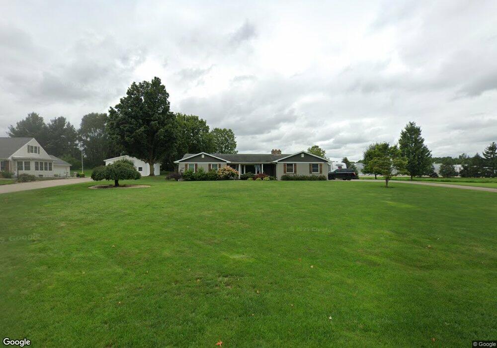
1950 72nd St SW Byron Center, MI 49315
Estimated Value: $442,361 - $609,000
--
Bed
1
Bath
1,947
Sq Ft
$271/Sq Ft
Est. Value
About This Home
This home is located at 1950 72nd St SW, Byron Center, MI 49315 and is currently estimated at $527,840, approximately $271 per square foot. 1950 72nd St SW is a home located in Kent County with nearby schools including Marshall Elementary School, Robert L. Nickels Intermediate School, and Byron Center West Middle School.
Ownership History
Date
Name
Owned For
Owner Type
Purchase Details
Closed on
Mar 20, 2012
Sold by
Raak David R and Raak Janet K
Bought by
Raak Robert J and Raak Amy J
Current Estimated Value
Home Financials for this Owner
Home Financials are based on the most recent Mortgage that was taken out on this home.
Original Mortgage
$148,000
Outstanding Balance
$101,811
Interest Rate
3.9%
Mortgage Type
New Conventional
Estimated Equity
$426,029
Purchase Details
Closed on
Mar 12, 2012
Sold by
Henry Mast Greenhouses Inc
Bought by
Raak David R and Raak Janet K
Home Financials for this Owner
Home Financials are based on the most recent Mortgage that was taken out on this home.
Original Mortgage
$148,000
Outstanding Balance
$101,811
Interest Rate
3.9%
Mortgage Type
New Conventional
Estimated Equity
$426,029
Purchase Details
Closed on
Jun 27, 2011
Sold by
Raak David R and Raak Janet K
Bought by
Raak David R and Raak Janet K
Create a Home Valuation Report for This Property
The Home Valuation Report is an in-depth analysis detailing your home's value as well as a comparison with similar homes in the area
Home Values in the Area
Average Home Value in this Area
Purchase History
| Date | Buyer | Sale Price | Title Company |
|---|---|---|---|
| Raak Robert J | $185,000 | None Available | |
| Raak David R | -- | Chicago Title | |
| Raak David R | -- | None Available |
Source: Public Records
Mortgage History
| Date | Status | Borrower | Loan Amount |
|---|---|---|---|
| Open | Raak Robert J | $148,000 |
Source: Public Records
Tax History Compared to Growth
Tax History
| Year | Tax Paid | Tax Assessment Tax Assessment Total Assessment is a certain percentage of the fair market value that is determined by local assessors to be the total taxable value of land and additions on the property. | Land | Improvement |
|---|---|---|---|---|
| 2025 | $2,371 | $206,800 | $0 | $0 |
| 2024 | $2,371 | $196,100 | $0 | $0 |
| 2023 | $2,267 | $174,300 | $0 | $0 |
| 2022 | $3,160 | $145,000 | $0 | $0 |
| 2021 | $3,076 | $134,700 | $0 | $0 |
| 2020 | $2,087 | $134,500 | $0 | $0 |
| 2019 | $3,001 | $127,000 | $0 | $0 |
| 2018 | $2,940 | $119,500 | $21,500 | $98,000 |
| 2017 | $2,874 | $107,200 | $0 | $0 |
| 2016 | $2,758 | $101,500 | $0 | $0 |
| 2015 | $2,710 | $101,500 | $0 | $0 |
| 2013 | -- | $87,100 | $0 | $0 |
Source: Public Records
Map
Nearby Homes
- 1752 Springwind Dr SW
- 1645 Springwind Dr SW
- 1557 Marksbury Ct
- 1568 Bogey St SW Unit 1
- 7609 Clementine Ave
- The Preston Plan at Alden Grove
- The Marley Plan at Alden Grove
- The Grayson Plan at Alden Grove
- The Crestview Plan at Alden Grove
- The Hadley Plan at Alden Grove
- The Maxwell Plan at Alden Grove
- The Stockton Plan at Alden Grove
- The Mayfair Plan at Alden Grove
- The Balsam Plan at Alden Grove
- The Newport Plan at Alden Grove
- The Sebastian Plan at Alden Grove
- The Jamestown Plan at Alden Grove
- The Georgetown Plan at Alden Grove
- The Fitzgerald Plan at Alden Grove
- The Sanibel Plan at Alden Grove
- 1932 72nd St SW
- 7187 Cattail SW
- 1961 72nd St SW
- 1927 72nd St SW
- 7179 Cattail SW
- 1991 72nd St SW
- 1878 72nd St SW
- 1907 72nd St SW
- 1891 72nd St SW
- 1946 Lilypad Dr SW
- 1946 Lillypad Dr SW
- 2015 72nd St SW
- 1960 Lillypad Dr SW
- 2030 72nd St SW
- 7170 Cattail SW
- 1856 72nd St SW
- 1934 Lillypad Dr SW
- 1871 72nd St SW
- 1870 72nd St SW
- 7087 Country Springs Dr SW