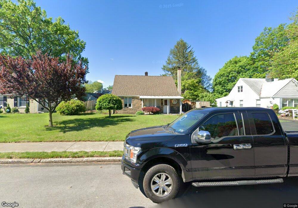
1950 Clearview Ave Norristown, PA 19403
West Norriton Township NeighborhoodEstimated Value: $324,911 - $359,000
3
Beds
1
Bath
1,259
Sq Ft
$268/Sq Ft
Est. Value
About This Home
This home is located at 1950 Clearview Ave, Norristown, PA 19403 and is currently estimated at $337,728, approximately $268 per square foot. 1950 Clearview Ave is a home located in Montgomery County with nearby schools including Charles Blockson Middle School, Paul V Fly Elementary School, and East Norriton Middle School.
Ownership History
Date
Name
Owned For
Owner Type
Purchase Details
Closed on
Nov 23, 2010
Sold by
Lombardo Dorothea M and Angelo John A Dell
Bought by
Angelo Dorothea M Dell and Angelo John A Dell
Current Estimated Value
Home Financials for this Owner
Home Financials are based on the most recent Mortgage that was taken out on this home.
Original Mortgage
$68,000
Interest Rate
4.24%
Create a Home Valuation Report for This Property
The Home Valuation Report is an in-depth analysis detailing your home's value as well as a comparison with similar homes in the area
Home Values in the Area
Average Home Value in this Area
Purchase History
| Date | Buyer | Sale Price | Title Company |
|---|---|---|---|
| Angelo Dorothea M Dell | -- | None Available |
Source: Public Records
Mortgage History
| Date | Status | Borrower | Loan Amount |
|---|---|---|---|
| Closed | Angelo Dorothea M Dell | $68,000 |
Source: Public Records
Tax History Compared to Growth
Tax History
| Year | Tax Paid | Tax Assessment Tax Assessment Total Assessment is a certain percentage of the fair market value that is determined by local assessors to be the total taxable value of land and additions on the property. | Land | Improvement |
|---|---|---|---|---|
| 2025 | $4,347 | $88,970 | $41,360 | $47,610 |
| 2024 | $4,347 | $88,970 | $41,360 | $47,610 |
| 2023 | $4,298 | $88,970 | $41,360 | $47,610 |
| 2022 | $4,270 | $88,970 | $41,360 | $47,610 |
| 2021 | $4,244 | $88,970 | $41,360 | $47,610 |
| 2020 | $4,117 | $88,970 | $41,360 | $47,610 |
| 2019 | $4,025 | $88,970 | $41,360 | $47,610 |
| 2018 | $3,038 | $88,970 | $41,360 | $47,610 |
| 2017 | $3,800 | $88,970 | $41,360 | $47,610 |
| 2016 | $3,766 | $88,970 | $41,360 | $47,610 |
| 2015 | $3,488 | $88,970 | $41,360 | $47,610 |
| 2014 | $3,488 | $88,970 | $41,360 | $47,610 |
Source: Public Records
Map
Nearby Homes
- 709 Middleton Place
- 1104 Arden Dr Unit METHACTON SCHOOL
- 1749 W Marshall St
- 166 Hoover Ave
- 214 Oxford Cir
- 2025 Sterigere St
- 145 Colonial Ave
- 37 Burnside Ave
- 1635 W Marshall W Marshall St
- 612 Glen Ln Unit 56A
- 1924 Juniata Rd
- 1506 W Marshall St
- 1448 W James St
- 1633 Williams Way
- 89 Centre Ave
- 0 Centre Unit 430 PAMC2099854
- 621 N Forrest
- 533 Brandon Rd
- 1613 Countryside Ln
- 1219 Stonybrook Dr Unit 1219
- 1946 Clearview Ave
- 1954 Clearview Ave
- 9 Constitution Ave
- 1942 Clearview Ave
- 13 Constitution Ave
- 1949 Clearview Ave
- 1953 Clearview Ave
- 1945 Clearview Ave
- 1938 Clearview Ave
- 19 Constitution Ave
- 1941 Clearview Ave
- 1961 Clearview Ave
- 1966 Clearview Ave
- 1937 Clearview Ave
- 1934 Clearview Ave
- 10 Constitution Ave
- 6 Constitution Ave
- 2 Constitution Ave
- 1965 Clearview Ave
- 14 Constitution Ave