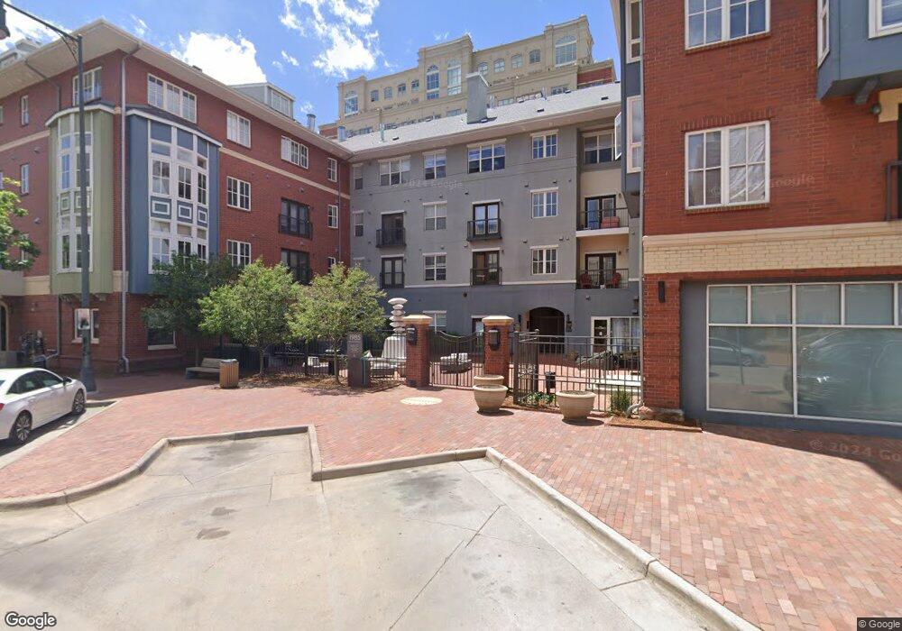
1950 Logan St Unit 301 Denver, CO 80203
Uptown NeighborhoodEstimated Value: $428,576 - $571,000
2
Beds
2
Baths
935
Sq Ft
$513/Sq Ft
Est. Value
About This Home
This home is located at 1950 Logan St Unit 301, Denver, CO 80203 and is currently estimated at $479,894, approximately $513 per square foot. 1950 Logan St Unit 301 is a home located in Denver County with nearby schools including Whittier ECE-8 School, Cole Arts & Science Academy, and McAuliffe Manual Middle School.
Ownership History
Date
Name
Owned For
Owner Type
Purchase Details
Closed on
Oct 3, 2005
Sold by
Shefchik Daniel F
Bought by
Jon Denious Living Trust and Sharon Denious Living Trust
Current Estimated Value
Purchase Details
Closed on
Sep 27, 2004
Sold by
1950 Logan Llc
Bought by
Shefchik Daniel F
Home Financials for this Owner
Home Financials are based on the most recent Mortgage that was taken out on this home.
Original Mortgage
$250,500
Interest Rate
5.37%
Mortgage Type
Purchase Money Mortgage
Create a Home Valuation Report for This Property
The Home Valuation Report is an in-depth analysis detailing your home's value as well as a comparison with similar homes in the area
Home Values in the Area
Average Home Value in this Area
Purchase History
| Date | Buyer | Sale Price | Title Company |
|---|---|---|---|
| Jon Denious Living Trust | $280,000 | Chicago Title Co | |
| Shefchik Daniel F | $263,700 | Chicago Title Co |
Source: Public Records
Mortgage History
| Date | Status | Borrower | Loan Amount |
|---|---|---|---|
| Previous Owner | Shefchik Daniel F | $250,500 |
Source: Public Records
Tax History Compared to Growth
Tax History
| Year | Tax Paid | Tax Assessment Tax Assessment Total Assessment is a certain percentage of the fair market value that is determined by local assessors to be the total taxable value of land and additions on the property. | Land | Improvement |
|---|---|---|---|---|
| 2024 | $2,113 | $26,680 | $2,980 | $23,700 |
| 2023 | $2,067 | $26,680 | $2,980 | $23,700 |
| 2022 | $1,954 | $24,570 | $1,860 | $22,710 |
| 2021 | $1,886 | $25,280 | $1,910 | $23,370 |
| 2020 | $2,158 | $29,090 | $1,910 | $27,180 |
| 2019 | $2,098 | $29,090 | $1,910 | $27,180 |
| 2018 | $2,086 | $26,960 | $1,280 | $25,680 |
| 2017 | $2,080 | $26,960 | $1,280 | $25,680 |
| 2016 | $2,008 | $24,620 | $1,067 | $23,553 |
| 2015 | $1,923 | $24,620 | $1,067 | $23,553 |
| 2014 | $1,708 | $20,570 | $565 | $20,005 |
Source: Public Records
Map
Nearby Homes
- 1950 N Logan St
- 1950 N Logan St Unit 601
- 1950 N Logan St Unit 1013
- 1950 N Logan St Unit 1109
- 1950 N Logan St Unit 411
- 1975 N Grant St Unit 827
- 1975 N Grant St Unit 404
- 1975 N Grant St Unit 527
- 1975 N Grant St Unit 509
- 1975 N Grant St Unit 810
- 2200 Tremont Place Unit 5
- 1827 N Grant St Unit 800
- 1827 N Grant St Unit 604
- 1827 N Grant St Unit 502
- 100 Park Ave W Unit 1004
- 100 Park Ave W Unit 606
- 100 Park Ave W Unit 204
- 100 Park Ave W Unit 707
- 100 Park Ave W Unit 908
- 100 Park Ave W Unit 408
- 1950 Logan St Unit 1207
- 1950 Logan St Unit 1206
- 1950 Logan St Unit 1205
- 1950 Logan St Unit 1204
- 1950 Logan St Unit 1203
- 1950 Logan St Unit 1202
- 1950 Logan St Unit 1201
- 1950 Logan St Unit 1112
- 1950 Logan St Unit 1111
- 1950 Logan St Unit 1110
- 1950 Logan St Unit 1109
- 1950 Logan St
- 1950 Logan St
- 1950 Logan St Unit 1106
- 1950 Logan St Unit 1105
- 1950 Logan St Unit 1104
- 1950 Logan St Unit 1103
- 1950 Logan St Unit 1102
- 1950 Logan St Unit 1101
- 1950 Logan St Unit 108