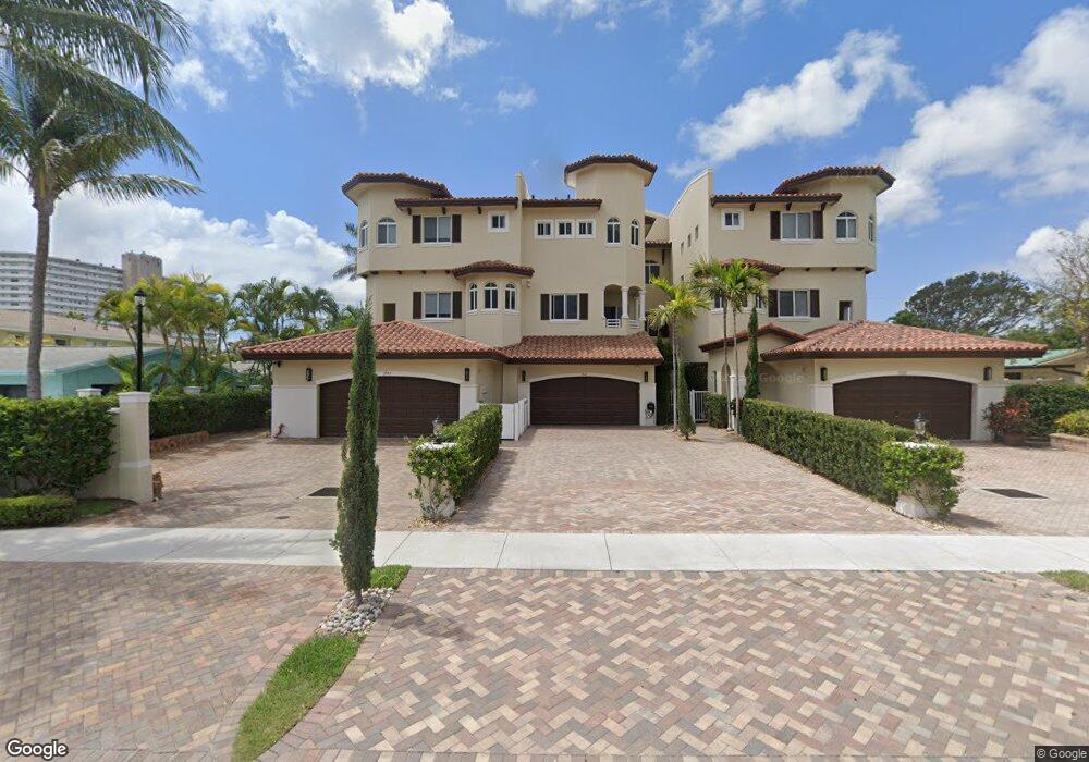
1950 NE 6th St Unit 1-2 Deerfield Beach, FL 33441
Deerfield Beach Island NeighborhoodEstimated Value: $832,000 - $1,226,000
5
Beds
4
Baths
2,012
Sq Ft
$512/Sq Ft
Est. Value
About This Home
This home is located at 1950 NE 6th St Unit 1-2, Deerfield Beach, FL 33441 and is currently estimated at $1,030,763, approximately $512 per square foot. 1950 NE 6th St Unit 1-2 is a home located in Broward County with nearby schools including Deerfield Beach Elementary School, Deerfield Beach Middle School, and Deerfield Beach High School.
Ownership History
Date
Name
Owned For
Owner Type
Purchase Details
Closed on
Apr 5, 2019
Sold by
Kiemschies George and Kiemschies Elfriede
Bought by
Victor Mark and Mark Victor Trust
Current Estimated Value
Purchase Details
Closed on
Oct 29, 1993
Sold by
Morris Ida and Harker James E
Bought by
Kiemschies George and Kiemschies Elfriede
Home Financials for this Owner
Home Financials are based on the most recent Mortgage that was taken out on this home.
Original Mortgage
$45,000
Interest Rate
7.07%
Mortgage Type
Commercial
Create a Home Valuation Report for This Property
The Home Valuation Report is an in-depth analysis detailing your home's value as well as a comparison with similar homes in the area
Home Values in the Area
Average Home Value in this Area
Purchase History
| Date | Buyer | Sale Price | Title Company |
|---|---|---|---|
| Victor Mark | $532,000 | Attorney | |
| Kiemschies George | $169,000 | -- |
Source: Public Records
Mortgage History
| Date | Status | Borrower | Loan Amount |
|---|---|---|---|
| Previous Owner | Kiemschies George | $45,000 |
Source: Public Records
Tax History Compared to Growth
Tax History
| Year | Tax Paid | Tax Assessment Tax Assessment Total Assessment is a certain percentage of the fair market value that is determined by local assessors to be the total taxable value of land and additions on the property. | Land | Improvement |
|---|---|---|---|---|
| 2025 | $15,290 | $713,050 | -- | -- |
| 2024 | $13,952 | $713,050 | -- | -- |
| 2023 | $13,952 | $589,300 | $0 | $0 |
| 2022 | $12,469 | $535,730 | $0 | $0 |
| 2021 | $10,493 | $487,030 | $101,690 | $385,340 |
| 2020 | $10,486 | $487,070 | $101,690 | $385,380 |
| 2019 | $5,271 | $341,460 | $0 | $0 |
| 2018 | $4,964 | $344,050 | $0 | $0 |
| 2017 | $4,729 | $222,800 | $0 | $0 |
| 2016 | $4,528 | $214,700 | $0 | $0 |
| 2015 | $4,374 | $207,820 | $0 | $0 |
| 2014 | $4,247 | $201,500 | $0 | $0 |
| 2013 | -- | $283,060 | $101,690 | $181,370 |
Source: Public Records
Map
Nearby Homes
- 1962 NE 6th St Unit 3B
- 505 NE 20th Ave Unit 118
- 1998 NE 7th St Unit 101
- 1944 NE 5th St
- 1912 NE 6th St
- 1980 NE 7th St Unit 104
- 811 SE 31st St
- 3097 Banyan Rd Unit N
- 549 NE 19th Ave
- 3093 Banyan Rd
- 609 NE 19th Ave
- 333 NE 21 Ave Unit 414
- 783 Valencia Dr
- 462 NE 21st Ave Unit (N. Ocean Drive)
- 3000 Banyan Rd Unit A
- 333 NE 21st Ave Unit 516
- 333 NE 21st Ave Unit 206
- 333 NE 21st Ave Unit 1106
- 333 NE 21st Ave Unit 1614
- 333 NE 21st Ave Unit 608
- 1950 NE 6th St
- 1942 NE 6th St Unit C
- 1938 NE 6th St Unit B
- 1938 NE 6th St Unit A
- 1938 NE 6th St
- 1940 NE 6th St Unit B
- 1940 NE 6th St
- 1962 NE 6th St Unit 3A
- 1962 NE 6th St Unit 5A
- 1962 NE 6th St Unit 2B
- 1962 NE 6th St Unit 1B
- 1962 NE 6th St Unit 1A
- 1962 NE 6th St Unit 2A
- 1962 NE 6th St Unit 5B
- 1962 NE 6th St Unit 4A
- 1951 NE 5th St
- 1949 NE 5th St Unit 1
- 1949 NE 5th St
- 1949 1949 Ne 5th St # 1 Unit 1
- 1957 NE 5th St